Province of Nuoro
| Province of Nuoro | |
|---|---|
| Province | |
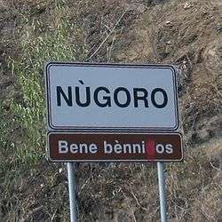 A road signal in Sardinian language near Nuoro. | |
 Map highlighting the location of the province of Nuoro in Italy | |
| Country |
|
| Region | Sardinia |
| Capital(s) | Nuoro |
| Comuni | 52 |
| Government | |
| • President | Costantino Tidu |
| Area | |
| • Total | 5,638.06 km2 (2,176.87 sq mi) |
| Population (31 July 2017) | |
| • Total | 210,972 |
| • Density | 37/km2 (97/sq mi) |
| Time zone | UTC+1 (CET) |
| • Summer (DST) | UTC+2 (CEST) |
| Postal code | 08010-08040, 08042-08049, 08100 |
| Telephone prefix | 070, 079, 0484, 0782, 0784, 0785 |
| Vehicle registration | NU |
| ISTAT | 091 |
The Province of Nuoro (Italian: Provincia di Nuoro; Sardinian: Provìntzia de Nùgoro) is a province in the autonomous island region of Sardinia, Italy. Its capital is the city of Nuoro.
It has an area of 5,638 square kilometres (2,177 sq mi), and, As of 2017, a total population of 210,972. The province is divided into 74 comuni, the largest of which are Nuoro (36,925 inhabitants), Siniscola (11,492), Macomer (10,043), and Dorgali (8,576).[1] The other comuni are generally not so large, even if Oliena (7,123 inhtabitans) and Orosei (7,025) can be considered as well as populated towns.
The province was established in 1927.[2] In 2005, the territory of the Province of Nuoro has been substantially reduced as a consequence of the establishment in the island of four new provinces.
The province hosts some of the wildest and most beautiful natural landscapes in the world. Part of these landscapes has been included in the National Park of the Gulf of Orosei and Gennargentu which straddles the border between the Provinces of Nuoro and Ogliastra.
The Province of Nuoro is one of Europe's less-densely populated areas. However, it is known for its high concentration of centenarians and supercentenarians. From 5 March 2001 to 3 January 2002, Antonio Todde, from Tiana, was the oldest man in the world.
References
External links
| Wikimedia Commons has media related to Province of Nuoro. |
- Official website (in Italian)
| Administrative divisions |  | |
|---|---|---|
| History | ||
| Politics | ||
| Culture | ||
| Languages |
| |
Categories | ||
Coordinates: 40°19′N 9°20′E / 40.317°N 9.333°E
| Authority control |
|---|