Irgoli
| Irgoli Irgòli | |
|---|---|
| Comune | |
| Comune di Irgoli | |
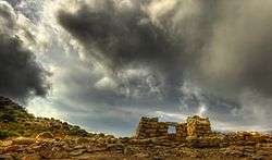 Nuraghe sanctuary. | |
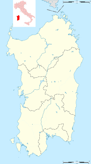 Irgoli Location of Irgoli in Sardinia | |
| Coordinates: 40°25′N 9°38′E / 40.417°N 9.633°ECoordinates: 40°25′N 9°38′E / 40.417°N 9.633°E | |
| Country | Italy |
| Region | Sardinia |
| Province | Nuoro (NU) |
| Government | |
| • Mayor | Giovanni Porcu |
| Area | |
| • Total | 75.0 km2 (29.0 sq mi) |
| Elevation | 26 m (85 ft) |
| Population (31 August 2017)[1] | |
| • Total | 2,307 |
| • Density | 31/km2 (80/sq mi) |
| Demonym(s) | Irgolesi |
| Time zone | UTC+1 (CET) |
| • Summer (DST) | UTC+2 (CEST) |
| Postal code | 08020 |
| Dialing code | 0784 |
| Website | Official website |
Irgoli (Latin: Fanum Carisi, Sardinian: Irgòli) is a comune (municipality) in the Province of Nuoro in the Italian region Sardinia, located about 140 kilometres (87 mi) northeast of Cagliari and about 30 kilometres (19 mi) northeast of Nuoro.
Irgoli borders the following municipalities: Galtellì, Loculi, Lula, Onifai, Siniscola.
References
Sources
- Richard Talbert, Barrington Atlas of the Greek and Roman World, ( ISBN 0-691-03169-X), Map 48.

This article is issued from
Wikipedia.
The text is licensed under Creative Commons - Attribution - Sharealike.
Additional terms may apply for the media files.