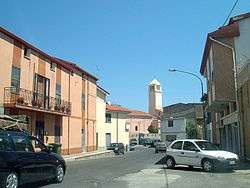
Lula, Sardinia
| Lula Lùvula | |
|---|---|
| Comune | |
| Comune di Lula | |
 Lula | |
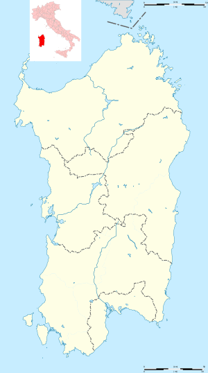 Lula Location of Lula in Sardinia | |
| Coordinates: 40°28′N 9°29′E / 40.467°N 9.483°ECoordinates: 40°28′N 9°29′E / 40.467°N 9.483°E | |
| Country | Italy |
| Region | Sardinia |
| Province | Nuoro (NU) |
| Government | |
| • Mayor | Mario Calia |
| Area | |
| • Total | 148.72 km2 (57.42 sq mi) |
| Elevation | 521 m (1,709 ft) |
| Population (28 February 2017)[1] | |
| • Total | 1,395 |
| • Density | 9.4/km2 (24/sq mi) |
| Demonym(s) | Lulesi |
| Time zone | UTC+1 (CET) |
| • Summer (DST) | UTC+2 (CEST) |
| Postal code | 08020 |
| Dialing code | 0784 |
| Website | Official website |
Lula (Sardinian: Lùvula) is a comune (municipality) in the Province of Nuoro in the Italian region Sardinia, located about 220 kilometres (140 mi) north of the regional capital Cagliari and about 40 kilometres (25 mi) northeast of the provincial capital Nuoro.
Lula is located on the bottom of Mount Albo, a chain of white limestone, with numerous natural caves and stalactites.
Lula borders the following municipalities: Bitti, Dorgali, Galtellì, Irgoli, Loculi, Lodè, Onanì, Orune, Siniscola.
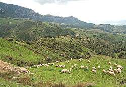
Sheep near Lula.
References
| Wikimedia Commons has media related to Lula (Italy). |

This article is issued from
Wikipedia.
The text is licensed under Creative Commons - Attribution - Sharealike.
Additional terms may apply for the media files.