Pollenfeld
| Pollenfeld | ||
|---|---|---|
| ||
 Pollenfeld Location of Pollenfeld within Eichstätt district  | ||
| Coordinates: 48°57′N 11°12′E / 48.950°N 11.200°ECoordinates: 48°57′N 11°12′E / 48.950°N 11.200°E | ||
| Country | Germany | |
| State | Bavaria | |
| Admin. region | Oberbayern | |
| District | Eichstätt | |
| Municipal assoc. | Eichstätt | |
| Government | ||
| • Mayor | Willibald Schneider sen. | |
| Area | ||
| • Total | 45.66 km2 (17.63 sq mi) | |
| Elevation | 534 m (1,752 ft) | |
| Population (2017-12-31)[1] | ||
| • Total | 2,903 | |
| • Density | 64/km2 (160/sq mi) | |
| Time zone | CET/CEST (UTC+1/+2) | |
| Postal codes | 85131 | |
| Dialling codes | 08421 | |
| Vehicle registration | EI | |
| Website | www.pollenfeld.de | |

Pollenfeld is a municipality in the district of Eichstätt in Bavaria in Germany.
Division of Pollenfeld
Districts: Pollenfeld with Wörmersdorf, Seuversholz with Ziegelhütte, Sornhüll with Götzelshard, Wachenzell with Ziegelhütte, Weigersdorf and Preith.
Geography
Pollenfeld lies in the Ingolstadt region, 8 km (approx. 5 miles) north of the district seat (Kreisstadt) of Eichstätt in the Franconian Jura mountains.
History
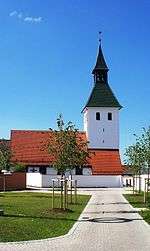
The Pollenfeld Church had long been incorporated into the Eichstätt diocese. The place has been a part of Bavaria since the Peace Treaty of Brünn and Pressburg in 1805. In 1818, through the Bavarian Municipality Edict ("Bayerische Gemeindeedikt"), the municipality of Pollenfeld was created. The incorporation of the municipalities of Seuversholz, Sornhüll, Wachenzell, Weigersdorf (all of the foregoing in 1972) and in part, also, in 1978, of Preith, followed thereafter in connection with district or provincial reform in Bavaria.
References
- ↑ "Fortschreibung des Bevölkerungsstandes". Bayerisches Landesamt für Statistik und Datenverarbeitung (in German). September 2018.
| Wikimedia Commons has media related to Pollenfeld. |