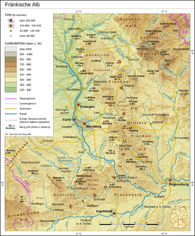
Franconian Jura
| Franconian Jura (Fränkische Alb / Frankenalb / Fränkischer Jura / Frankenjura) | |
|---|---|
 The Franconian Jura
| |
| Highest point | |
| Peak | Dürrenberg |
| Elevation | 656.4 m above NN |
| Dimensions | |
| Area | 7,053.8 km2 (2,723.5 sq mi) |
| Geography | |
| State |
Bavaria, |
| Range coordinates | 49°00′56″N 10°45′43″E / 49.01556°N 10.76194°ECoordinates: 49°00′56″N 10°45′43″E / 49.01556°N 10.76194°E |
| Parent range | South German Scarplands |
| Geology | |
| Orogeny | low mountains, cuesta |
The Franconian Jura (German: Fränkische Alb, ![]()
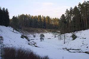
Large portions of the Franconian Jura are part of the Altmühl Valley Nature Park. The scenic meanders and gorges formed by the Altmühl River draw tourists to visit the region.
Geologically, the Franconian Jura is the eastern continuation of the Swabian Jura. Both are part of the Jura Mountains. The mountain chains are separated from each other by the impact crater of the Nördlinger Ries.
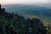
The northern part of the Franconian Jura is known as Little Switzerland (German: Fränkische Schweiz).
References
- ↑ Emil Meynen, Josef Schmithüsen: Handbuch der naturräumlichen Gliederung Deutschlands. Bundesanstalt für Landeskunde, Remagen/Bad Godesberg 1953–1962 (9 editions in 8 volumes, updated map 1:1,000,000 scale with major units, 1960).
| Authority control |
|---|