Polangui, Albay
| Polangui | |
|---|---|
| Municipality | |
| Municipality of Polangui | |
| Motto(s): Next Level...Progress | |
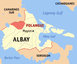 Map of Albay with Polangui highlighted | |
.svg.png) Polangui Location within the Philippines | |
| Coordinates: 13°17′32″N 123°29′08″E / 13.2922°N 123.4856°ECoordinates: 13°17′32″N 123°29′08″E / 13.2922°N 123.4856°E | |
| Country |
|
| Region | Bicol Region (Region V) |
| Province | Albay |
| District | 3rd district |
| Founded | 1584 |
| Barangays | 44 (see Barangays) |
| Government [1] | |
| • Type | Sangguniang Bayan |
| • Mayor | Cherilie M. Sampal |
| • Vice Mayor | Herbert S. Borja |
| • Electorate | 48,728 voters (2016) |
| Area [2] | |
| • Total | 145.30 km2 (56.10 sq mi) |
| Population (2015 census)[3] | |
| • Total | 88,221 |
| • Density | 610/km2 (1,600/sq mi) |
| Time zone | UTC+8 (PST) |
| ZIP code | 4506 |
| PSGC | 050514000 |
| IDD : area code | +63 (0)52 |
| Climate type | Tropical rainforest climate |
| Income class | 1st municipal income class |
| Revenue (₱) | 184,051,083.62 (2016) |
| Native languages |
Albay Bikol language Tagalog |
| Website |
www |
Polangui, officially the Municipality of Polangui, (Central Bicolano: Banwaan kan Polangui; Filipino: Bayan ng Polangui), is a 1st class municipality in the province of Albay, Philippines. According to the 2015 census, it has a population of 88,221 people.[3]
Etymology
The origin of the name Polangui has many versions. The foremost and seemingly more accepted version is, "that of a giant robust tree which existed majestically in the early municipal settlement". The natives of the settlement called the "Oyangue", which also served as the early landmark of the area whereby new settlers looked upon in their wandering. Similarly, the early Spanish frontier settlers found this tree and it became their famous settlement landmark. The settlement was then called "Binanuaan" but often referred to as "Oyangue" by nearby settlers. As more settlers came to dwell and engage in trade endeavors with the indigenous inhabitants, the more was the settlement known in distant areas by the name "Oyangue" (referring to the tree landmark) which was more widely accepted than "Binanuaan". The passing of generations corrupted the word "Oyangue" into several acronyms. Most acceptable and widely used before was "Polangue" and later "Polangui" which has remained today.
Another legend is about the story of a maiden named "Pulang Angui" which means "Red Maria" (Angui is the nickname for Maria) who loved red colors for dress and whose beautiful body, face and red lips became the object of affection by the males to the point of adoration. She was modest in her ways, talented for possessing various skills, with happy disposition, showing love of arts and religion. She would lead the tribe in festivities. When the Spaniards came, the soldiers who first set foot in Polangui asked for the name of the place. The native thought the foreigners was asking for the name of "Pulang Angui" and said so. The Spaniards recorded the name of the place as Pulangui, a concoction of the name which was later on, as years went by, was converted to Polangui.
.jpg)
.jpg)
History
Precolonial period
Pre-colonial Polangui was a fertile valley cradled by the virgin forests of Mount Masaraga. It was formed out of five settlements ruled by the Datu of Ponso till the late 1583. The center of the settlements was called Banwang gurang, meaning "old town" and is now known as Magurang.
In 1584, Fray Baltazar de la Magdalena, left Ambos Camarines and stumbled upon this place west of Mount Masaraga. He found that each of the five settlements had about 100 inhabitants. In the same year, he founded a settlement within the fertile valley and established a ranch, which he called "Binanwaan". Being inland and strategically situated, the town was spared from the frequent raids of sea pirates as well as from the occasional destruction caused by the eruption of Mayon Volcano.
Polangui became a visita, or outreach village under the jurisdiction of the Villa Santiago de Libon, which was established in 1573 by Juan de Salcedo, the grandson of the Spanish conquistador Miguel Lopez de Legazpi. The villa, which lies south-west of Polangui, would be known as the fourth of its kind in the entire archipelago.
Fray de la Magdalena was credited with the founding of Polangui. Old manuscripts in the Archives of Manila and in the Franciscan Convent in Manila point to 1584 as the year Polangui was founded, and thus considered as one of the oldest municipalities in the Philippines.
Spanish regime
By 1654, the original settlement became considerably bigger when Fray Alonzo de San Juan, was assigned in Polangui as "Encargado". The settlement was expanded reaching the present barangay sites in Lanigay, Ponso and Balinad. The town proper was established in Lanigay where a church made of wood was erected adjacent to about 280 wooden dwellings and more than 1,000 nipa huts. Unfortunately, this church together with the dwelling units was razed by a fire to the ground.
With the coming of another missionary, Fray Juan Bautista Marza, a new church made of bricks and stones was completed in 1664. This church stood on a new elevated site and still stands to this day. Under the leadership of Fray Marza, roads and bridges were also initiated and schools were introduced simultaneously with the Christian Doctrine and Spanish culture.
Growth of the settlement was so fast that it became a Poblacion and finally recognized as a Pueblo in 1674. Owing to its steady growth, a link with nearby Libon and Oas became a necessity. Hence, Fr. Jose Arnao, parish priest and Encargado from 1832 until 1852, directed the construction of roads and bridges that would connect Polangui to neighboring towns, including upland Buhi in Camarines Sur.
During Spanish regime, a significant highlight is the construction of its parish church which took 10 years to be completed starting in 1654 by Fray Alonzo de San Juan and completed in 1664 by Fray Juan Bautista Marza.
Polangueño martyr, Camilo Jacob, who is a photographer, was executed in January 4, 1897 with other Bicolanos. They are now commemorated as the Quince Martires del Bicolandia. A year later, the Spanish rule in Bicol ended with the mutiny of Guardia Civil in Naga led by Elias Angeles.
American period
Sometime during the Philippine-American War, Polangui became the seat of the Provincial Government of Albay for a brief period under Governor Domingo Samson. When the Americans conquered Polangui in 1890 without firing a single shot, the form of government went through transition from military to civil government then Commonwealth system. The seat of the municipal government was in Ponso with Clemente Sarte as the acting Chief Executive. A few months later, the seat of the municipal government was transferred to Centro Occidental and still remains up to this day.
Japanese occupation
When the Japanese forces occupied Polangui on December 13, 1941, Cipriano Saunar, then vice mayor of the Commonwealth government was appointed mayor by the Japanese military administration. A secret civil government was established simultaneously headed by Julian Saunar which was supported by the people. Cipriano Saunar’s successor was Manuel Samson Sr. and in turn was succeeded by Jesus Salalima who ruled from 1947 to 1960.
Geography
Polangui is located at 13°17′32″N 123°29′08″E / 13.2922°N 123.4856°E, in the north-eastern quadrant of the third district of Albay.
According to the Philippine Statistics Authority, the municipality has a land area of 145.30 square kilometres (56.10 sq mi) [2] constituting 5.64% of the 2,575.77-square-kilometre- (994.51 sq mi) total area of Albay.
Polangui is bounded on the north by Buhi and Iriga City of Camarines Sur province, south by Libon, Oas and City of Ligao; and west by Malinao and the City of Tabaco. It is about 43 kilometres (27 mi) north of the regional center of the Bicol Region, Legazpi City; 56 kilometres (35 mi) north-east of Naga City and 136 kilometres (85 mi) south of Daet, Camarines Norte.
Climate
Polangui has a general climate characterized by dry season with a very pronounced maximum rainfall from November to December. Prevailing wind is in the general direction from north-east to south-west.
Barangays
Polangui is politically subdivided into 44 barangays.[4], grouped into three divisions:
- Poblacion Barangays - 13 member barangays
- Rinconada Area Development Council (RADC) - 11 member barangays
- Upland Area Development Council (UADC) - 20 member barangays
| Barangay | Land area (ha.) | Population (2010)[5] | Class | District | Etymology | Brief history |
|---|---|---|---|---|---|---|
| Agos | 298.84 | 3,356 | Rural | RADC | The old name of this sitio during the early Spanish rule was "Bato Lis Non". On the eastern side of the sitio was Sitio Matakot, or known to be later as Matacon. Because of the difficulty in remembering its former name, visitors and strangers to the sitio would easily remember the wide river that separates the province of Albay and Camarines Sur, the Agos River. Thus, as time passed by, the barangay was named Agos. | A certain Angel Servas was the first Teniente del Barrio to lead a group of 24 households in the early years of Spanish rule. Others to follow were: Antonio Mendoza, Paulino Segui, Vicente Epres, Eustaquio Seda, Pedro General (first to assume the position of Barangay Captain), Felicisimo Cagnayo Sr., and Rogelio Laynes. |
| Alnay | 214.87 | 2,194 | Urban | Poblacion | Unknown | A sitio of Barangay Ponso in the early days, it was a verdant place full of ricefields. In the latter part of the 60's, Dr. Esteban Ante (deceased), a landowner, developed his ricefields into a subdivision, thus attracting people to reside in the place. With that development, Councilor Santiago M. Revale passed a resolution creating Alnay as an independent barangay. It was approved and concurred in by the Sangguniang Panlalawigan of Albay, headed then by Governor Felix Imperial. |
| Alomon | 154.19 | 1,167 | Urban | Poblacion | As old folks say, the place was inhabited by people who are very industrious, that even in the evening they work at their farms. There was then a visitor in the barrio, a foreigner, who greeted the workers in the ricefields, and jokingly greeted the bright moon in this way: "Hello Moon!". Thinking that the stranger was naming the place, the residents remembered it as "Hello Moon". As the time passed by, the place was named as Alomon. | During the early years, Alomon was a sitio of Barrio Kinale. Its first Teniente del Barrio was Domingo Satorre, who was responsible for its establishment as an independent barrio in 1972. |
| Amoguis | 147.13 | 518 | Rural | UADC | Unknown | As old folks used to tell, there were only three barangays that comprised Polangui then in the year 1654 when Father Alonzo de San Juan founded the pueblo of Binanuaan. Amoguis and several other settlements were part of Barangay Layugay (now known as Lanigay). With the passing of time, these sitios became independent barangays through RA 2370 or the Barrio Charter enacted during the term of President Carlos P. Garcia on June 20, 1959. |
| Anopol | 200.32 | 1,085 | Rural | UADC | The barangay got its name from a vine called "anopol", with the leaves that climb on tall trees and are commonly found along river banks, creeks and natural springs. | Anopol was a former sitio of Barrio Lanigay. It became an independent barrio pursuant to RA 3590 or the Revised Barrio Charter enacted during the term of President Carlos P. Garcia on June 22, 1963. Its first administrator was Bienvenido Cellona. |
| Apad | 455.76 | 1,323 | Rural | RADC | A sitio of Barrio Lanigay during the early years of Spanish rule, it was the center of convergence of several upland sitios namely: Kinuartelan, La Medalla, Upper Santicon, San Roque and several other sitios. During that time, the only means of transportation was the "RailBoss" of the Ferrocarril de Manila-Dagupan (predececcor of the Philippine National Railways). The "railbos" had its terminal located in Apad, thus becoming known as "Parada". As years passed by, the word was corrupted until it became Apad. | A sitio of Barrio Lanigay during the early years of Spanish rule, it was the center of convergence of several upland sitios namely: Kinuartelan, La Medalla, Upper Santicon, San Roque and several other sitios. |
| Balaba | 510.40 | 1,355 | Rural | UADC | Old folks traces the name Balaba from the word "balabag na dalan", or the crookedness of its road due to the steepness of its slope leading to the settlement. | Formerly a sitio of Barangay Balinad, it became an independent barrio in 1967. Councilwoman Benigna Calpe was the sponsor of the resolution creating Balaba. First appointed Teniente del Barrio was Carlos Sangat, serving from 1948 to 1951. |
| Balangibang | 269.95 | 1,600 | Urban | Poblacion | Unknown | As with other present barangays of Polangui, Balangibang was a sitio of Lanigay (the mother barangay in the early years of Spanish rule). It was a vast agricultural land owned by the Alsua/Buenviaje and Catalina vda. de Gloria families. With the implementation of the Comprehensive Agrarian Reform Law (CARL) during the term of President Diosdado Macapagal, these ricelands were distributed to the tenants tilling the lands. With the enactment of the Revised Barrio Charter in 1963, Balangibang became an independent barrio. |
| Balinad | 727.65 | 3,032 | Rural | UADC | The name Balinad originated from the name of a certain tree called "sorsogon" (locally known as "balinad"), which grew abundantly in the said place. | Barangay Balinad is one of the original mother barangays that was established when Polangui was founded. |
| Basud | 116.34 | 3,408 | Urban | Poblacion | As old folks narrated the story, Basud got its name when the earlier farmer settlers backfilled the lower portion of the fields with "basud" (sand). This was the area between the boundary of Polangui and Oas. Large tract of lands were filled with sand in the desire of the farmers to make the area productive. Due to that development, the place was known as Basud. | It used to be a part of Sitio Ubaliw that belongs to the mother barangay of Lanigay in the early settlement years of Spanish rule. When the center of Pueblo was transferred from Lanigay to the present poblacion, these two (Basud and Ubaliw) became independent barangays. |
| Buyo | 220.11 | 990 | Rural | UADC | The place derived its name from "buyo", a native name of a vine which is an ingredient for making "ikmo" or "nganga", which thrives abundantly in the place. | It was a sitio of mother barangay Lanigay in the early years. It was established as an independent barangay in the year 1946, under the administration of Mayor Manuel Samson, Sr. |
| Centro Occidental (seat of church and government) | 191.82 | 3,384 | Urban | Poblacion | Due to increased development in the area, this former sitio of Lanigay became a barangay of its own and was called Centro Occidental, as it is in the western portion of the Poblacion (centro). It is also popularly called "Ilaod". This is because when people go to the market, they would call it "Iraya" (meaning upstream) and when they go home, they would say "Ilaod" (meaning downstream). | Barangay Centro Occidental used to be a sitio of Barangay Lanigay. When the latter's settlement was hit by a conflagration in 1654 including the church, the encargado decided to transfer the church to the present site where it stands (now in present-day Centro Occidental). The church, municipal building and the market site were all eventually situated here, so the place was considered the centro of the Pueblo (divided into Centro Oriental or the eastern portion and Centro Occidental or the western portion). It was the center of commerce, seat of government and the center of religious activities.
When the Revised Barrio Charter was enacted in 1963, Centro Oriental and Centro Occidental both became independent barangays. Years later, the Philippine National Railways (PNR) station was constructed at Barangay Basud. It was decided that the public market be transferred near the station. But because the seat of government and the parish church were still in place, Centro Occidental remains the de facto centro of the Municipality of Polangui. As population grew fast, development in the area grew fast too. More residential houses were constructed on the vast track of talahib. Elementary and secondary schools were also established. |
| Centro Oriental | 29.12 | 2,264 | Urban | Poblacion | Due to increased development in the area, this former sitio of Lanigay became a barangay of its own and was called Centro Oriental, as it is in the eastern portion of the Poblacion (centro). | When the settlement of Lanigay was hit by a conflagration in 1654 including the church, the encargado decided to transfer the church to the present site where it stands (now in present-day Centro Occidental). The church, municipal building and the market site were all eventually situated here, so the place was considered the centro of the Pueblo (divided into Centro Oriental or the eastern portion and Centro Occidental or the western portion). It was the center of commerce, seat of government and the center of religious activities. When the Revised Barrio Charter was enacted in 1963, Centro Oriental and Centro Occidental both became independent barangays. |
| Cepres | 263.35 | 1,414 | Rural | UADC | Old folks narrate that "two American strangers came and rested for a while, and saw people planting cypress shrubs and remarked that this place is safe to rest". The natives thought that the Americans were referring to the shrubs. From that time on, the place as known as Cepres. | Cepres was originally a sitio of mother barangay Lanigay. It was known as Cepres during the early years of 1930 during the term of Marciano Rosela as their Teniente del Barrio. |
| Cotmon | 485.30 | 529 | Rural | UADC | As the people of this barangay, the name was derived from the name of the tree that once thrived the place. That tree was called kutmon in the locality. Later, the form was changed and Hispanicized, thus the form being used today, as was with the naming of most places. The kutmon is katmon in the Filipino language's orthography. | |
| Cotnogan | 231.13 | 1,405 | Rural | RADC | ||
| Danao | 383.50 | 879 | Rural | UADC | ||
| Gabon | 88.67 | 3,223 | Urban | Poblacion | ||
| Gamot | 345.17 | 1,395 | Rural | UADC | ||
| Itaran | 312.09 | 1,740 | Rural | UADC | ||
| Kinale | 176.39 | 2,204 | Urban | Poblacion | ||
| Kinuartelan | 341.27 | 587 | Rural | UADC | ||
| La Medalla | 368.27 | 841 | Rural | RADC | ||
| Lanigay | 313.06 | 3,592 | Rural | RADC | ||
| La Purisima | 493.02 | 613 | Rural | RADC | ||
| Lidong | 121.26 | 1,355 | Rural | UADC | Lidong was the center of commerce back then. The 'saūd' or market, where the 'agtâs' bartered their goods with rice from the vast 'uma' or rice farms of 'Langtad' and 'Lidong', as well as with fresh-caught fish from Lake Buhi, was near where the two tributary rivers that meet to form one river. The water in the area where the rivers meet swirls so that when the traders from one side crosses with their 'balsa' gets 'nauseated' or in local term 'libūng'. Soon the corruption and Hispanicization of the word arrived to its present form. | |
| Lourdes | 348.71 | 594 | Rural | UADC | ||
| Magpanambo | 251.87 | 1,361 | Rural | RADC | ||
| Magurang | 115.22 | 3,846 | Urban | Poblacion | ||
| Matacon | 317.64 | 4,148 | Urban | Poblacion | ||
| Maynaga | 262.39 | 1,361 | Rural | UADC | ||
| Maysua | 430.15 | 891 | Rural | UADC | ||
| Mendez | 165.90 | 991 | Rural | UADC | ||
| Napo | 361.85 | 3,113 | Rural | UADC | ||
| Pinagdapugan | 190.91 | 888 | Rural | UADC | ||
| Pintor (Binangbangan) | 182.94 | 918 | Rural | UADC | ||
| Ponso | 317.91 | 4,927 | Urban | Poblacion | ||
| Salvacion | 175.99 | 1,088 | Rural | RADC | ||
| San Roque | 301.32 | 1,533 | Rural | RADC | ||
| Santicon | 393.38 | 2,744 | Rural | RADC | ||
| Santa Cruz | 280.51 | 652 | Rural | UADC | ||
| Santa Teresita | 285.13 | 927 | Rural | RADC | ||
| Sugcad | 372.85 | 3,637 | Urban | Poblacion | ||
| Ubaliw | 221.44 | 3,235 | Urban | Poblacion |
Demographics
| Population census of Polangui | ||
|---|---|---|
| Year | Pop. | ±% p.a. |
| 1903 | 7,960 | — |
| 1918 | 13,327 | +3.50% |
| 1939 | 21,086 | +2.21% |
| 1948 | 27,623 | +3.05% |
| 1960 | 38,374 | +2.78% |
| 1970 | 48,586 | +2.38% |
| 1975 | 52,541 | +1.58% |
| 1980 | 55,610 | +1.14% |
| 1990 | 61,556 | +1.02% |
| 1995 | 67,314 | +1.69% |
| 2000 | 70,451 | +0.98% |
| 2007 | 77,122 | +1.26% |
| 2010 | 82,307 | +2.40% |
| 2015 | 88,221 | +1.33% |
| Source: Philippine Statistics Authority[3][5][6][7] | ||
In the 2015 census, Polangui had a population of 88,221.[3] The population density was 610 inhabitants per square kilometre (1,600/sq mi).
Languages
Bikol Polangueño[8] is the main dialect in Polangui. The majority of the population speak Tagalog and English. Other languages/dialects spoken are Bicolano Viejo and Bikol Rinconada (Agos-Matacon Area)
Religion
Christianity is the predominant religion with Roman Catholicism having the biggest practitioners. There are four (4) Catholic parishes in the municipality: Saints Peter and Paul Parish at Barangay Centro Occidental (main parish), Saint Dominic Guzman Parish at Barangay Matacon, Saint Anthony of Padua Parish at Barangay Ponso and Our Lady of Guadalupe Parish at Barangay Lidong.
Other Christian denominations present in the municipality include Protestants, Baptist, United Pentecostal Church, and Iglesia ni Cristo. Islam and Buddhism also have followers in the municipality.
All of the barangays have their respective patron saints and barangay chapels.
Atrractions
Polangui provides a good view of Mount Mayon. The town hosts various historical and cultural tourism spots and other tourism-oriented recreation centers. Among these are:
Spring resorts
- Highlanders Watering Hole Resort is a "back-to-nature" vacation spot, located at Barangay Maynaga. It is 10 kilometres (6.2 mi) away from the business district of Polangui.
- Danny's Spring Resort at Barangay Balinad
- Kathleen's Paradise Resort at Barangay Agos
- Villa Sofia Resort (formerly La Oping Swimming Pool and Resort) at Barangay Gabon
- 7 Hills Farm and Resort at Barangay Balinad
Public parks
- Sabido Park
- Parish Patio
- Kiwanis Children's Park
Nature parks
- Lake Danao Natural Park in Barangay Danao is a small, scenic crater lake, located 15 kilometres (9.3 mi) from the town proper. It is nestled between Mount Malinao and Mount Masaraga. The rare tabios or sinarapan (Mystichtys luzonensis), the world’s smallest fish, is also cultured here. The lake is a 30-minute hike through carabao trails and abaca plantations.
- Saint Expeditus Eco-Park is part of the Zepeda Leisure Estates, located at Barangay Agos. Its primary activities such as nature trailing, birdwatching, horseback riding and camping, among others.
- Bastian Wildlife Center
Leisure and sports parks
- Zepeda Leisure Estates — Situated at Barangay Agos, this leisure park offers a variety of amenities and facilities such as the Albay's first golf course, a driving range, a spring resort, camping grounds, lodge cabin, a restaurant, picnic area and a nature trail. Aside from playing golf and throwing in a picnic, available activities also includes pitch and putt, birdwatching and horseback riding.
- Polangui Tennis Club at Barangay Centro Occidental
- JGL Gamefarm at Barangay Ubaliw
- Salceda Sports Complex at Barangay Centro Oriental
- Polangui Oval at Barangay Centro Oriental (for renovation)
Religious landmarks
- The Saints Peter and Paul Parish Church is located at Barangay Centro Occidental. It is one of the oldest Catholic churches in the Philippines, which took 10 years to finish. The church construction was started in 1654 by Fr. Alonzo de San Juan and was finished in 1664 under the management of Fr. Juan Bautista Marza.
- Santo Entierro Shrine
- Angustia / La Pieta Shrine
Monuments
- The Pedro Sabido Monument was constructed as a dedication to former Philippine Senator, Pedro Sabido, who was born in Polangui on October 19, 1894 to Don Juan D. Sabido and Doña Maximina Ribaya. His monument is located at the Sabido Park, beside the Office of the Sangguniang Bayan. A provincial road, the Pedro Sabido Road, was also dedicated in his honor. It serves as a major transport road which connects the municipality of Polangui to the municipalities of Oas, the City of Ligao and the First District of Albay.
- The Camilo Jacob Monument was constructed as a dedication to Camilo Jacob, a Polangueño photographer who is commemorated as one of the Fifteen Martyrs of Bicol. On March 7, 2017, the National Historical Commission of the Philippines (NHCP) unveiled the Camilo Jacob historical marker and turned it over to the local government of Polangui. The monument is located in front of the Sangguniang Bayan Building.
- The Veterans' Memorial was constructed as a dedication to the fallen sons of Polangui who died and shed their blood during the Japanese military occupation in World War II. The memorial is located in front of the Polangui Tennis Club.
- Cristo Rey
Festivals and events
- Polangui town fiesta — started as "Oyangui Festival" in 2003 and later became "Pulang Angui Festival". It is an annual celebration of Polangueños during the whole month of June.
- Pulang Angui festival
- Semana Santa (Holy Week) — The procession of pasos (Holy images) during Viernes Santo (Good Friday) has attracted devotees and local tourist alike because of the colorful and grandiose life-sized rebultos (statues) depicting the Passion of Christ and His resurrection installed on top of ornately decorated and lighter carrozas or cars. Many of the images and sculpture are of great antiquity and of magnificent artistry. Some of them are even centuries-old, like the image of St. Peter which dates back to 1857 as an heirloom piece.[9][10]
- Karangahan sa Polangui — is Polangui's adaptation of the month-long celebration of the province's Karangahan sa Pasko: Albay Green Christmas, usually starting during the last week of November throughout December. Karangahan originated from the Bicolano term, ranga, which pertains to a higher level of joy and contentment; a term of endearment. The festival is aimed at the safety of both families and environment by means of an environment-friendly celebration which can be achieved through continued propagation and adherence to its original campaign which is the "plastic-free, smoke-free and zero casualty" advocacy and objectives of the province. Before it was even called Karangahan sa Polangui, Polangueños are already celebrating it as Tia Angui Festival, a concoction of the name of the town's maiden, Angui (Tiya Angui), from which the town derived its name. Likewise, it may be interpreted as tiangge, a local term for "bazaar", which flood the town's public market during Christmas season. Usually, it is a tight gridwork of crowded stalls peddling Christmas decorations, fireworks, fresh fruits, assorted toys, discounted clothes, jewelry, accessories, electronics, and handicrafts, in the hallways and other empty spaces.
Local products and delicacies
- Calamay (Sankaka) — also spelled Kalamay, which means "sugar", is a sticky sweet delicacy popular in many regions of the Philippines. It is locally known in Polangui as sankaka and is made of coconut milk, brown sugar, and ground glutinous rice. Kalamay can be eaten alone but is usually used as a sweetener for a number of Filipino desserts and beverages. The town's largest natural producer of sankaka is the Sarilla's Muscovado Milling Facility at Barangay Balaba.
- Rice Cakes
- Ibos — is made from glutinous rice cooked in coconut milk, and often steamed wrapped in buli or buri palm (Corypha) leaves. It is usually eaten sprinkled with sugar.
- Balinsuso — is a Bicolano suman made up of ground rice (ordinary or sticky rice), coconut milk, sugar and grated coconut. In other towns, they call it balisongsong.
- Binûtong — is made up of glutinous rice with coconut cream, wrapped in banana leaves. This is often served as breakfast or merienda, and best paired with hot chocolate or coffee. The term itself, probably came from the root word "butok" or to "tie a knot" as the mouthwatering meal is wrapped and tied in layers of banana leaves in order to confine the flavors inside white it is being cooked.[11] The banana leaves gives a wonderful flavor to the rice.
- Sinapot — a local term for maruya. These are sliced bananas dipped in batter, deep fried and dredged in sugar. All are popular street food and is best eaten during merienda.
- Biniribid — is made from grated lukadon (young coconut)/coconut milk, and flour, topped with a mixture of kalamay and brown sugar. Its name is a Bikol term for twisted, as it is usually curled to form an eight much like twisted bread. Like the sinapot, it is also best eaten during merienda.
- Pili — Of the family Burseracea, pili (Canarium ovatum) is native to the Philippines and can be found in especially in the Bicol region where it is an important crop and source of income of many families. Pili is a versatile nut being used for a variety of products. The nut kernel is the most important product. It can be eaten raw or roasted where its mild, nutty taste and tender-crispy texture can compare with and even found better than an almond.
Economy
Polangui is classified as a first class municipality,
Agriculture
Its economy is still heavily dependent on agriculture. Major crops include rice, corn, cacao, pili, root crops, vegetables, coconuts and abacá. Poultry and livestock raising are also very much alive.
Shopping centers
Major business commercial establishments include the Liberty Commercial Center (LCC)- Bicol's largest mall chain; and the Novo Asia Jeans and Shirts. Other establishments are Tri-Star Commercial and V5 General Merchandise and the newest mall is the Xentro Mall.
Transportation
Roads in Polangui are classified into:
- National roads
- Provincial roads
- Municipal roads
- Barangay roads
Airport
The nearest airport is in Legazpi City Legazpi Airport - about 39.1 kilometres (24.3 mi) from Polangui. Four commercial airline companies like Philippine Airlines,Cebu Pacific, Air Philippines,Zest Air operate in the airport. The construction of the soon Polangui Domestic Airport at Barangay Balangibang is still under negotiation.
Seaport
The nearest ports available are the Tabaco International Seaport,Albay/ Legazpi Seaport and Pantao Port in, Albay/Libon.
Buses
There are regular transportation to and from Manila and to the other main cities in the Bicol Region. Some bus companies with stations in Polangui are:
- Alps
- Antonina Lines
- Cagsawa Travel & Tours
- DLTB Co.
- Executive Carriers
- Gold Line Tours, Inc.
- Peñafrancia Tours
- Philtranco
- Raymond Transportation
- RSL Bus Transport Corporation
Other forms of transportation
- There are motorized (Auto rickshaw/tricycles)with routes to different barangays and neighboring municipalities.
- There are some pedicabs for transportation within the (poblacion).
- There are several (jeepney) routes around the city or to anywhere in the province.
Mode of access
By air
The construction of the soon Polangui Domestic Airport at Barangay Balangibang is still under negotiation.
By land
Polangui can be reached through land transport (by bus) from Manila in about 10 hours, two hours less if the new (Andaya Highway)route is taken. Main routes can be reached through by aircon buses, Garage to Terminal (GT) Vans and FX (location and access to is underway with the new Polangui Terminal), private cars, trimobiles, padyak and motorcycles.
By train
As of March 2012, The 10 1/2-hour Mayon Limited started traveling between Manila and Ligao, about (convert/28|km) from Legazpi. The Mayon Limited serves this place.
By water
Polangui is a landlocked municipality, entirely enclosed by land. The nearest ports available are the Tabaco International Seaport, Legazpi Seaport and Pantao Port in Libon.
Communication
Radio station
The municipality receives signal from all the major radio stations from Legazpi City and even Naga City in Camarines Sur. But there is one FM Station that originate from the municipality- the Hot FM Polangui DWJJ 97.9 MHz. It broadcasts live updates, news and entertainment.[12]
TV stations
There is one TV relay station operating in the municipality (ABS-CBN). However, local TVs get strong signals from nearby Legazpi City and Naga City relay stations. Cable services are also offered in the area by two companies:
- Dream Cable Television (DCTV)
- Estevez Cable Television (ESTV)
TelephoneThere are two existing telephone lines in Polangui:
|
Cellular telephone sitesThe municipality is served by the Philippines' three main mobile phone carriers:
|
Education
Presently, there are almost 20 Day Care Centers, 3 private pre-schools, 42 public elementary schools, 5 private elementary schools, 7 public high schools, 3 private high schools and 4 tertiary schools in the municipality.
Tertiary / vocational / technical education
The municipality has four tertiary schools:
- The Bicol University Polangui Campus (BUPC) is located in Barangay Centro Occidental, and used to be known as the School for Philippine Craftsmen and offered vocational courses.[13] It was integrated into Bicol University,[13] through R.A. 7722, R.A. 8292 & R.A. 8769, on December 14, 2000 and renamed as Bicol University Polangui Campus. From the five courses offered in 2000, it now offers fifteen courses including BS in Nursing, BS in Computer Engineering and BS in Electronics and Communications Engineering.
- The Polangui Community College (PCC) has four major program offerings: Associate in Hotel & Restaurant Management, Associate in Office Administration, Bachelor in Secondary Education and Bachelor of Science in Agribusiness.
- The Elite Fashion School, which offers technical and vocational courses. It is located at Barangay Centro Oriental, in front of the Land Bank of the Philippines- Polangui Branch.
- The Computer Arts and Technological (CAT) College, which was opened in 2012. It is located at the newly constructed commercial building at Barangay Ubaliw, beside the Polangui Terminal.
Secondary education
Public high schools
- The Polangui General Comprehensive High School is located in Barangay Centro Occidental, and started as Albay High School Polangui (AHSP) with Mr. Sisenando Reantaso as its first Principal (1948-1953). In 1963, President Diosdado Macapagal signed RA No. 3993 converting the AHSP into a community school, The Polangui General Comprehensive High School (PGCHS), a national secondary school patterned after the comprehensive high school in Detroit, Michigan U.S.A. At present, it is touted as Albay's best public high school, having been a consistent frontrunner in division, regional and national competitions, such as the Sci-Math Competition, Secondary Schools Press Conference, Metrobank-MTAP-DepEd Math Challenge and Intel Philippines Science Fair, among others.
- Ponso National High School
- Matacon National High School
- Magpanambo National High School
- Itaran National High School
- La Medalla National High School
- Lanigay National High School
Private high schools
- Salle Learning Center at Barangay Centro Occidental
- Saint Peter's Academy at Barangay Centro Occidental
- Colegio de Santa Monica of Polangui, Inc. at Barangay Centro Occidental
Primary education
Public elementary schools
|
|
Private elementary schools
|
Day care and pre-schoolPrivate Pre-schools
|
Public services
Healthcare
The present health services of the municipality are administered by 2 Municipal Health Officers, 2 Public Health Nurses, 1 Medical Technologist, 1 Dentist, and 12 Midwives.
Aside from the Municipal Health Office and Barangay Health Stations, there are 2 Private Hospitals (Isip General Hospital in Gabon and Perillo General Hospital in Magurang), and 14 clinics that provide alternative health services to the population of the municipality. Polangui is equipped with 6 ambulances- 1 in the Rural Health Unit (RHU), 2 in the municipal hall, and 3 in the health station centers in Balinad, Itaran and Matacon.
The Basic Emergency Obstetric and Newborn Care (BEmONC) Birthing Facility at RHU-Polangui specializes in maternal healthcare, along with several lying-in and birthing clinics. Polangui's BEmONC Birthing Facility is a PhilHealth-accredited institution and offers free services to cardholders.
A new medical establishment recently opened its doors- the Our Lady of Perpetual Help Diagnostic and Dialysis Center at Barangay Centro Oriental, in front of the Polangui South Central Elementary School. Polangui and Legazpi City are the only ones in Albay who have a dialysis facility.
Waste disposal
In dealing with solid waste management, the Municipality of Polangui has adopted the usual means of dumping garbage in an open-pit dumpsite. Garbage is collected from each barangay in the poblacion every Tuesday and Friday. The municipality has four garbage trucks to ensure that the garbage is collected and disposed in the waste disposal site located at Sitio Barobo, about 4-kilometre (2.5 mi) distance from the central business district.
Fire protection
The Polangui Fire Station, Bureau of Fire Protection is located at Barangay Centro Occidental, between the Municipal Hall and the Polangui Police Station. The Polangui BFP is headed by Fire Marshal Insp. Noel N. Peñarubia.
Police and law enforcement
Polangui PNP is headed by PSI Jon R. Retumban.
Penology
The Polangui District Jail is manned by officers of the Bureau of Jail Management and Penology (BJMP), headed by Jail Warden Sr. Insp. Alfredo R. Ricaford, Jr.
Utilities
Power
The Albay Electric Cooperative (ALECO) Sub-Station 2 in Barangay Centro Occidental provides electricity to the majority of the town's barangays.
Water
Water supply is managed by the Polangui Water System (inaugurated by President Gloria Macapagal-Arroyo and Governor Joey Salceda) located in Barangay Balinad. Its present service area encompasses the poblacion and some of the other barangays. The rest of the residents, most especially those in the upland and rural areas are still dependent on shallow wells, deep wells or spring-water.
Burial grounds
There are 7 cemeteries in the municipality:
- Polangui Catholic Cemetery at Barangay Sugcad
- Our Garden of Faith Memorial Park at Barangay Sugcad
- Polangui Chinese Cemetery at Barangay Sugcad
- Parish Ossuary at Barangay Centro Occidental
- Parish Cemetery at Barangay Lidong
- Parish Cemetery at Barangay Matacon
- Parish Cemetery at Barangay Ponso
Local government
Incumbent municipal officials (2016-2019)
- Mayor: Cherilie Mella Sampal ‹›
- Vice Mayor: Herbert S. Borja ♯
- Councilors:
- * Jesciel Richard S. Salceda ‹›
- * Noli Samlero +
- * Wex Gonzales +
- * Andy Mariscotes +
- * William H. Buendia, Sr. ‹›
- * Restituto "Buboy" Fernandez +
- * Edgar B. Arbo ‹›
- * Edna R. Siguenza ‹›
- ABC President: Vacant
- SK Federation President: Vacant
- Legend
- A + indicates that the official is a new entrant and previously never held any position.
- A ‹› indicates that the official is re-elected to the same position.
- A ♯ indicates that the official is new to the local government but previously held a government position. (Herbert S. Borja was a Board Member of Albay's Third Legislative District in his previous term)
Past municipal administrators
|
|
|
Post-war period (1947-date)
| Inclusive years | Municipal Mayor | Municipal Vice Mayor | SK Federation President | ABC President | Remarks |
|---|---|---|---|---|---|
| 1947-1960 | Jesus S. Salalima | ||||
| 1960-1964 | Conrado A. Sabater | ||||
| 1964-1968 | Mariano Sapalicio | ||||
| 1968-1981 | Conrado A. Sabater | Conrado A. Sabater was only Presiding Officer from 1976 to 1981 | |||
| 1981-1986 | Irineo T. Sales, Jr. | ||||
| 1986-1987 | Romeo Gonzales | Honesto S. Borja | |||
| 1987-1988 | Honesto S. Borja | Honesto S. Borja took the place as Municipal Mayor after the death of then incumbent Mayor Romeo Gonzales. | |||
| 1988-1998 | Rafael A. Lo | Jesus S. Salceda, Sr. | |||
| 1998-2001 | Brett Joseph B. Salalima | Norberto S. Sabaybay | |||
| 2001-2010 | Jesus S. Salceda, Sr. | Brando M. Sael (2001-2004)
Renato S. Borja (2004-2010) |
Shayne T. Samaniego (2002-2007)
Josue L. Del Villar (2007-2010) |
Jose A. Zamora (2004-2007)
Lito S. Ret (2007-2010) |
|
| 2010–present | Cherilie M. Sampal | Jesus S. Salceda, Jr. (2010-2013)
Raul G. Lim (2013–2016) Herbert S. Borja (2016–present) |
Patricia Anne R. Magistrado (2010–2013) |
William H. Buendia, Sr. (2010–2013) | Cherilie M. Sampal was the first female municipal mayor and fifth in Albay (next to Agnes P. Dycoco of Libon, Cielo Krisel L. Luistro of Tabaco City, Linda P. Gonzales of Ligao City and Carmen Geraldine Rosal of Legazpi City) |
Awards and recognitions
| Year | Award | Level | Award-giving body |
|---|---|---|---|
| September 2016 | Best LGU Rabies Program Implementer | National | Department of Agriculture-Bureau of Animal Industry |
Notable people
- Pedro R. Sabio — Former Philippine Senator, Former Philippine Ambassador to Spain and the Vatican, 3rd District of Albay Former Congressman (1922-1925, 1925-1928, 1928-1931, 1931-1934, 1935–1938, 1938-1941)[14]
- Jose Ma. Clemente "Joey" S. Salceda — Albay Provincial Governor (2007–present),[15] 3rd District of Albay Former Congressman (1998-2001, 2001-2004, 2004–2007),[14] Malacañang Chief of Staff (February 10, 2007 – March 29, 2007)[16][17]
- Reno G. Lim — Former Congressman, 3rd District of Albay (2007-2010)
- Dianne Elaine S. Necio — Binibining Pilipinas International 2011, Binibining Pilipinas 2010 First Runner-up, Miss Tabak 2009, Mutya ng Bicolandia
References
- ↑ "Municipality". Quezon City, Philippines: Department of the Interior and Local Government. Retrieved 31 May 2013.
- 1 2 "Province: Albay". PSGC Interactive. Quezon City, Philippines: Philippine Statistics Authority. Retrieved 12 November 2016.
- 1 2 3 4 Census of Population (2015). "Region V (Bicol Region)". Total Population by Province, City, Municipality and Barangay. PSA. Retrieved 20 June 2016.
- ↑ "Municipal: Polangui, Albay". PSGC Interactive. Quezon City, Philippines: Philippine Statistics Authority. Retrieved 8 January 2016.
- 1 2 Census of Population and Housing (2010). "Region V (Bicol Region)". Total Population by Province, City, Municipality and Barangay. NSO. Retrieved 29 June 2016.
- ↑ Censuses of Population (1903–2007). "Region V (Bicol Region)". Table 1. Population Enumerated in Various Censuses by Province/Highly Urbanized City: 1903 to 2007. NSO.
- ↑ "Province of Albay". Municipality Population Data. Local Water Utilities Administration Research Division. Retrieved 17 December 2016.
- ↑ http://learnbicol.blogspot.com/
- ↑ "Archived copy". Archived from the original on 2014-01-10. Retrieved 2013-05-10.
- ↑ "Archived copy". Archived from the original on 2014-01-10. Retrieved 2013-05-10.
- ↑ http://memoinsights.blogspot.com/2011/09/i-miss-binutong-i-miss-my-lola-as-i.html
- ↑ https://www.facebook.com/Dwjj979RadyoPolangui
- 1 2 http://www.courses.com.ph/bicol-university-polangui-campus/
- 1 2 Legislative districts of Albay#3rd District
- ↑ http://biklish.com/2008/06/17/20080616-01/
- ↑ Joey Salceda
- ↑ Chief of Staff (Philippines)
External links

Places adjacent to Polangui, Albay | ||||||||||
|---|---|---|---|---|---|---|---|---|---|---|
| ||||||||||