Phen District
| Phen เพ็ญ | |
|---|---|
| Amphoe | |
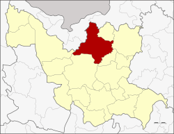 Amphoe location in Udon Thani Province | |
| Coordinates: 17°41′43″N 102°54′26″E / 17.69528°N 102.90722°ECoordinates: 17°41′43″N 102°54′26″E / 17.69528°N 102.90722°E | |
| Country | Thailand |
| Province | Udon Thani |
| Area | |
| • Total | 908.089 km2 (350.615 sq mi) |
| Population (2005) | |
| • Total | 110,190 |
| • Density | 121.3/km2 (314/sq mi) |
| Time zone | UTC+7 (ICT) |
| Postal code | 41150 |
| Geocode | 4119 |
Phen (Thai: เพ็ญ, pronounced [pʰēn]) is a district (amphoe) in the northern part of Udon Thani Province, Isan, Thailand.
Geography
Neighboring districts are (from the northeast clockwise) Sang Khom, Ban Dung, Phibun Rak, Mueang Udon Thani, Ban Phue of Udon Thani Province, Sakhrai, Mueang Nong Khai and Phon Phisai of Nong Khai Province.
History
The district dates back to Mueang Phen, which was a subordinate of Mueang Nong Khai. In 1907 it became a district, then named Mueang Phen (เมืองเพ็ญ) within Udon Thani Province. In 1917 it was renamed Phen.[1]
Administration
The district is divided into 11 sub-districts (tambon), which are further divided into 151 villages (muban). Phen is a township (thesaban tambon) which covers parts of the tambon Phen. There are a further 11 tambon administrative organizations (TAO).
| No. | Name | Thai name | Villages | Pop. | |
|---|---|---|---|---|---|
| 1. | Phen | เพ็ญ | 16 | 12,407 | |
| 2. | Ban That | บ้านธาตุ | 19 | 16,337 | |
| 3. | Na Phu | นาพู่ | 15 | 12,156 | |
| 4. | Chiang Wang | เชียงหวาง | 15 | 13,964 | |
| 5. | Sum Sao | สุมเส้า | 19 | 11,916 | |
| 6. | Na Bua | นาบัว | 11 | 6,521 | |
| 7. | Ban Lao | บ้านเหล่า | 11 | 8,379 | |
| 8. | Chom Si | จอมศรี | 17 | 9,751 | |
| 9. | Tao Hai | เตาไห | 8 | 5,782 | |
| 10. | Khok Klang | โคกกลาง | 11 | 7,262 | |
| 11. | Sang Paen | สร้างแป้น | 9 | 5,715 |
References
- ↑ ประกาศกระทรวงมหาดไทย เรื่อง เปลี่ยนชื่ออำเภอ (PDF). Royal Gazette (in Thai). 34 (0 ก): 40–68. April 29, 1917.