Kumphawapi District
| Kumphawapi กุมภวาปี | |
|---|---|
| Amphoe | |
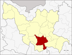 Amphoe location in Udon Thani Province | |
| Coordinates: 17°6′50″N 103°1′7″E / 17.11389°N 103.01861°ECoordinates: 17°6′50″N 103°1′7″E / 17.11389°N 103.01861°E | |
| Country | Thailand |
| Province | Udon Thani |
| Seat | Kumphawapi |
| Area | |
| • Total | 672.6 km2 (259.7 sq mi) |
| Population (2017) | |
| • Total | 124,241 |
| • Density | 187.6/km2 (486/sq mi) |
| Time zone | UTC+7 (ICT) |
| Postal code | 41110 |
| Geocode | 4104 |
Kumphawapi (Thai: กุมภวาปี, pronounced [kūm.pʰā.wāː.pīː]) is a district (amphoe) in the southern part of Udon Thani Province, northeastern Thailand.
Etymology
กุมภ[า] Kumpha is from Sanskrit "pitcher", "water-pot", as reflected in the name of February, associated with the zodiac sign of Aquarius. วาปี wapi is from Sanskrit "pond", synonymous with หนองนํ้า, บึง.[1]
Geography
Neighboring districts are (from the southwest clockwise) Non Sa-at, Nong Saeng, Mueang Udon Thani, Prachaksinlapakhom, Ku Kaeo and Si That of Udon Thani Province, Tha Khantho of Kalasin Province and Kranuan of Khon Kaen Province.
North of the central town is the shallow Nong Han Kumphawapi lake. The lake is surrounded by marshland, one of the largest natural wetlands in northeast Thailand. The lake is drained by Lam Pao.
History
Mueang Kumphawapi was one of the four original subdivisions of Udon Thani, which were converted into Amphoe during the Thesaphiban administrative reforms in 1908.[2]
Symbols
The district slogan is Kumphawapi, city of sugar, monkey park, highland of glass Buddha station, goose wetland stream of life.
Administration
Central administration
Kumphawapi is divided into 13 sub-districts (Tambon), which are further subdivided into 176 administrative villages (muban).
| No. | Name | Thai | Villages | Pop.[3] |
|---|---|---|---|---|
| 1. | Tum Tai | ตูมใต้ | 9 | 7,042 |
| 2. | Phan Don | พันดอน | 20 | 17,410 |
| 3. | Wiang Kham | เวียงคำ | 18 | 10,496 |
| 4. | Chaelae | แชแล | 14 | 10,311 |
| 6. | Chiang Wae | เชียงแหว | 13 | 8,633 |
| 7. | Huai Koeng | ห้วยเกิ้ง | 8 | 5,424 |
| 9. | Soephloe | เสอเพลอ | 19 | 11,959 |
| 10. | Si O | สีออ | 8 | 4,546 |
| 11. | Pakho | ปะโค | 17 | 11,304 |
| 13. | Pha Suk | ผาสุก | 10 | 6,379 |
| 14. | Tha Li | ท่าลี่ | 14 | 9,775 |
| 15. | Kumphawapi | กุมภวาปี | 15 | 12,890 |
| 16. | Nong Wa | หนองหว้า | 11 | 8,072 |
Missing numbers are tambon which now form Prachak Sinlapakhom District.
Local administration
There are nine sub-district municipalities (thesaban tambon) in the district:
- Kumphawapi (Thai: เทศบาลตำบลกุมภวาปี) consisting of parts of sub-district Kumphawapi.
- Phan Don (Thai: เทศบาลตำบลพันดอน) consisting of parts of sub-district Phan Don.
- Huai Koeng (Thai: เทศบาลตำบลห้วยเกิ้ง) consisting of sub-district Huai Koeng.
- Pa Kho (Thai: เทศบาลตำบลปะโค) consisting of sub-district Pakho.
- Wiang Kham (Thai: เทศบาลตำบลเวียงคำ) consisting of sub-district Wiang Kham.
- Nong Wa (Thai: เทศบาลตำบลหนองหว้า) consisting of sub-district Nong Wa.
- Kong Phan Phan Don (Thai: เทศบาลตำบลกงพานพันดอน) consisting of parts of sub-district Phan Don.
- Chaelae (Thai: เทศบาลตำบลแชแล) consisting of sub-district Chaelae.
- Chiang Wae (Thai: เทศบาลตำบลเชียงแหว) consisting of sub-district Chiang Wae.
There are six subdistrict administrative organizations (SAO) in the district:
- Tum Tai (Thai: องค์การบริหารส่วนตำบลตูมใต้) consisting of sub-district Tum Tai.
- Soephloe (Thai: องค์การบริหารส่วนตำบลเสอเพลอ) consisting of sub-district Soephloe.
- Si O (Thai: องค์การบริหารส่วนตำบลสีออ) consisting of sub-district Si O.
- Pha Suk (Thai: องค์การบริหารส่วนตำบลผาสุก) consisting of sub-district Pha Suk.
- Tha Li (Thai: องค์การบริหารส่วนตำบลท่าลี่) consisting of sub-district Tha Li.
- Kumphawapi (Thai: องค์การบริหารส่วนตำบลกุมภวาปี) consisting of parts of sub-district Kumphawapi.
References
- ↑ Dictionary Archived 2009-03-03 at the Wayback Machine. of the Royal Institute of Thailand(1982)
- ↑ แจ้งความกระทรวงมหาดไทย เรื่อง ให้รวมเมืองกมุทธาไส ๑ เมือง กุมภวาปี ๑ เมือง หนองหาย ๑ อำเภอ บ้านหมากแข้ง ๑ ตั้งเป็นเมืองจัตวา เรียกว่าเมืองอุดรธานีบริเวณน้ำชีให้เปลี่ยนเรียกว่าเมืองขอนแก่น บริเวณน้ำเหืองให้เปลี่ยนเรียกว่าเมืองเลย บริเวณสกลนครให้เปลี่ยน เรียกว่าเมืองสกลนคร บริเวณธาตุพนมให้เปลี่ยนเรียกว่าเมืองนครพนม ส่วนเมืองหนองคายเมืองโพนพิสัยให้คงไว้ตามเดิม (PDF). Royal Gazette (in Thai). 24 (41): 1088. 1908-01-12.
- ↑ "Population statistics 2017" (in Thai). Department of Provincial Administration. Retrieved 2018-03-13.
External links