Nong Han District
| Nong Han หนองหาน | |
|---|---|
| District | |
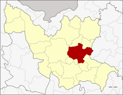 District location in Udon Thani Province | |
| Coordinates: 17°21′38″N 103°6′20″E / 17.36056°N 103.10556°ECoordinates: 17°21′38″N 103°6′20″E / 17.36056°N 103.10556°E | |
| Country | Thailand |
| Province | Udon Thani |
| Seat | Nong Han |
| Area | |
| • Total | 708.119 km2 (273.406 sq mi) |
| Population (2005) | |
| • Total | 114,982 |
| • Density | 162.4/km2 (421/sq mi) |
| Time zone | UTC+7 (ICT) |
| Postal code | 41130 |
| Geocode | 4106 |
Nong Han (Thai: หนองหาน, pronounced [nɔ̌ːŋ hǎːn]) is a district (amphoe) of Udon Thani Province, northeastern Thailand.
Geography
Neighboring districts are (from the south clockwise) Chai Wan, Ku Kaeo, Prachaksinlapakhom, Mueang Udon Thani, Phibun Rak and Thung Fon of Udon Thani Province, and Sawang Daen Din of Sakon Nakhon Province.
History
The Ban Chiang (Thai: มู่ที่ 13 ตำบล บ้านเชียง, translit. Hamlet 13 Tambon Ban Chiang) archaeological site has been a world heritage site since 1992. It was settled from the Neolithic to the Iron Age, and then abandoned from about 300 CE until the early-19th century. It is best known for its red painted pottery.
Mueang Nong Han was one of the four original subdivisions of Udon Thani, which were converted into amphoe during the monthon Thesaphiban administrative reforms in 1908.[1]
Economy
Tambon Phak Top is to be the site of Thailand's largest biomass-fired power plant if plans by its owner, the Thai Appliance Industry PLC (Thaico) come to fruition. The 20 megawatt plant is facing significant local opposition. The plant would require the construction of six waste sorting plants not too distant to provide feedstock to the power plant.[2]
Administration
The district is divided into 12 sub-districts (tambons), which are further divided into 161 villages (mubans). There are three sub-district municipalities (thesaban tambon): Nong Han, Nong Mek, and Ban Chiang. Each cover parts of tambons of the same name. There are a further 12 tambon administrative organizations (TAO).
| No. | Name | Thai | Villages | Pop.[3] |
|---|---|---|---|---|
| 1. | Nong Han | หนองหาน | 17 | 16,902 |
| 2. | Nong Mek | หนองเม็ก | 19 | 14,915 |
| 5. | Phang Ngu | พังงู | 15 | 9,540 |
| 6. | Sabaeng | สะแบง | 8 | 8,015 |
| 7. | Soi Phrao | สร้อยพร้าว | 11 | 5,921 |
| 9. | Ban Chiang | บ้านเชียง | 15 | 11,198 |
| 10. | Ban Ya | บ้านยา | 11 | 5,419 |
| 11. | Phon Ngam | โพนงาม | 20 | 13,381 |
| 12. | Phak Top | ผักตบ | 13 | 8,297 |
| 14. | Nong Phai | หนองไผ่ | 14 | 9,172 |
| 17. | Don Hai Sok | ดอนหายโศก | 10 | 6,496 |
| 18. | Nong Sa Pla | หนองสระปลา | 8 | 6,037 |
Missing numbers are tambon which now form the districts Phibun Rak and Ku Kaeo.
References
- ↑ แจ้งความกระทรวงมหาดไทย เรื่อง ให้รวมเมืองกมุทธาไส ๑ เมือง กุมภวาปี ๑ เมือง หนองหาย ๑ อำเภอ บ้านหมากแข้ง ๑ ตั้งเป็นเมืองจัตวา เรียกว่าเมืองอุดรธานีบริเวณน้ำชีให้เปลี่ยนเรียกว่าเมืองขอนแก่น บริเวณน้ำเหืองให้เปลี่ยนเรียกว่าเมืองเลย บริเวณสกลนครให้เปลี่ยน เรียกว่าเมืองสกลนคร บริเวณธาตุพนมให้เปลี่ยนเรียกว่าเมืองนครพนม ส่วนเมืองหนองคายเมืองโพนพิสัยให้คงไว้ตามเดิม (PDF). Royal Gazette (in Thai). 28 (81): 1088. 1908-01-12.
- ↑ Kumnodnae, Yuttapong (13 September 2018). "Energy protesters halt public hearing". Bangkok Post. Retrieved 13 September 2018.
- ↑ "Population statistics 2008". Department of Provincial Administration. Archived from the original on 2009-08-20.
External links
- amphoe.com (Thai)