Petropavlivka
| Petropavlivka Петропавлiвка | |
|---|---|
| Urban-type settlement | |
 Petropavlivka | |
| Coordinates: 48°27′15″N 36°26′25″E / 48.45417°N 36.44028°ECoordinates: 48°27′15″N 36°26′25″E / 48.45417°N 36.44028°E | |
| Country | Ukraine |
| Oblast | Dnipropetrovsk Oblast |
| Raion | Petropavlivka Raion |
| Population (2017) | |
| • Total | 7,168[1] |
| Time zone | UTC+2 (EET) |
| • Summer (DST) | UTC+3 (EEST) |
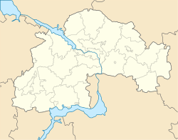
Petropavlivka (Ukrainian: Петропавлiвка; Russian: Петропавловка) is an urban-type settlement in Dnipropetrovsk Oblast in Ukraine and the administrative center of Petropavlivka Raion. Population: 7,168 (2017 est.)[1]
Petropavlivka is located on the left bank of the Samara River, a left tributary of the Dnieper.
Economy
Transportation
Petropavlivka is just north of the Highway M04, connecting Pokrovsk with Dnipro and Kryvyi Rih. A road to Kramatorsk branches off north.
Petropavlivka railway station is located southeast of the settlement, in the village of Zaliznychne, on the railway connecting Pokrovsk and Pavlohrad.
References
- 1 2 "Чисельність наявного населення України (Actual population of Ukraine)" (in Ukrainian). State Statistics Service of Ukraine. Retrieved 26 August 2017.
This article is issued from
Wikipedia.
The text is licensed under Creative Commons - Attribution - Sharealike.
Additional terms may apply for the media files.