Peixoto de Azevedo
| Peixoto de Azevedo | |
|---|---|
| Municipality | |
 Location in Mato Grosso state | |
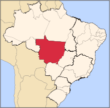
 Peixoto de Azevedo Location in Brazil | |
| Coordinates: 10°13′23″S 54°58′47″W / 10.22306°S 54.97972°WCoordinates: 10°13′23″S 54°58′47″W / 10.22306°S 54.97972°W | |
| Country |
|
| Region | Central-West Region |
| State | Mato Grosso |
| Founded | May 13, 1986 |
| Government | |
| • Mayor | Mayor (Mauricio Ferreira de Souza (PSDB)) |
| Area | |
| • Total | 14,257.8 km2 (5,505.0 sq mi) |
| Elevation | 346 m (1,135 ft) |
| Population (2017) | |
| • Total | 33,630 |
| • Density | 2.4/km2 (6.1/sq mi) |
| Time zone | BRT-1/BRST-1 (UTC-4/-3) |

Gold specimen from the Alta Floresta Gold Province, near Peixoto de Azevedo. 2.6 x 2.2 x 1.4 cm.
Peixoto de Azevedo is a municipality in the Brazilian state of Mato Grosso. Peixoto de Azevedo was the ancient location of Panará's indigenous tribes. They were expelled during the 19th century gold rush in the region. From the 20th century, the Panará tribes were relocated to the Kapoto-Jarinã indian reservation created by the Villa-Boas brothers.
The nearby Alta Floresta Gold Province comprises 38 gold mines. [1]
On September 29, 2006, Gol Transportes Aéreos Flight 1907 crashed approximately 200 kilometers (120 mi) east of the city center.
References
Capital: Cuiabá | |||||||||||||||||
| Centro-Sul Mato-Grossense |
|  | |||||||||||||||
| Nordeste Mato-Grossense |
| ||||||||||||||||
| Norte Mato-Grossense |
| ||||||||||||||||
| Sudeste Mato-Grossense |
| ||||||||||||||||
| Sudoeste Mato-Grossense |
| ||||||||||||||||
This article is issued from
Wikipedia.
The text is licensed under Creative Commons - Attribution - Sharealike.
Additional terms may apply for the media files.