Barra do Bugres
| Barra do Bugres, Mato Grosso | |||
|---|---|---|---|
| Municipality | |||
| |||
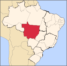
 Location of Barra do Bugres, Mato Grosso | |||
 Barra do Bugres, Mato Grosso Location in Brazil | |||
| Coordinates: 15°04′22″S 57°10′51″W / 15.07278°S 57.18083°WCoordinates: 15°04′22″S 57°10′51″W / 15.07278°S 57.18083°W | |||
| Country |
| ||
| Region | Central-West | ||
| State |
| ||
| Founded | December 31, 1943 | ||
| Government | |||
| • Mayor | Julio Florinde (2013-2016) | ||
| Area | |||
| • Total | 7,228.902 km2 (2,791.095 sq mi) | ||
| Population (2017) | |||
| • Total | 33,644 | ||
| • Density | 4.7/km2 (12/sq mi) | ||
| Demonym(s) | barra-burrense | ||
| Time zone | UTC-3 (UTC-3) | ||


Barra do Bugres is a municipality in the state of Mato Grosso in the Central-West Region of Brazil.[1][2][3][4]
See also
References
- ↑ "Divisão Territorial do Brasil" (in Portuguese). Divisão Territorial do Brasil e Limites Territoriais, Instituto Brasileiro de Geografia e Estatística (IBGE). July 1, 2008. Retrieved December 17, 2009.
- ↑ "Estimativas da população para 1º de julho de 2009" (PDF) (in Portuguese). Estimativas de População, Instituto Brasileiro de Geografia e Estatística (IBGE). August 14, 2009. Retrieved December 17, 2009.
- ↑ "Ranking decrescente do IDH-M dos municípios do Brasil" (in Portuguese). Atlas do Desenvolvimento Humano, Programa das Nações Unidas para o Desenvolvimento (PNUD). 2000. Archived from the original on October 3, 2009. Retrieved December 17, 2009.
- ↑ "Produto Interno Bruto dos Municípios 2002-2005" (PDF) (in Portuguese). Instituto Brasileiro de Geografia e Estatística (IBGE). December 19, 2007. Archived from the original (PDF) on October 2, 2008. Retrieved December 17, 2009.
Mayor of Barra do Bugres physically threatens female journalist
Capital: Cuiabá | |||||||||||||||||
| Centro-Sul Mato-Grossense |
|  | |||||||||||||||
| Nordeste Mato-Grossense |
| ||||||||||||||||
| Norte Mato-Grossense |
| ||||||||||||||||
| Sudeste Mato-Grossense |
| ||||||||||||||||
| Sudoeste Mato-Grossense |
| ||||||||||||||||
This article is issued from
Wikipedia.
The text is licensed under Creative Commons - Attribution - Sharealike.
Additional terms may apply for the media files.