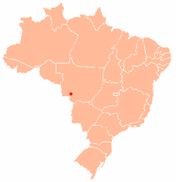
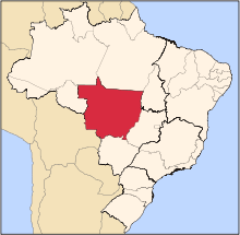
Cáceres, Mato Grosso
| Cáceres | |||
|---|---|---|---|
|
| |||
| |||
 | |||
| Country | Brazil | ||
| State | Mato Grosso | ||
| Founded | 6 October 1778[1] | ||
| Population (July 1 2018) | |||
| • Total | 93,882 | ||
Cáceres is a municipality in the Brazilian state of Mato Grosso. It covers an area of 24,000km2 and as of 2014 had an estimated population of 90,000. [2]
The town is sited on the Paraguay River, and hosts a popular fishing festival each September.[3] The municipality contains part of the Serra das Araras Ecological Station.[4] It also contains part of the Taiamã Ecological Station.[5] The municipality contains the 114,000 hectares (280,000 acres) Guirá State Park, created in 2002.[6]
Cáceres was the starting point of the Roosevelt–Rondon Scientific Expedition.[7]
Cáceres is the administrative headquarters of the Mato Grosso State University and counts with 13 graduation courses and 3 post graduation courses.[8]
References
- ↑ Ivan Sache (21 November 2010). "Cáceres, Mato Grosso (Brazil)". Flags of the World. Retrieved 8 December 2012.
- ↑ "Mato Grosso: Caceres". Cidades. IBGE. Retrieved 26 December 2014.
- ↑ "Thousands of piranhas infest beach, bite swimmers". Sydney Morning Herald. Fairfax Media. 17 November 2011. Retrieved 4 May 2014.
- ↑ Unidade de Conservação: Estação Ecológica da Serra das Araras (in Portuguese), MMA: Ministério do Meio Ambiente, retrieved 2016-04-19
- ↑ Unidade de Conservação: Estação Ecológica de Taiamã (in Portuguese), MMA: Ministério do Meio Ambiente, retrieved 2016-04-18
- ↑ Parque Estadual Guirá (in Portuguese), Via Rural, retrieved 2016-12-08
- ↑ Roosevel-Rondon Scientifi Expedition Website, retrieved 2017-03-27
- ↑ UNEMAT Website (in Portuguese), retrieved 2017-03-27
External links

- Cáceres Governo Municipal (in Portuguese)
- Pantanal Escapes - Travel Guide and tourist information for Cáceres
16°11′S 57°40′W / 16.183°S 57.667°W


