Passu
| Passu پسو | |
|---|---|
| Village | |
 The Passu Cones, also known as Cathedral Ridge, as viewed from the Karakoram Highway in Passu | |
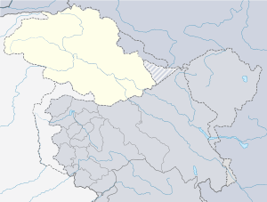 Passu Location in Pakistan  Passu Passu (Pakistan) | |
| Coordinates: Coordinates: 36°28′N 74°54′E / 36.467°N 74.900°E | |
| Country |
|
| Autonomous state |
|
| District | Gilgit District |
| Time zone | UTC+5 (PST) |
Passu (Urdu: پسو) is a small village located in the Gilgit Baltistan region of northern Pakistan. Situated along the Karakoram Highway in Upper Hunza, Passu is a popular tourist destination because of its easily accessible sweeping landscapes, and vistas of the 7,478 m (24,534 ft) tall Passu Sar mountain, the Passu Glacier, and Passu Cones.
Geography
Passu is along the Hunza River, some 15 kilometers from Gulmit, the Tehsil headquarters of Gojal, in the Gilgit-Baltistan region of Pakistan, and about 150 km upriver from Gilgit. Passu is located in Upper Hunza, also known as the Gojal Valley.
It lies very near the tongue of the Passu Glacier, and just south of the tongue of the Batura Glacier. The latter is the seventh longest non-polar glacier in the world at 56 km, and reaches very near to the highway.
Tupopdan, 6,106 metres (20,033 ft), also known as "Passu Cones" or "Passu Cathedral", lies to the north of the village; it is the most photographed peak of the region. Also nearby are the high peaks of Pasu Sar, Shispare Sar, and Batura.
Demographics
The people are predominantly Wakhi[1] and speak the Wakhi Language. Religiously they are Ismaili, a sect of Shia Islam.
Gallery

 Batura Lake near Pass
 Passu Cones
 Passu cones
 Passu
Passu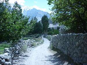 village
 Nabod area of Passu
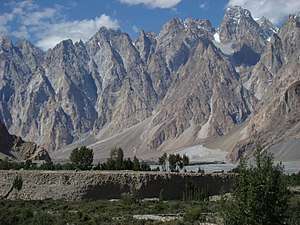 The Passu ones are located adjacent to the Karakoram Highway
References
- ↑ Salopek, Paul (January 2, 2018). "Walking Grass". National Geographic. Retrieved January 2, 2018.
The inhabitants of this austere landscape, many of them ethnic Wakhi farmers, have learned to trap this explosive blessing through the filter of grass.