Parris, Texas
| Parris, Texas | |
|---|---|
| ghost town | |
 Parris, Texas Location within the state of Texas | |
| Coordinates: 33°15′10″N 96°36′21″W / 33.25278°N 96.60583°WCoordinates: 33°15′10″N 96°36′21″W / 33.25278°N 96.60583°W | |
| Country | United States |
| State | Texas |
| Counties | Collin |
| Elevation | 551 ft (168 m) |
| Time zone | UTC-6 |
| • Summer (DST) | UTC-5 (CDT) |
| ZIP code | 75454 |
| Area code(s) | 214, 469, 972 |
| GNIS feature ID | 2034654[1] |
Parris, Texas is a community that once existed just south of Melissa in central Collin County near the banks of the East Fork[2] of the Trinity River.
History
In 1859 Thaddeus Parris, a Mexican–American War veteran for whom the community was named built an ox-turned Gristmill[3] at this location. This attracted settlers of the area during the next decade and until sometime in the late nineteenth or early twentieth century Parris remained a community center for area farmers.[4]
Further reading
References
- ↑ "US Board on Geographic Names". United States Geological Survey. 2007-10-25. Retrieved 2008-01-31.
- ↑ "East Fork Trinity Watershed". United States Environmental Protection Agency. Retrieved March 19, 2013.
- ↑ "Milling". Texas State Historical Association. Retrieved March 20, 2013.
- ↑ "Parris, Texas". Texas State Historical Association. Retrieved March 17, 2013.
External links
- Thaddeus Parris - United States Census, 1870
- Thaddeus Parris - Find A Grave Memorial
- TopoQuest
- Roadside Thoughts
Municipalities and communities of Collin County, Texas, United States | ||
|---|---|---|
| Cities | 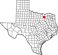 | |
| Towns | ||
| CDP | ||
| Other unincorporated communities |
| |
| Historical communities | ||
| Ghost towns | ||
| Footnotes | ‡This populated place also has portions in an adjacent county or counties | |

This article is issued from
Wikipedia.
The text is licensed under Creative Commons - Attribution - Sharealike.
Additional terms may apply for the media files.