Parks and open spaces in the London Borough of Havering

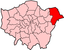
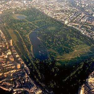
The London Borough of Havering is a London borough in northeast London, England. Part of Outer London, much of its area is protected from development by the Metropolitan Green Belt and more than half the borough is now parkland. Its parks and open spaces range from the large urban park to village greens and there are more than a hundred of them in total, mostly in the care of Havering London Borough Council, but some by other organisations. Part of the extensive community forest known as Thames Chase is also within the borough and a large new regional parkland is currently under development, called Wildspace. There are 93 Sites of Importance for Nature Conservation in Havering.[1] Other parks and open spaces are:

Park or open spaceGreen
Flag
Co-ordinates
Bedfords Park☑51°36′22″N 0°11′31″E / 51.606°N 0.192°E / 51.606; 0.192 (Bedfords Park)
Central Park51°36′25″N 0°13′41″E / 51.607°N 0.228°E / 51.607; 0.228 (Central Park)
Cottons Park☑51°34′30″N 0°10′19″E / 51.575°N 0.172°E / 51.575; 0.172 (Cottons Park)
Harold Wood Park☑51°35′13″N 0°14′10″E / 51.587°N 0.236°E / 51.587; 0.236 (Harold Wood Park)
Harrow Lodge Park51°33′25″N 0°12′07″E / 51.557°N 0.202°E / 51.557; 0.202 (Harrow Lodge Park)
Havering Country Park51°36′50″N 0°10′12″E / 51.614°N 0.170°E / 51.614; 0.170 (Havering Country Park)
Hornchurch Country Park51°32′20″N 0°12′29″E / 51.539°N 0.208°E / 51.539; 0.208 (Hornchurch Country Park)
Hylands Park☑51°34′16″N 0°12′04″E / 51.571°N 0.201°E / 51.571; 0.201 (Hylands Park)
King Georges Playing Fields (also known as Mawney Park)51°35′06″N 0°09′54″E / 51.585°N 0.165°E / 51.585; 0.165 (King Georges Playing Fields)
Ingrebourne Valley Greenway:
  • Gaynes Parkway
  • Hacton Parkway
  • Pages Wood
  • Rainham Creekside Path
  • Suttons Parkway
Langtons Gardens51°33′54″N 0°13′01″E / 51.565°N 0.217°E / 51.565; 0.217 (Langtons Gardens)
Lawns Park51°35′46″N 0°10′05″E / 51.596°N 0.168°E / 51.596; 0.168 (Lawns Park)
Lodge Farm Park☑51°34′55″N 0°11′31″E / 51.582°N 0.192°E / 51.582; 0.192 (Lodge Farm Park)
Pyrgo Park51°37′08″N 0°11′56″E / 51.619°N 0.199°E / 51.619; 0.199 (Pyrgo Park)
Raphael Park51°35′20″N 0°11′24″E / 51.589°N 0.190°E / 51.589; 0.190 (Raphael Park)
Rise Park51°35′49″N 0°11′06″E / 51.597°N 0.185°E / 51.597; 0.185 (Rise Park)
Tylers Common (also known as Upminster Common)51°35′31″N 0°15′32″E / 51.592°N 0.259°E / 51.592; 0.259 (Tylers Common)
Upminster Park☑51°33′14″N 0°14′46″E / 51.554°N 0.246°E / 51.554; 0.246 (Upminster Park)
Windmill Field51°33′32″N 0°14′42″E / 51.559°N 0.245°E / 51.559; 0.245 (Windmill Field)
Wildspace51°30′07″N 0°11′42″E / 51.502°N 0.195°E / 51.502; 0.195 (Wildspace)

References

  1. "Sites of Importance for Nature Conservation in Havering" (PDF). London Borough of Havering.
This article is issued from Wikipedia. The text is licensed under Creative Commons - Attribution - Sharealike. Additional terms may apply for the media files.