Grade I and II* listed buildings in the London Borough of Havering
There are over 9,000 Grade I listed buildings and 20,000 Grade II* listed buildings in England. This page is a list of these buildings in the London Borough of Havering.
Grade I
| Name | Location | Type | Completed [note 1] | Date designated | Grid ref.[note 2] Geo-coordinates |
Entry number [note 3] | Image |
|---|---|---|---|---|---|---|---|
| Church of St Helen and St Giles | Havering | Church | c. 1170 | 7 January 1955 | TQ5208382208 51°31′06″N 0°11′26″E / 51.518324°N 0.190537°E |
1358505 | 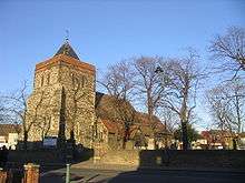 |
| Church of St Laurence | Havering | Church | Medieval | 7 January 1955 | TQ5592986496 51°33′21″N 0°14′52″E / 51.555802°N 0.247821°E |
1184679 | 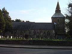 |
| Church of St Mary Magdalene | North Ockendon, Havering | Church | 12th century | 7 January 1955 | TQ5873984866 51°32′25″N 0°17′15″E / 51.540374°N 0.287585°E |
1183610 | 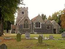 |
| Parish Church of St Andrew | Havering | Parish Church | 13th century | 7 January 1955 | TQ5440986968 51°33′38″N 0°13′34″E / 51.56046°N 0.226121°E |
1358529 |  |
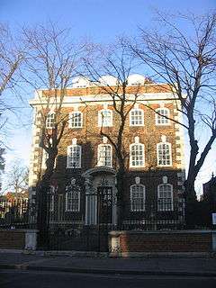
| The Bower House | Havering Atte Bower, Havering | Country House | 1729 | 4 July 1952 | TQ5125492708 51°36′46″N 0°10′59″E / 51.612887°N 0.183113°E |
1079873 | .jpg) |
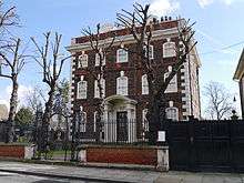
| Stable Block at the Bower House | Havering-atte-Bower, Havering | Stable | c. 1729 | 4 July 1952 | TQ5124392695 51°36′46″N 0°10′59″E / 51.612773°N 0.182949°E |
1079874 | .jpg) |
Grade II*


Notes
- 1 2 The date given is the date used by Historic England as significant for the initial building or that of an important part in the structure's description.
- 1 2 Sometimes known as OSGB36, the grid reference is based on the British national grid reference system used by the Ordnance Survey.
- 1 2 The "List Entry Number" is a unique number assigned to each listed building and scheduled monument by Historic England.
External links

| Districts |
|  |
|---|---|---|
| Attractions | ||
| Major retail | ||
| Places of worship | ||
| Parks and open spaces | ||
| Constituencies | ||
| Tube and rail stations | ||
| Other topics | ||
This article is issued from
Wikipedia.
The text is licensed under Creative Commons - Attribution - Sharealike.
Additional terms may apply for the media files.