Panaon Island
 Wawa Bridge connecting Panaon and Leyte island | |
.svg.png) Panaon Island Location within the Philippines | |
| Geography | |
|---|---|
| Coordinates | 10°3′5″N 125°12′45″E / 10.05139°N 125.21250°ECoordinates: 10°3′5″N 125°12′45″E / 10.05139°N 125.21250°E |
| Adjacent bodies of water | |
| Area | 191 km2 (74 sq mi) |
| Administration | |
| Region | Eastern Visayas |
| Province | Southern Leyte |
| Municipalities | |
| Demographics | |
| Population | 57,703 (as of 2015) |
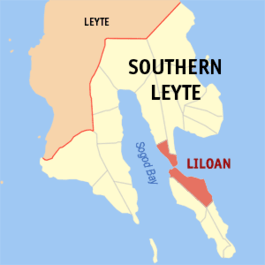
Map of Southern Leyte with Panaon Island on the right bottom corner
Panaon Island is a small island in the Philippines, in the province of Southern Leyte. It lies south of Leyte, separated from Dinagat to the east, and Mindanao to the southeast by Surigao Strait. The Mindanao Sea lies to the southwest.
Panaon is about 30 kilometres (19 mi) long from north to south. The largest town is Liloan, which is connected by a bridge called the Wawa Bridge to the main Leyte Island.

Panaon Island is composed of the municipalities of Liloan, San Francisco, Pintuyan and San Ricardo. The basic forms of living are harvesting coconut, rice, fish and edible green leaves.
Scuba diving and whale watching (referred to locally as Tikitiki) are popular tourist activities.
External links
This article is issued from
Wikipedia.
The text is licensed under Creative Commons - Attribution - Sharealike.
Additional terms may apply for the media files.