Palata, Nepal
| Palata पलाता गाउँपालिका | |
|---|---|
| Rural Municipality | |
 Palata Location in Nepal | |
| Coordinates: 29°18′0″N 81°48′45″E / 29.30000°N 81.81250°ECoordinates: 29°18′0″N 81°48′45″E / 29.30000°N 81.81250°E | |
| Country |
|
| Province | Karnali Pradesh |
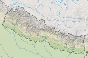
| District | Kalikot |
| Wards | 9 |
| Established | 10 March 2017 |
| Government | |
| • Type | Rural Council |
| • Chairperson | Mr. Laxman Bahadur Bam |
| • Vice-chairperson | Mrs. Dana Neupane |
| Area | |
| • Total | 318.84 km2 (123.10 sq mi) |
| Population (2011) | |
| • Total | 15,303 |
| • Density | 48/km2 (120/sq mi) |
| Time zone | UTC+5:45 (NST) |
| Headquarter | Thirpu |
| Website |
palatamun |
Palata (Nepali: पलाता गाउँपालिका) is a rural municipality located in Kalikot District of Karnali Province of Nepal.[1][2]
According to Ministry of Federal Affairs and General Administration, Palata rural municipality has an area of 318.84 square kilometres (123.10 sq mi) and the total population of the rural municipality is 15,303 as of 2011 Nepal census.[3]
Dholagohe, Khin and Thirpu which previously were all separate Village development committees merged to form this new local level body. Fulfilling the requirement of the new Constitution of Nepal 2015, Ministry of Federal Affairs and General Administration replaced all old VDCs and Municipalities into 753 new local level bodies.
The rural municipality is divided into total 9 wards and the headquarters of this newly formed rural municipality is situated at Thirpu.
References
- ↑ "स्थानीय तहहरुको विवरण (Details of local levels)". www.mofald.gov.np/en. Ministry of Federal Affairs and General Administration. Retrieved 30 July 2018.
- ↑ "Final District 1-75 Corrected Last for RAJPATRA" (PDF). Retrieved 30 July 2018.
- ↑ "Palata Rural Municipality in Nepal". CITY POPULATION. Retrieved 30 July 2018.
External links
Headquarters: Manma (today part of Khandachakra Municipality) | ||
| Municipalities | 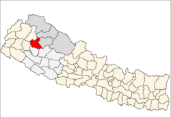 | |
| Rural municipalities | ||
| Former VDCs | ||
List of municipalities and rural municipalities of Nepal | ||