Owasco, New York
| Owasco, New York | |
|---|---|
| Town | |
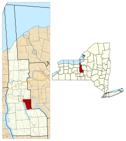 Location within Cayuga County and New York | |
 Owasco Location within the state of New York | |
| Coordinates: 42°53′23″N 76°30′12″W / 42.88972°N 76.50333°W | |
| Country | United States |
| State | New York |
| County | Cayuga |
| Government | |
| • Type | Town Council |
| • Town Supervisor | John J. Klink (D) |
| • Town Council |
Members' List
|
| Area[1] | |
| • Total | 23.48 sq mi (60.80 km2) |
| • Land | 20.88 sq mi (54.08 km2) |
| • Water | 2.59 sq mi (6.72 km2) |
| Elevation | 896 ft (273 m) |
| Population (2010) | |
| • Total | 3,793 |
| • Estimate (2016)[2] | 3,678 |
| • Density | 176.14/sq mi (68.01/km2) |
| Time zone | UTC-5 (Eastern (EST)) |
| • Summer (DST) | UTC-4 (EDT) |
| ZIP code | 13021 |
| Area code(s) | 315 |
| FIPS code | 36-011-55871 |
| GNIS feature ID | 0979333 |
| Website |
www |
Owasco is a town in Cayuga County, New York, United States. The population was 3,793 at the 2010 census.[3] Owasco is in the eastern part of Cayuga County and is at the southeast city line of Auburn. The town borders Owasco Lake, from where it gets its name. Owasco is home for many of the wealthier residents of Cayuga County.
History
The land was first settled around 1792, by a man named Herman Mesgow. The town of Owasco was formed in 1802 from the town of Aurelius.
Lakeside Park was listed on the National Register of Historic Places in 1989.[4]
Notable people
- Enos Throop, tenth governor of New York
Geography
According to the United States Census Bureau, the town has a total area of 23.5 square miles (60.8 km2), of which 20.9 square miles (54.1 km2) is land and 2.6 square miles (6.7 km2), or 11.05%, is water.[3]
Owasco Lake, one of the Finger Lakes, defines the west town line. The east town line is the border of Onondaga County. Sucker Brook enters Owasco Lake at the north end, and Owasco Outlet marks the town line south of Auburn. Dutch Hollow Brook enters Owasco Lake near Burtis Point.
New York State Route 38A is a north-south highway in the town, running southward along Owasco Lake.
Demographics
| Historical population | |||
|---|---|---|---|
| Census | Pop. | %± | |
| 1820 | 1,290 | — | |
| 1830 | 1,350 | 4.7% | |
| 1840 | 1,319 | −2.3% | |
| 1850 | 1,254 | −4.9% | |
| 1860 | 1,351 | 7.7% | |
| 1870 | 1,261 | −6.7% | |
| 1880 | 1,297 | 2.9% | |
| 1890 | 1,162 | −10.4% | |
| 1900 | 1,331 | 14.5% | |
| 1910 | 1,393 | 4.7% | |
| 1920 | 1,458 | 4.7% | |
| 1930 | 1,754 | 20.3% | |
| 1940 | 2,100 | 19.7% | |
| 1950 | 2,543 | 21.1% | |
| 1960 | 3,409 | 34.1% | |
| 1970 | 3,619 | 6.2% | |
| 1980 | 3,612 | −0.2% | |
| 1990 | 3,490 | −3.4% | |
| 2000 | 3,760 | 7.7% | |
| 2010 | 3,793 | 0.9% | |
| Est. 2016 | 3,678 | [2] | −3.0% |
| U.S. Decennial Census[5] | |||
As of the census[6] of 2000, there were 3,755 people, 1,425 households, and 1,107 families residing in the town. The population density was 179.4 people per square mile (69.3/km²). There were 1,608 housing units at an average density of 76.8 per square mile (29.7/km²). The racial makeup of the town was 98.91% White, 0.11% African American, 0.03% Native American, 0.53% Asian, 0.08% from other races, and 0.35% from two or more races. Hispanic or Latino of any race were 0.32% of the population.
There were 1,425 households out of which 34.7% had children under the age of 18 living with them, 68.7% were married couples living together, 6.3% had a female householder with no husband present, and 22.3% were non-families. 19.2% of all households were made up of individuals and 10.7% had someone living alone who was 65 years of age or older. The average household size was 2.63 and the average family size was 3.01.
In the town, the population was spread out with 25.7% under the age of 18, 5.1% from 18 to 24, 26.2% from 25 to 44, 26.8% from 45 to 64, and 16.2% who were 65 years of age or older. The median age was 41 years. For every 100 females, there were 96.6 males. For every 100 females age 18 and over, there were 92.2 males.
The median income for a household in the town was $52,544, and the median income for a family was $60,978. Males had a median income of $40,943 versus $27,500 for females. The per capita income for the town was $23,922. About 2.1% of families and 4.5% of the population were below the poverty line, including 4.6% of those under age 18 and 3.6% of those age 65 or over.
Communities and locations in Owasco
- Baptist Corners – A hamlet in the northeast part of the town.
- Burtis Point – A projection into Owasco Lake.
- Degroff – A hamlet in the northwest part of the town.
- Highland Beach – A hamlet on the shore of Lake Owasco and NY-38A.
- Koenigs Point – A location on Owasco Lake at the southwest corner of the town.
- Melrose Park – A suburban area south of Auburn on NY-38A.
- Owasco – The hamlet of Owasco is in the southeast part of the town on NY-38A. The Owasco Reformed Church was listed on the National Register of Historic Places in 2010.[4]
- Petty Corner – A hamlet in the northern part of Owasco, near Auburn.
- Valentines Corners – A hamlet west of Owasco village.
References
- ↑ "2016 U.S. Gazetteer Files". United States Census Bureau. Retrieved Jul 4, 2017.
- 1 2 "Population and Housing Unit Estimates". Retrieved June 9, 2017.
- 1 2 "Geographic Identifiers: 2010 Demographic Profile Data (G001): Owasco town, Cayuga County, New York". U.S. Census Bureau, American Factfinder. Retrieved November 13, 2014.
- 1 2 National Park Service (2009-03-13). "National Register Information System". National Register of Historic Places. National Park Service.
- ↑ "Census of Population and Housing". Census.gov. Retrieved June 4, 2015.
- ↑ "American FactFinder". United States Census Bureau. Retrieved 2008-01-31.
External links
Coordinates: 42°51′18″N 76°27′55″W / 42.85500°N 76.46528°W
Municipalities and communities of Cayuga County, New York, United States | ||
|---|---|---|
| City | 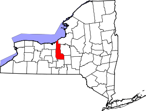 | |
| Towns | ||
| Villages | ||
| CDP | ||
| Other hamlets | ||
| Footnotes | ‡This populated place also has portions in an adjacent county or counties | |