Oton, Iloilo
| Oton | ||
|---|---|---|
| Municipality | ||
| Municipality of Oton | ||
| ||
| Motto(s): Banwang Panganay of Western Visayas | ||
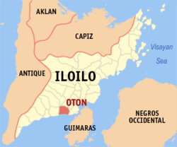 Map of Iloilo with Oton highlighted | ||
.svg.png) Oton Location within the Philippines | ||
| Coordinates: 10°42′N 122°28′E / 10.7°N 122.47°ECoordinates: 10°42′N 122°28′E / 10.7°N 122.47°E | ||
| Country |
| |
| Region | Western Visayas (Region VI) | |
| Province | Iloilo | |
| District | 1st district of Iloilo | |
| Founded | May 3, 1572 | |
| Barangays | 37 (see Barangays) | |
| Government [1] | ||
| • Type | Sangguniang Bayan | |
| • Mayor | Carina V. Flores | |
| • Electorate | 45,508 voters (2016) | |
| Area [2] | ||
| • Total | 86.44 km2 (33.37 sq mi) | |
| Population (2015 census)[3] | ||
| • Total | 89,115 | |
| • Density | 1,000/km2 (2,700/sq mi) | |
| Time zone | UTC+8 (PST) | |
| ZIP code | 5020 | |
| PSGC | 063034000 | |
| IDD : area code | +63 (0)33 | |
| Climate type | Tropical climate | |
| Income class | 1st municipal income class | |
| Revenue (₱) | 184,113,453.06 (2016) | |
| Native languages |
Kinaray-a language Hiligaynon Tagalog | |
| Website |
www | |

Oton, officially the Municipality of Oton, (Kinaray-a: Banwa kang Oton; Hiligaynon: Banwa sang Oton; Filipino: Bayan ng Oton) is a 1st class municipality in the province of Iloilo, Philippines. According to the 2015 census, it has a population of 89,115 people.[3]
Oton is 11 kilometres (6.8 mi) west from Iloilo City.
Barangays
Oton is politically subdivided into 37 barangays. [2]
- Abilay Norte
- Abilay Sur
- Alegre
- Batuan Ilaud
- Batuan Ilaya
- Bita Norte
- Bita Sur
- Botong
- Buray
- Cabanbanan
- Cabolo-an Norte
- Cabolo-an Sur
- Cadinglian
- Cagbang
- Calam-isan
- Galang
- Lambuyao
- Mambog
- Pakiad
- Poblacion East
- Poblacion North
- Poblacion South
- Poblacion West
- Pulo Maestra Vita
- Rizal
- Salngan
- Sambaludan
- San Antonio
- San Nicolas
- Santa Clara
- Santa Monica
- Santa Rita
- Tagbac Norte
- Tagbac Sur
- Trapiche
- Tuburan
- Turog-Turog
Demographics
| Population census of Oton | ||
|---|---|---|
| Year | Pop. | ±% p.a. |
| 1903 | 14,464 | — |
| 1918 | 15,396 | +0.42% |
| 1939 | 20,577 | +1.39% |
| 1948 | 21,306 | +0.39% |
| 1960 | 27,246 | +2.07% |
| 1970 | 32,862 | +1.89% |
| 1975 | 36,566 | +2.17% |
| 1980 | 41,044 | +2.34% |
| 1990 | 52,125 | +2.42% |
| 1995 | 56,821 | +1.63% |
| 2000 | 65,374 | +3.05% |
| 2007 | 77,621 | +2.40% |
| 2010 | 82,572 | +2.28% |
| 2015 | 89,115 | +1.46% |
| Source: Philippine Statistics Authority[3][4][5][6] | ||
_OldCathedral_1901.jpg)
Old Oton cathedral, destroyed in the 1948 earthquake (1901).
In the 2015 census, the population of Oton, Iloilo, was 89,115 people,[3] with a density of 1,000 inhabitants per square kilometre or 2,600 inhabitants per square mile.
Kinaray-a is the main speech of the people in Oton. Hiligaynon is spoken as a secondary language.
References
- ↑ "Municipality". Quezon City, Philippines: Department of the Interior and Local Government. Retrieved 31 May 2013.
- 1 2 "Province: Iloilo". PSGC Interactive. Quezon City, Philippines: Philippine Statistics Authority. Retrieved 12 November 2016.
- 1 2 3 4 Census of Population (2015). "Region VI (Western Visayas)". Total Population by Province, City, Municipality and Barangay. PSA. Retrieved 20 June 2016.
- ↑ Census of Population and Housing (2010). "Region VI (Western Visayas)". Total Population by Province, City, Municipality and Barangay. NSO. Retrieved 29 June 2016.
- ↑ Censuses of Population (1903–2007). "Region VI (Western Visayas)". Table 1. Population Enumerated in Various Censuses by Province/Highly Urbanized City: 1903 to 2007. NSO.
- ↑ "Province of Iloilo". Municipality Population Data. Local Water Utilities Administration Research Division. Retrieved 17 December 2016.
External links
| Wikimedia Commons has media related to Oton, Iloilo. |
- Iloilo Travel Website.
- Philippine Standard Geographic Code
- Philippine Census Information
- Local Governance Performance Management System
Places adjacent to Oton, Iloilo | |
|---|---|
Iloilo (capital) | |
| Municipalities |
|
| Component city | |
| Highly urbanized city |
|
This article is issued from
Wikipedia.
The text is licensed under Creative Commons - Attribution - Sharealike.
Additional terms may apply for the media files.