Maasin, Iloilo
| Maasin | |
|---|---|
| Municipality | |
| Municipality of Maasin | |
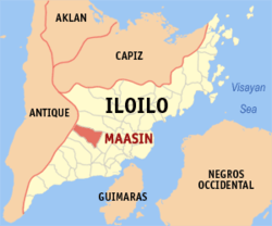 Map of Iloilo with Maasin highlighted | |
.svg.png) Maasin Location within the Philippines | |
| Coordinates: 10°53′N 122°26′E / 10.88°N 122.43°ECoordinates: 10°53′N 122°26′E / 10.88°N 122.43°E | |
| Country |
|
| Region | Western Visayas (Region VI) |
| Province | Iloilo |
| District | 3rd district of Iloilo |
| Barangays | 50 (see Barangays) |
| Government [1] | |
| • Type | Sangguniang Bayan |
| • Mayor | Mariano M. Malones Sr. |
| • Electorate | 21,494 voters (2016) |
| Area [2] | |
| • Total | 128.59 km2 (49.65 sq mi) |
| Population (2015 census)[3] | |
| • Total | 36,922 |
| • Density | 290/km2 (740/sq mi) |
| Time zone | UTC+8 (PST) |
| ZIP code | 5030 |
| PSGC | 063029000 |
| IDD : area code | +63 (0)33 |
| Climate type | Tropical climate |
| Income class | 3rd municipal income class |
| Revenue (₱) | 94,529,817.15 (2016) |
| Native languages |
Kinaray-a language Hiligaynon Tagalog |
| Website |
www |
Maasin, officially the Municipality of Maasin, is a 3rd class municipality in the province of Iloilo, Philippines. According to the 2015 census, it has a population of 36,922 people.[3]
Maasin is 30 kilometres (19 mi) from Iloilo City.
Barangays
Maasin is politically subdivided into 50 barangays. [2]
- Abay
- Abilay
- AGROCEL Pob.(Aguinaldo-Roxas-Celso)
- Amerang
- Bagacay East
- Bacuranan
- Bagacay West
- Bug-ot
- Bolo
- Bulay
- Buntalan
- Burak
- Cabangcalan
- Cabatac
- Caigon
- Cananghan
- Canawili
- Dagami
- Daja
- Dalusan
- DELCAR Pob. (Delgado-Cartagena)
- Inabasan
- Layog
- Liñagan Calsada
- Liñagan Tacas
- Linab
- MABRIZ Pob. (Mabini-Rizal)
- Magsaysay
- Mandog
- Miapa
- Nagba
- Nasaka
- Naslo-Bucao
- Nasuli
- Panalian
- Piandaan East
- Piandaan West
- Pispis
- Punong
- Sinubsuban
- Siwalo
- Santa Rita
- Subog
- THT & P Pob. (Taft-Hughes-Thompson-del Pilar)
- Tigbauan
- Trangka
- Tubang
- Tulahong
- Tuy-an East
- Tuy-an West
- Ubian
Demographics
| Population census of Maasin | ||
|---|---|---|
| Year | Pop. | ±% p.a. |
| 1903 | 8,401 | — |
| 1918 | 8,317 | −0.07% |
| 1939 | 13,167 | +2.21% |
| 1948 | 16,384 | +2.46% |
| 1960 | 21,510 | +2.29% |
| 1970 | 20,768 | −0.35% |
| 1975 | 24,412 | +3.30% |
| 1980 | 26,962 | +2.01% |
| 1990 | 29,062 | +0.75% |
| 1995 | 29,364 | +0.19% |
| 2000 | 30,828 | +1.05% |
| 2007 | 32,555 | +0.75% |
| 2010 | 35,069 | +2.74% |
| 2015 | 36,922 | +0.99% |
| Source: Philippine Statistics Authority[3][4][5][6] | ||
In the 2015 census, the population of Maasin, Iloilo, was 36,922 people,[3] with a density of 290 inhabitants per square kilometre or 750 inhabitants per square mile.
References
- ↑ "Municipality". Quezon City, Philippines: Department of the Interior and Local Government. Retrieved 31 May 2013.
- 1 2 "Province: Iloilo". PSGC Interactive. Quezon City, Philippines: Philippine Statistics Authority. Retrieved 12 November 2016.
- 1 2 3 4 Census of Population (2015). "Region VI (Western Visayas)". Total Population by Province, City, Municipality and Barangay. PSA. Retrieved 20 June 2016.
- ↑ Census of Population and Housing (2010). "Region VI (Western Visayas)". Total Population by Province, City, Municipality and Barangay. NSO. Retrieved 29 June 2016.
- ↑ Censuses of Population (1903–2007). "Region VI (Western Visayas)". Table 1. Population Enumerated in Various Censuses by Province/Highly Urbanized City: 1903 to 2007. NSO.
- ↑ "Province of Iloilo". Municipality Population Data. Local Water Utilities Administration Research Division. Retrieved 17 December 2016.
External links
- Philippine Standard Geographic Code
- Philippine Census Information
- Local Governance Performance Management System
Places adjacent to Maasin, Iloilo | |
|---|---|
Iloilo (capital) | |
| Municipalities |
|
| Component city | |
| Highly urbanized city |
|
This article is issued from
Wikipedia.
The text is licensed under Creative Commons - Attribution - Sharealike.
Additional terms may apply for the media files.