Lambunao
| Lambunao | |
|---|---|
| Municipality | |
| Municipality of Lambunao | |
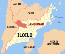 Map of Iloilo with Lambunao highlighted | |
.svg.png) Lambunao Location within the Philippines | |
| Coordinates: 11°03′N 122°29′E / 11.05°N 122.48°ECoordinates: 11°03′N 122°29′E / 11.05°N 122.48°E | |
| Country |
|
| Region | Western Visayas (Region VI) |
| Province | Iloilo |
| District | 3rd district of Iloilo |
| Barangays | 73 (see Barangays) |
| Government [1] | |
| • Type | Sangguniang Bayan |
| • Mayor | Reynor R. Gonzales |
| • Electorate | 35,261 voters (2016) |
| Area [2] | |
| • Total | 407.09 km2 (157.18 sq mi) |
| Population (2015 census)[3] | |
| • Total | 73,640 |
| • Density | 180/km2 (470/sq mi) |
| Time zone | UTC+8 (PST) |
| ZIP code | 5042 |
| PSGC | 063025000 |
| IDD : area code | +63 (0)33 |
| Climate type | Tropical climate |
| Income class | 1st municipal income class |
| Revenue (₱) | 168,550,147.05 (2016) |
| Native languages |
Sulod Kinaray-a language Hiligaynon Capiznon Tagalog |
| Website |
www |
Lambunao, officially the Municipality of Lambunao, is a 1st class municipality in the province of Iloilo, Philippines. According to the 2015 census, it has a population of 73,640 people.[3]
Lambunao is the largest municipality in Iloilo in terms of land area and is 47 kilometres (29 mi) from Iloilo City.
Barangays
Lambunao is politically subdivided into 73 barangays. [2]
- Agsirab
- Agtuman
- Alugmawa
- Badiangan
- Bagongbong
- Balagiao
- Banban
- Bansag
- Bayuco
- Binaba-an Armada
- Binaba-an Labayno
- Binaba-an Limoso
- Binaba-an Portigo
- Binaba-an Tirador
- Bonbon
- Bontoc
- Buri
- Burirao
- Buwang
- Cabatangan
- Cabugao
- Cabunlawan
- Caguisanan
- Caloy-ahan
- Caninguan
- Capangyan
- Cayan Este
- Cayan Oeste
- Corot-on
- Coto
- Cubay
- Cunarum
- Daanbanwa
- Gines
- Hipgos
- Jayubo
- Jorog
- Lanot Grande
- Lanot Pequeño
- Legayada
- Lumanay (Daanbanwa I)
- Madarag
- Magbato
- Maite Grande
- Maite Pequeño
- Malag-it
- Manaulan
- Maribong
- Marong
- Misi
- Natividad
- Pajo
- Pandan
- Panuran
- Pasig
- Patag
- Poblacion Ilawod
- Poblacion Ilaya
- Poong
- Pughanan
- Pungsod
- Quiling
- Sagcup
- San Gregorio
- Sibacungan
- Sibaguan
- Simsiman
- Supoc
- Tampucao
- Tranghawan
- Tubungan
- Tuburan
- Walang
Demographics
| Population census of Lambunao | ||
|---|---|---|
| Year | Pop. | ±% p.a. |
| 1903 | 6,661 | — |
| 1918 | 13,120 | +4.62% |
| 1939 | 23,249 | +2.76% |
| 1948 | 26,099 | +1.29% |
| 1960 | 31,504 | +1.58% |
| 1970 | 36,630 | +1.52% |
| 1975 | 42,537 | +3.04% |
| 1980 | 45,435 | +1.33% |
| 1990 | 55,325 | +1.99% |
| 1995 | 58,792 | +1.15% |
| 2000 | 61,084 | +0.82% |
| 2007 | 63,300 | +0.49% |
| 2010 | 69,023 | +3.20% |
| 2015 | 73,640 | +1.24% |
| Source: Philippine Statistics Authority[3][4][5][6] | ||
In the 2015 census, the population of Lambunao was 73,640 people,[3] with a density of 180 inhabitants per square kilometre or 470 inhabitants per square mile.
References
- ↑ "Municipality". Quezon City, Philippines: Department of the Interior and Local Government. Retrieved 31 May 2013.
- 1 2 "Province: Iloilo". PSGC Interactive. Quezon City, Philippines: Philippine Statistics Authority. Retrieved 12 November 2016.
- 1 2 3 4 Census of Population (2015). "Region VI (Western Visayas)". Total Population by Province, City, Municipality and Barangay. PSA. Retrieved 20 June 2016.
- ↑ Census of Population and Housing (2010). "Region VI (Western Visayas)". Total Population by Province, City, Municipality and Barangay. NSO. Retrieved 29 June 2016.
- ↑ Censuses of Population (1903–2007). "Region VI (Western Visayas)". Table 1. Population Enumerated in Various Censuses by Province/Highly Urbanized City: 1903 to 2007. NSO.
- ↑ "Province of Iloilo". Municipality Population Data. Local Water Utilities Administration Research Division. Retrieved 17 December 2016.
External links
- Official Website of the Municipality of Lambunao
- Philippine Standard Geographic Code
- Philippine Census Information
- Local Governance Performance Management System
Places adjacent to Lambunao | ||||||||||
|---|---|---|---|---|---|---|---|---|---|---|
| ||||||||||
Iloilo (capital) | |
| Municipalities |
|
| Component city | |
| Highly urbanized city |
|
This article is issued from
Wikipedia.
The text is licensed under Creative Commons - Attribution - Sharealike.
Additional terms may apply for the media files.