Oronsay, Loch Sunart
| Gaelic name | Orasaigh |
|---|---|
| Norse name | Örfirirsey |
| Meaning of name | tidal island (Norse via Gaelic) |
| Location | |
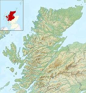 Oronsay Oronsay shown within Highland Scotland | |
| OS grid reference | NM591592 |
| Coordinates | 56°40′N 5°56′W / 56.66°N 5.93°W |
| Physical geography | |
| Island group | Inner Hebrides |
| Area | 240 hectares (0.93 sq mi)[1] |
| Area rank | 99= [2] |
| Highest elevation | 58 metres (190 ft) |
| Administration | |
| Sovereign state | United Kingdom |
| Country | Scotland |
| Council area | Highland |
| Demographics | |
| Population | 0[3] |
| References | [4][5] |
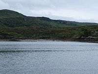
Oronsay from southern end of Sàilean Mòr
Oronsay is an uninhabited island in Loch Sunart, Scotland.
It is low-lying, barren and rocky, deeply indented with sea lochs.[6]
The island encloses Loch Drumbuie (Scottish Gaelic: Loch na Droma Buidhe), a popular anchorage for yachts and a temporary home to fish farm cages.
References
- ↑ Rick Livingstone’s Tables of the Islands of Scotland (pdf) Argyll Yacht Charters. Retrieved 12 Dec 2011.
- ↑ Area and population ranks: there are c. 300 islands over 20 ha in extent and 93 permanently inhabited islands were listed in the 2011 census.
- ↑ National Records of Scotland (15 August 2013) (pdf) Statistical Bulletin: 2011 Census: First Results on Population and Household Estimates for Scotland - Release 1C (Part Two). "Appendix 2: Population and households on Scotland’s inhabited islands". Retrieved 17 August 2013.
- ↑ Haswell-Smith, Hamish (2004). The Scottish Islands. Edinburgh: Canongate. ISBN 978-1-84195-454-7.
- ↑ Ordnance Survey: Landranger map sheet 47 Tobermory & North Mull (Map). Ordnance Survey. 2013. ISBN 9780319229835.
- ↑ Perrott, David (1988). Guide to the Western Islands of Scotland. Edinburgh: Kittiwake. ISBN 0-7028-0886-5.
| Wikimedia Commons has media related to Oronsay. |
Inhabited islands of the Hebrides | ||
|---|---|---|
| Inner Hebrides | 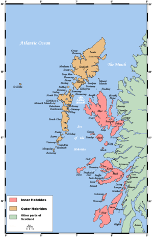 | |
| Outer Hebrides | ||
Coordinates: 56°39′43″N 5°55′48″W / 56.66194°N 5.93000°W
This article is issued from
Wikipedia.
The text is licensed under Creative Commons - Attribution - Sharealike.
Additional terms may apply for the media files.