Flodaigh
| Gaelic name | Flodaigh |
|---|---|
| Meaning of name | "Float island", from Norse |
| Location | |
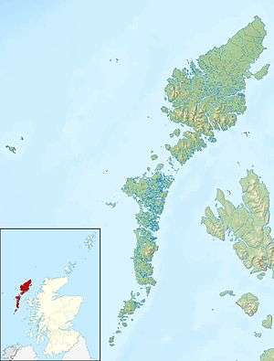 Flodaigh Flodaigh shown within the Outer Hebrides | |
| OS grid reference | NF846553 |
| Coordinates | 57°29′N 7°16′W / 57.48°N 7.26°W |
| Physical geography | |
| Island group | Uists and Barra |
| Area | 145 hectares (360 acres)[1] |
| Area rank | 124= [2] |
| Highest elevation | 20 m |
| Administration | |
| Sovereign state | United Kingdom |
| Country | Scotland |
| Council area | Na h-Eileanan Siar |
| Demographics | |
| Population | 7[3] |
| Population rank | 72= [2] |
| Population density | 4.8 people/km2[3][4] |
| References | [4][5] |
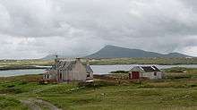
Flodaigh with Eaval on North Uist behind.
Flodaigh is a tidal island lying to the north of Benbecula and south of Grimsay in the Outer Hebrides, Scotland. It is connected to Benbecula by a causeway.
The island is 145 hectares and in 2001 had a population of 11[1] and 7 in 2011.[3] The census refers to the island by its anglicized name of 'Flodda'.
Footnotes
- 1 2 General Register Office for Scotland (28 November 2003) Scotland's Census 2001 – Occasional Paper No 10: Statistics for Inhabited Islands. Retrieved 26 February 2012.
- 1 2 Area and population ranks: there are c. 300 islands over 20 ha in extent and 93 permanently inhabited islands were listed in the 2011 census.
- 1 2 3 National Records of Scotland (15 August 2013) (pdf) Statistical Bulletin: 2011 Census: First Results on Population and Household Estimates for Scotland - Release 1C (Part Two). "Appendix 2: Population and households on Scotland’s inhabited islands". Retrieved 17 August 2013.
- 1 2 Haswell-Smith, Hamish (2004). The Scottish Islands. Edinburgh: Canongate. ISBN 978-1-84195-454-7.
- ↑ Ordnance Survey. OS Maps Online (Map). 1:25,000. Leisure.
Coordinates: 57°28′43″N 7°15′44″W / 57.47861°N 7.26222°W
Inhabited islands of the Hebrides | ||
|---|---|---|
| Inner Hebrides |  | |
| Outer Hebrides | ||
This article is issued from
Wikipedia.
The text is licensed under Creative Commons - Attribution - Sharealike.
Additional terms may apply for the media files.