Orinda station
Orinda | |||||||||||
|---|---|---|---|---|---|---|---|---|---|---|---|
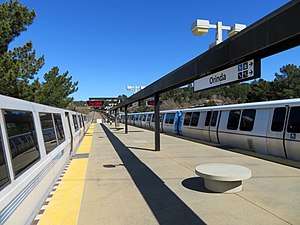 Old and new BART trains at Orinda station in 2018 | |||||||||||
| Location |
11 Camino Pablo Orinda, California | ||||||||||
| Coordinates | 37°52′42″N 122°11′01″W / 37.878427°N 122.18374°WCoordinates: 37°52′42″N 122°11′01″W / 37.878427°N 122.18374°W | ||||||||||
| Owned by | Bay Area Rapid Transit | ||||||||||
| Line(s) | BART C-Line | ||||||||||
| Platforms | 1 island platform | ||||||||||
| Connections |
| ||||||||||
| Construction | |||||||||||
| Parking | 1406 spaces | ||||||||||
| Bicycle facilities | 24 Lockers | ||||||||||
| Disabled access | Yes | ||||||||||
| History | |||||||||||
| Opened | May 21, 1973 | ||||||||||
| Traffic | |||||||||||
| Passengers (FY 2016) |
3,135 exits/day[1] | ||||||||||
| Services | |||||||||||
| |||||||||||
Orinda is a Bay Area Rapid Transit station in Orinda, California. The station has an island platform in the center median of State Route 24. Service at the station began on May 21, 1973 following the completion of the Berkeley Hills Tunnel, which connects it to Rockridge station.[2]
The solar radiation is the best in the entire system at this station, and the station was therefore earmarked for the installation of car ports with solar panels on top of them in 2008.[3]
Station layout
| P Platform level |
Southbound | ← Antioch–SFO/Millbrae toward San Francisco International Airport weekdays, Millbrae weekends (Rockridge) |
| Island platform, doors will open on the left | ||
| Northbound | → Antioch–SFO/Millbrae toward Pittsburg / Bay Point (Lafayette) → | |
| G | Street Level | Exits/Entrances |
| Mezzanine | One-way faregates, ticket machines, station agent | |
Transit connections
The station is served by County Connection route 6, as well as special school route 606.[4]
See also
Notes
- ↑ Bay Area Rapid Transit District. "Monthly Ridership Reports". Retrieved 6 February 2017.
- ↑ "BART Chronology January 1947 – March 2009" (PDF). San Francisco Bay Area Rapid Transit District. March 2009. Archived from the original (PDF) on October 13, 2013.
- ↑ BART goes solar at Orinda station, by Dennis Cuff, Contra Costa Times, July 10, 2008, access date July 13, 2008
- ↑ County Connection. "Maps & Schedules". Central Contra Costa Transit Authority. Retrieved 8 July 2013.
External links
| Wikimedia Commons has media related to Orinda station. |
| Current lines |
| ||||||||||||
|---|---|---|---|---|---|---|---|---|---|---|---|---|---|
| Stations |
| ||||||||||||
| Infrastructure | |||||||||||||
| History | |||||||||||||
| General Managers |
| ||||||||||||
| Connecting services |
| ||||||||||||
| Other | |||||||||||||
This article is issued from
Wikipedia.
The text is licensed under Creative Commons - Attribution - Sharealike.
Additional terms may apply for the media files.