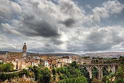
Ontinyent
| Ontinyent Onteniente | |||
|---|---|---|---|
| Municipality | |||
 | |||
| |||
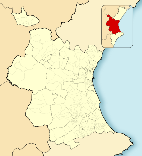 Ontinyent Location in Spain 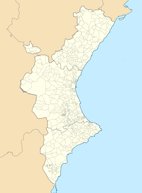 Ontinyent Ontinyent (Valencian Community)  Ontinyent Ontinyent (Spain) | |||
| Coordinates: 38°49′20″N 0°36′26″W / 38.82222°N 0.60722°WCoordinates: 38°49′20″N 0°36′26″W / 38.82222°N 0.60722°W | |||
| Country |
| ||
| Autonomous community |
| ||
| Province | Valencia | ||
| Comarca | Vall d'Albaida | ||
| Judicial district | Ontinyent | ||
| Government | |||
| • Alcalde | Jorge Rodríguez Gramage (2011) (PSPV-PSOE) | ||
| Area | |||
| • Total | 125.4 km2 (48.4 sq mi) | ||
| Elevation | 382 m (1,253 ft) | ||
| Population (2008) | |||
| • Total | 100,269 | ||
| • Density | 800/km2 (2,100/sq mi) | ||
| Demonym(s) | ontinyentí, ontinyentina | ||
| Time zone | UTC+1 (CET) | ||
| • Summer (DST) | UTC+2 (CEST) | ||
| Postal code | 46870 | ||
| Official language(s) | Spanish and Valencian | ||
| Website | Official website | ||


Ontinyent ( Valencian: [ontiˈɲent]) is a municipality in the comarca of Vall d'Albaida in the Valencian Community, Spain. It is situated on the right bank of the Clariano or Ontinyent, a tributary of the Xúquer, and on the Xàtiva–Alcoi railway.[1]
Ontinyent has a parish church remarkable for its lofty square tower, and a palace of the dukes of Almodòver. By 1910 there was a large modern suburb outside the old town, which was a walled city; some vestiges of the ramparts still remain. In 1910 linen and woolen cloth, paper, brandy, furniture and earthenware were manufactured; and there was some trade in cereals, wine, almonds and olive oil.[1]
Personalities
- Juan Carlos Ferrero, former world no. 1 tennis player, was born in Ontinyent
- Joaquín Lloréns Fernández de Cordoba, a Carlist soldier and politician, lived in Ontinyent 1879 to 1930.
References
- 1 2

External links
- Comparsa Saudites d'Ontinyent (in English) (en valencià) (en español)
- Ontinyent Tourist Information
- Weather in Ontinyent: Weather information for Ontinyent, as well as prior weather information, maps, and weather-related graphics (Catalan)
| Wikimedia Commons has media related to Ontinyent. |
This article is issued from
Wikipedia.
The text is licensed under Creative Commons - Attribution - Sharealike.
Additional terms may apply for the media files.