Llutxent
| Llutxent | ||
|---|---|---|
| Municipality of Spain | ||
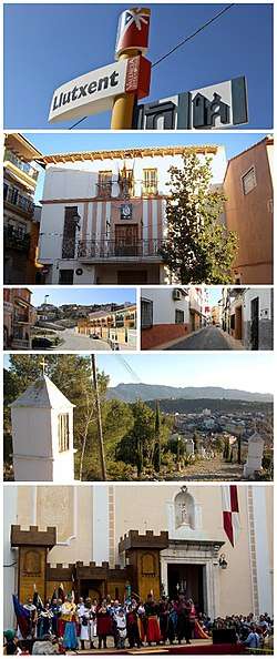 Clockwise: Llutxent's info-sign, Town hall building, Del Mig Street, View from top of The Coast, Town's Main Square during Moors and Christians, Montsant avenue | ||
| ||
| Nickname(s): Llutx | ||
 Llutxent Location of Llutxent 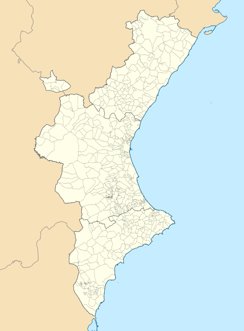 Llutxent Llutxent (Valencian Community) 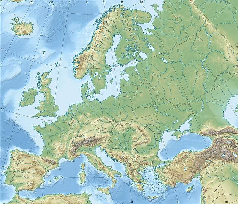 Llutxent Llutxent (Europe) | ||
| Coordinates: 38°56′33″N 0°21′23″W / 38.94250°N 0.35639°WCoordinates: 38°56′33″N 0°21′23″W / 38.94250°N 0.35639°W | ||
| Country |
| |
| Autonomous community |
| |
| Province | Valencia | |
| Comarca | Vall d'Albaida | |
| Judicial district | Ontinyent | |
| Government | ||
| • Alcalde | Pep Estornell Català (Unity for Llutxent) | |
| Area | ||
| • Total | 40.1 km2 (15.5 sq mi) | |
| Elevation | 280 m (920 ft) | |
| Population (2016) | ||
| • Total | 2,402 | |
| • Density | 60/km2 (160/sq mi) | |
| Demonym(s) |
Llutxentine llutxentí, -ina (va) | |
| Time zone | UTC+1 (CET) | |
| • Summer (DST) | UTC+2 (CEST) | |
| Postal code | 46838 | |
| Official languages | Valencian and Spanish | |
| Website | llutxent.es (in valencian) | |

Llutxent (Valencian pronunciation: [ʎuˈtʃent]) is a town located within the county of the Vall d'Albaida, in the middle-eastern part of the Valencian Community, Spain. As of the 2016, the town had a population of 2,402,[1] ranking as the 218th biggest Valencian municipality in terms of population. It is located 80 km south of Valencia and 110 km north of Alicante.[2]
The town was first settled by Ancient Romans.[3]
The town's economy is based on agriculture, construction, transport and the manufacture of pallets, and a small services sector.[4]
Llutxent is host to one of the most popular Moors and Cristians celebrations during the end of April, attracting many people around the Valencian Community to see the festival.[5]
History
Place name
The town derives its name from the Latin etymon Luciana villa or pagu Lucianu, meaning "Light Villa" or "Pagus of Light".[3]
Muslim rule (711-1492)
Little is known about the Islamic Period in Llutxent.
The town's area was made up of a large number of farmsteads (with names such as Benicia, Benitxellví, Xetà, Rafal, Osset, Cometa which are still used to indicate the areas where those farmsteads used to be) that depended upon the Castle of Xiu.[3]
Christian reconquest (1229-1245)
The first written references about the town are about the reconquest of the municipality's area by James I of Aragon and the arrival of Catalan-Aragonese troops to the "beyond the Xúquer" lands. These describe the "Great Islamic revolt of 1247-1248, after which James I of Aragon in 1248, besieged and conquered the castle of the Xiu. Subsequently, James I of Aragon gave the town to the conquering troops and established a permanent Christian population in Llutxent, while the farms located around the town's area kept their native Islamic population.
In 1276, the town is razed during Al-Azraq's revolt. Jaume I, in response to the town's razing, sent Christian troops which successfully re-conquered the town. Next year, the town's control and territory was given to the Italian noble "Joan de Proxita", who created the Barony of Llutxent.
Christian Rule
Between 1348 and 1349 Llutxent was scene to various skirmishes during the War of the Union of the Crown of Aragon.
The Proxitas, as lords of Llutxent, began the construction of the Palace Castle. In 1487, the town's lordship was handed over to the family of the Maçà.
Main sights
Castles and palaces
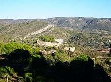
- Castle of Xiu. Muslim. Abandoned after the Expulsion of the Moriscos, the building is still an important landmark for the town and its surrounding area. In dire need of Renovation.
- Castle-palace of Llutxent. Constructed between the 15th and 16th centuries by the Proxitas. The building is currently owned by the municipality.
Religious buildings
- Church of the Assumption, built in the 19th century on top of an old Gothic Church in ruins. The building follows the Classical Architecture Style, and it is home to important pieces of art and culture of great historic value, such as the Santa Faç icon-chest.
- Monastery of the Corpus Christi (The convent), erected by the Dominicans, it was the first Valencian University (General Study in Arts and Theology). The building has undergone several renovations, modifications and extensions, with the most important one being the addition of the Corpus Christi in the 17th century, a church built in the Gothic style. A 200-year old Carob Tree can be found next to the Monastery.
- Chapel of the Consolation, founded by Catalan pilgrims in 1772, the building follows the Barroque Architecture Style. A stained glass windows were added to the chapel in the 1970s by Alfred Manessier.
Other sights
- The Coast, Stone-paved road built in 1580 that connected Monastery of the Corpus Christi with the town's church and was used for religious pilgrimage between the two.
- Farmer's park, near which various Llutxentine organizations are located.
| Recent demographic trend[6] | ||||||||||
| 1990 | 1992 | 1994 | 1996 | 1998 | 2000 | 2002 | 2004 | 2005 | 2007 | 2012 |
| 2,435 | 2,358 | 2,392 | 2,377 | 2,378 | 2,412 | 2,456 | 2,512 | 2,526 | 2,571 | 2,508 |
Main sights
See also
References
- ↑ "Instituto Nacional de Estadística. (Spanish Statistical Institute)". www.ine.es (in Spanish). Retrieved 2018-04-27.
- ↑ "On estem?". Ajuntament de Llutxent (in Catalan). 2015-07-23. Retrieved 2018-04-27.
- 1 2 3 "Història del poble". Ajuntament de Llutxent (in Catalan). 2015-07-23. Retrieved 2018-04-27.
- ↑ "Empresas de Llutxent, Valencia - Axesor". www.axesor.es (in Spanish). Retrieved 2018-04-27.
- ↑ "Festes". Ajuntament de Llutxent (in Catalan). 2015-07-29. Retrieved 2018-04-27.
- ↑ http://www.pegv.gva.es/. Missing or empty
|title=(help)