Mogente/Moixent
| Moixent/Mogente | |||
|---|---|---|---|
| Municipality | |||
 | |||
| |||
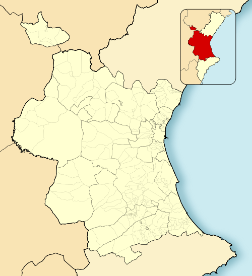 Moixent/Mogente Location in Spain  Moixent/Mogente Moixent/Mogente (Valencian Community)  Moixent/Mogente Moixent/Mogente (Spain) | |||
| Coordinates: 38°52′32″N 0°45′11″W / 38.87556°N 0.75306°WCoordinates: 38°52′32″N 0°45′11″W / 38.87556°N 0.75306°W | |||
| Country |
| ||
| Autonomous community |
| ||
| Province | Valencia | ||
| Comarca | Costera | ||
| Judicial district | Xàtiva | ||
| Government | |||
| • Alcalde | Teófilo Fito (2015) (C's) | ||
| Area | |||
| • Total | 150.23 km2 (58.00 sq mi) | ||
| Elevation | 284 m (932 ft) | ||
| Population (2008) | |||
| • Total | 4,724 | ||
| • Density | 31/km2 (81/sq mi) | ||
| Demonym(s) |
mogentino/a moixentí/ína | ||
| Time zone | UTC+1 (CET) | ||
| • Summer (DST) | UTC+2 (CEST) | ||
| Postal code | 46640 | ||
| Official language(s) | Valencian | ||
| Website | Official website | ||


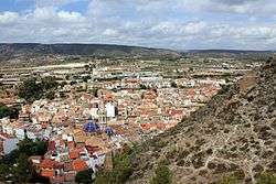
Mogente (Spanish: [moˈxente]) or Moixent (Valencian: [mojˈʃent]) is a municipality in the comarca of Costera in the Valencian Community, Spain.
The municipal area contains the ruins of la Bastida de les Alcusses, one of the most important Iberian archaeological sites in the Valencian Community.
Municipalities of Costera | ||
|---|---|---|
This article is issued from
Wikipedia.
The text is licensed under Creative Commons - Attribution - Sharealike.
Additional terms may apply for the media files.