North Caicos Airport
| North Caicos Airport | |||||||||||
|---|---|---|---|---|---|---|---|---|---|---|---|
| Summary | |||||||||||
| Airport type | Public | ||||||||||
| Location | North Caicos, Turks and Caicos Islands | ||||||||||
| Elevation AMSL | 10 ft / 3 m | ||||||||||
| Coordinates | 21°55′03″N 071°56′22″W / 21.91750°N 71.93944°WCoordinates: 21°55′03″N 071°56′22″W / 21.91750°N 71.93944°W | ||||||||||
| Map | |||||||||||
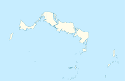 MBNC Location in North Caicos | |||||||||||
| Runways | |||||||||||
| |||||||||||
North Caicos Airport (IATA: NCA, ICAO: MBNC) is an airport serving North Caicos,[1] the second largest of the Turks and Caicos Islands.
Facilities
The airport resides at an elevation of 10 ft (3 m) above mean sea level. It has one runway designated 08/26 with an asphalt surface measuring 1,294 m × 23 m (4,245 ft × 75 ft).[1]
Airlines and destinations
| Airlines | Destinations |
|---|---|
| InterCaribbean Airways | Providenciales |
References
- 1 2 3 Airport information for MBNC at World Aero Data. Data current as of October 2006.
- ↑ Airport information for NCA at Great Circle Mapper. Source: DAFIF (effective October 2006).
External links
This article is issued from
Wikipedia.
The text is licensed under Creative Commons - Attribution - Sharealike.
Additional terms may apply for the media files.