Norala, South Cotabato
| Norala | |
|---|---|
| Municipality | |
| Municipality of Norala | |
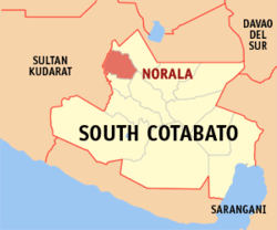 Map of South Cotabato with Norala highlighted | |
.svg.png) Norala Location within the Philippines | |
| Coordinates: 6°33′N 124°40′E / 6.55°N 124.67°ECoordinates: 6°33′N 124°40′E / 6.55°N 124.67°E | |
| Country |
|
| Region | Soccsksargen (Region XII) |
| Province | South Cotabato |
| District | 2nd District |
| Barangays | 14 (see Barangays) |
| Government [1] | |
| • Type | Sangguniang Bayan |
| • Mayor | Victor Y. Balayon |
| • Electorate | 25,116 voters (2016) |
| Area [2] | |
| • Total | 123.20 km2 (47.57 sq mi) |
| Population (2015 census)[3] | |
| • Total | 46,642 |
| • Density | 380/km2 (980/sq mi) |
| Time zone | UTC+8 (PST) |
| ZIP code | 9508 |
| PSGC | 126311000 |
| IDD : area code | +63 (0)83 |
| Climate type | Tropical rainforest climate |
| Income class | 3rd municipal income class |
| Revenue (₱) | 109,101,858.42 (2016) |
| Native languages |
Hiligaynon Cebuano Maguindanao language Blaan language Tagalog |
| Website |
noralascot |
Norala, officially the Municipality of Norala, (Hiligaynon: Banwa sang Norala), is a 3rd class municipality in the province of South Cotabato, Philippines. According to the 2015 census, it has a population of 46,642 people.[3]
Barangays
Norala is subdivided into 14 barangays.
- Dumaguil
- Esperanza
- Kibid
- Lapuz
- Liberty
- Lopez Jaena
- Matapol
- Poblacion
- Puti
- San Jose
- San Miguel
- Simsiman
- Tinago
- Benigno Aquino, Jr.
Demographics
| Population census of Norala | ||
|---|---|---|
| Year | Pop. | ±% p.a. |
| 1960 | 19,579 | — |
| 1970 | 34,131 | +5.71% |
| 1975 | 41,570 | +4.03% |
| 1980 | 47,397 | +2.66% |
| 1990 | 35,566 | −2.83% |
| 1995 | 39,688 | +2.08% |
| 2000 | 40,744 | +0.56% |
| 2007 | 44,070 | +1.09% |
| 2010 | 44,635 | +0.46% |
| 2015 | 46,642 | +0.84% |
| Source: Philippine Statistics Authority[3][4][5] | ||
References
- ↑ "Municipality". Quezon City, Philippines: Department of the Interior and Local Government. Retrieved 31 May 2013.
- ↑ "Province: South Cotabato". PSGC Interactive. Quezon City, Philippines: Philippine Statistics Authority. Retrieved 12 November 2016.
- 1 2 3 Census of Population (2015). "Region XII (Soccsksargen)". Total Population by Province, City, Municipality and Barangay. PSA. Retrieved 20 June 2016.
- ↑ Census of Population and Housing (2010). "Region XII (Soccsksargen)". Total Population by Province, City, Municipality and Barangay. NSO. Retrieved 29 June 2016.
- ↑ Censuses of Population (1903–2007). "Region XII (Soccsksargen)". Table 1. Population Enumerated in Various Censuses by Province/Highly Urbanized City: 1903 to 2007. NSO.
External links
Places adjacent to Norala, South Cotabato | |
|---|---|
Koronadal (capital) | |
| Municipalities | |
| Component City | |
| Highly Urbanized City |
|
This article is issued from
Wikipedia.
The text is licensed under Creative Commons - Attribution - Sharealike.
Additional terms may apply for the media files.