Banga, South Cotabato
| Banga | |
|---|---|
| Municipality | |
| Municipality of Banga | |
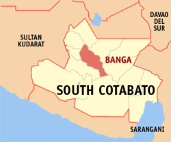 Map of South Cotabato with Banga highlighted | |
.svg.png) Banga Location within the Philippines | |
| Coordinates: 6°18′N 124°47′E / 6.3°N 124.78°ECoordinates: 6°18′N 124°47′E / 6.3°N 124.78°E | |
| Country |
|
| Region | Soccsksargen (Region XII) |
| Province | South Cotabato |
| District | 2nd District |
| Founded | September 11, 1953 |
| Barangays | 22 (see Barangays) |
| Government [1] | |
| • Type | Sangguniang Bayan |
| • Mayor | Albert Palencia |
| • Electorate | 43,824 voters (2016) |
| Area [2] | |
| • Total | 240.35 km2 (92.80 sq mi) |
| Population (2015 census)[3] | |
| • Total | 83,989 |
| • Density | 350/km2 (910/sq mi) |
| Time zone | UTC+8 (PST) |
| ZIP code | 9511 |
| PSGC | 126302000 |
| IDD : area code | +63 (0)83 |
| Climate type | Tropical rainforest climate |
| Income class | 1st municipal income class |
| Revenue (₱) | 174,601,229.62 (2016) |
| Native languages |
Hiligaynon Cebuano Maguindanao language Blaan language Tagalog |
| Website |
bangascot |
Banga, officially the Municipality of Banga, is a 1st class municipality in the province of South Cotabato, Philippines. According to the 2015 census, it has a population of 83,989 people.[3]
Banga is situated at the north-west of the province of South Cotabato. The town derived its name from a palm tree known to the natives of the place as "Buanga" which during the pre-settlement time, predominantly grew in the area.
Banga is linked by a concrete national highway road from Gen. Santos City in the east and Cotabato City in the west. The town is known for its spacious town plaza, its public market is situated in the heart of the town and ideally zonified. Water for households and commercial use is abundant and the best source to it is Banga River which narrowly dissects the municipality.
It is the leading corn producer in the province and has made extraordinary achievements in terms of producing corn husk products for the local market.
It is also blessed with rich resources such as livestock and rice and has shown potential for mango. Pineapple and banana production while endowed with big rice mills, metal craft potentials, places suited for inland fishing and some residential development.
Banga works under the slogan “Cooperative Efforts towards Peace and Progress” and it is targeting to rapidly lift its economy to the highest level.
Banga strives to sustaining self-sufficiency and increasing agricultural production. It currently aims for the diversification and intensification of traditional agricultural practices, advocacy of food sufficiency method such as vegetable and fruit planting, poultry and livestock development within family farms, intensification on agricultural nurseries for a high yielding variety of crops, strengthening of information dissemination of appropriate technology to all farmers in the Barangay’s by providing effective seminars, workshop and training in proper management of farmer’s cooperative.
Barangays
Banga is politically subdivided into 22 barangays.
- Benitez (Poblacion)
- Cabudian
- Cabuling
- Cinco (Barrio 5)
- Derilon
- El Nonok
- Improgo Village (Poblacion)
- Kusan (Barrio 8)
- Lam-Apos
- Lamba
- Lambingi
- Lampari
- Liwanay (Barrio 1)
- Malaya (Barrio 9)
- Punong Grande (Barrio 2)
- Rang-ay (Barrio 4)
- Reyes (Poblacion)
- Rizal (Barrio 3)
- Rizal Poblacion
- San Jose (Barrio 7)
- San Vicente (Barrio 6)
- Yangco Poblacion
History
It started as a Settlement District of the Allah Valley Project of the National Land Settlement Administration (NLSA) on March 4, 1941, with Gen. Paulino Santos as the General Manager. On September 11, 1953, by way of Presidential Proclamation No. 612 of the then President Elpidio Quirino, it was emancipated as a barrio of Koronadal and became an independent municipal entity.
Demographics
| Population census of Banga | ||
|---|---|---|
| Year | Pop. | ±% p.a. |
| 1960 | 36,468 | — |
| 1970 | 36,319 | −0.04% |
| 1975 | 43,452 | +3.66% |
| 1980 | 50,460 | +3.03% |
| 1990 | 59,743 | +1.70% |
| 1995 | 66,571 | +2.05% |
| 2000 | 69,131 | +0.81% |
| 2007 | 73,355 | +0.82% |
| 2010 | 76,343 | +1.46% |
| 2015 | 83,989 | +1.83% |
| Source: Philippine Statistics Authority[3] [4] [5] [6] | ||
Resources
Corn, livestock, rice mango production potential, pine- apple, bananas, big rice mills, metal craft, inland fishing residential development.
Festivals
Pasundayag Festival – 1st Week of March
Pasundayag, an Ilonggo term which means “show” or “presentation” is a unique fiesta celebration which showcases the municipality’s local talents in a week-long celebration of good life and thanksgiving of the people of Banga.
Banga, the corn production center of South Cotabato, celebrates its foundation every 1st Week of March with a colorful Pasundayag festival a showcase of merry-making activities with its week-long events of beer and food festivals, street dancing competition, beauty pageant, trade fare, bargain shops and street parties.
Tourist attractions
- Mila's Peak is the highest part of the Roxas Mt. Range in the east which elevates viewers to a ground where they can see the vast plains towards Mt. Matutum in the east and the entire Allah Valley areas in the north-west.
- Sitio Lamkot is located at Barangay Malaya. The uniqueness of the said sitio is one the spot where the agricultural plain surrounded by a mountain, open a panorama of a typical village that could sustain its economic needs independently in the midst of Plenty and Beauty.
Educational institutions
Secondary:
- Notre Dame of Banga
- Notre Dame of Lamba
- Mindanao Community School
- Banga National High School
- South Eastern Academy
- Lampari National High School
- Lamba National High School
- Punong Grande National High School
- Kusan National High School
- San Vicente National High School
- Malaya National High School
- San Jose National High School
- Rizal (3) National High School
- El Nonok National High School
Elementary:
- Notre Dame of Banga Elementary Dept.
- Lamba Central Elementary School
- BEC Elementary School
- SDA Elementary School
- Lampari Elementary School
- Liwanay Elementary School
- Purok Rizal Pob. Elementary School
- Banga Central Elementary School
- Purok Reyes Central Elementary School
- El Nonok Elementary School
- San Vicente Elementary School
- Malaya Elementary School
- Matlong Elementary School
References
- ↑ "Municipality". Quezon City, Philippines: Department of the Interior and Local Government. Retrieved 31 May 2013.
- ↑ "Province: South Cotabato". PSGC Interactive. Quezon City, Philippines: Philippine Statistics Authority. Retrieved 12 November 2016.
- 1 2 3 Census of Population (2015). "Region XII (Soccsksargen)". Total Population by Province, City, Municipality and Barangay. PSA. Retrieved 20 June 2016.
- ↑ Census of Population and Housing (2010). "Region XII (Soccsksargen)". Total Population by Province, City, Municipality and Barangay. NSO. Retrieved 29 June 2016.
- ↑ Censuses of Population (1903–2007). "Region XII (Soccsksargen)". Table 1. Population Enumerated in Various Censuses by Province/Highly Urbanized City: 1903 to 2007. NSO.
- ↑ "Province of South Cotabato". Municipality Population Data. Local Water Utilities Administration Research Division. Retrieved 17 December 2016.
External links
Places adjacent to Banga, South Cotabato | |
|---|---|
Koronadal (capital) | |
| Municipalities | |
| Component City | |
| Highly Urbanized City |
|