Nevada, Missouri
| Nevada, Missouri | |
|---|---|
| City | |
 Location within Vernon County and Missouri | |
| Coordinates: 37°50′27″N 94°21′20″W / 37.84083°N 94.35556°WCoordinates: 37°50′27″N 94°21′20″W / 37.84083°N 94.35556°W | |
| Country | United States |
| State | Missouri |
| County | Vernon |
| Area[1] | |
| • Total | 9.06 sq mi (23.47 km2) |
| • Land | 8.98 sq mi (23.26 km2) |
| • Water | 0.08 sq mi (0.21 km2) |
| Elevation | 873 ft (266 m) |
| Population (2010)[2] | |
| • Total | 8,386 |
| • Estimate (2016)[3] | 8,224 |
| • Density | 930/sq mi (360/km2) |
| Time zone | UTC-6 (Central (CST)) |
| • Summer (DST) | UTC-5 (CDT) |
| ZIP code | 64772 |
| Area code(s) | 417 |
| FIPS code | 29-51644 [4] |
| GNIS feature ID | 0729934 [5] |
| Website | http://nevadamo.gov/ |
Nevada (/nəˈveɪdə/ nə-VEY-də; pronounced differently than the state) is a city and a county seat of Vernon County, Missouri, United States.[6] The population was 8,386 at the 2010 census, and 8,171 in the 2012 estimate.[7]
Nevada is the home of Cottey College. Its local government uses the council-manager model. The mayor of Nevada is Brian Leonard.
History
Nevada was originally called "Hog Eye", and under the latter name was platted in 1855.[8] The town's name was changed to Nevada by circuit and county clerk DeWitt C. Hunter, after Nevada City, California, where he had been a miner.[9]
From 1897−1933, Nevada was home of the Weltmer Institute of Suggestive Therapeutics. During the early 20th century, this healing institution attracted many clients and generated enough business to add to the growing prosperity of the town.[10]
The Carrington Osage Village Site is a National Historic Landmark, located on a hilltop above the Osage River valley. Significant historic properties in the town include the Infirmary Building, Missouri State Hospital Number 3, Vernon County Courthouse, and Vernon County Jail, Sheriff's House and Office, which are also listed on the National Register of Historic Places.[11]
Geography
Nevada is located at 37°50′27″N 94°21′20″W / 37.84083°N 94.35556°W (37.840930, -94.355576).[12] According to the United States Census Bureau, the city has a total area of 9.06 square miles (23.47 km2), of which 8.98 square miles (23.26 km2) is land and 0.08 square miles (0.21 km2) is water.[1]
Climate
| Climate data for Nevada, Missouri | |||||||||||||
|---|---|---|---|---|---|---|---|---|---|---|---|---|---|
| Month | Jan | Feb | Mar | Apr | May | Jun | Jul | Aug | Sep | Oct | Nov | Dec | Year |
| Average high °F (°C) | 40 (4) |
46 (8) |
57 (14) |
67 (19) |
76 (24) |
85 (29) |
90 (32) |
89 (32) |
81 (27) |
71 (22) |
55 (13) |
44 (7) |
67 (19) |
| Average low °F (°C) | 19 (−7) |
25 (−4) |
35 (2) |
44 (7) |
54 (12) |
64 (18) |
68 (20) |
66 (19) |
58 (14) |
47 (8) |
35 (2) |
25 (−4) |
45 (7) |
| Average precipitation inches (mm) | 1.65 (41.9) |
2.01 (51.1) |
3.66 (93) |
4.29 (109) |
5.28 (134.1) |
5.63 (143) |
3.98 (101.1) |
3.98 (101.1) |
4.21 (106.9) |
4.17 (105.9) |
3.58 (90.9) |
2.32 (58.9) |
44.76 (1,136.9) |
| Source: [13] | |||||||||||||
Demographics
| Historical population | |||
|---|---|---|---|
| Census | Pop. | %± | |
| 1880 | 1,913 | — | |
| 1890 | 7,262 | 279.6% | |
| 1900 | 7,461 | 2.7% | |
| 1910 | 7,176 | −3.8% | |
| 1920 | 7,139 | −0.5% | |
| 1930 | 7,448 | 4.3% | |
| 1940 | 8,181 | 9.8% | |
| 1950 | 8,009 | −2.1% | |
| 1960 | 8,416 | 5.1% | |
| 1970 | 9,736 | 15.7% | |
| 1980 | 9,044 | −7.1% | |
| 1990 | 8,597 | −4.9% | |
| 2000 | 8,607 | 0.1% | |
| 2010 | 8,386 | −2.6% | |
| Est. 2016 | 8,224 | [3] | −1.9% |
| U.S. Decennial Census[14] | |||
2010 census
As of the census[2] of 2010, there were 8,386 people, 3,491 households, and 1,908 families residing in the city. The population density was 933.9 inhabitants per square mile (360.6/km2). There were 4,018 housing units at an average density of 447.4 per square mile (172.7/km2). The racial makeup of the city was 95.1% White, 1.1% African American, 0.8% Native American, 0.8% Asian, 0.6% from other races, and 1.6% from two or more races. Hispanic or Latino of any race were 2.0% of the population.
There were 3,491 households of which 28.2% had children under the age of 18 living with them, 35.9% were married couples living together, 14.1% had a female householder with no husband present, 4.6% had a male householder with no wife present, and 45.3% were non-families. 40.3% of all households were made up of individuals and 17.1% had someone living alone who was 65 years of age or older. The average household size was 2.16 and the average family size was 2.88.
The median age in the city was 38.3 years. 23.3% of residents were under the age of 18; 11.5% were between the ages of 18 and 24; 22.6% were from 25 to 44; 24.4% were from 45 to 64; and 18.2% were 65 years of age or older. The gender makeup of the city was 45.3% male and 54.7% female.
2000 census
As of the census[4] of 2000, there were 8,607 people, 3,463 households, and 1,973 families residing in the city. The population density was 964.1 people per square mile (372.1/km²). There were 3,857 housing units at an average density of 432.0 per square mile (166.8/km²). The racial makeup of the city was 95.79% White, 1.03% African American, 0.94% Native American, 0.44% Asian, 0.05% Pacific Islander, 0.49% from other races, and 1.25% from two or more races. Hispanic or Latino of any race were 1.29% of the population.
There were 3,463 households out of which 29.9% had children under the age of 18 living with them, 40.1% were married couples living together, 13.3% had a female householder with no husband present, and 43.0% were non-families. 38.5% of all households were made up of individuals and 17.8% had someone living alone who was 65 years of age or older. The average household size was 2.22 and the average family size was 2.95.
In the city, the population was spread out, with 25.8% under the age of 18, 11.8% from 18 to 24, 24.7% from 25 to 44, 18.8% from 45 to 64, and 18.9% who were 65 years of age or older. The median age was 35 years. For every 100 females, there were 82.1 males. For every 100 females age 18 and over, there were 74.3 males.
The median income for a household in the city was $25,774, and the median income for a family was $36,639. Males had a median income of $28,939 versus $17,424 for females. The per capita income for the city was $15,118. About 13.7% of families and 20.0% of the population were below the poverty line, including 28.7% of those under age 18 and 16.4% of those age 65 or over.
Notable people
- Brett Merriman — Major League Baseball Player
- Russell Alexander — circus band composer, performer and entertainer
- Eva Bowring − United States Senator for Nebraska
- Patricia Breckenridge − current Associate Justice of Supreme Court of Missouri
- Frank Buckles − America's last surviving World War I veteran when he died in 2011. Buckles attended elementary and high school in Nevada.
- Forrest DeBernardi − member of the Basketball Hall of Fame
- Ed Emery — state senator and former state representative
- John Huston − actor, director, screenwriter and producer (born there)
- Frank James − guerrilla and outlaw, brother of Jesse James
- Bill Phelps − former lieutenant governor of Missouri
- Sue Thompson − country and pop singer, born Eva Sue McKee
- Sidney Weltmer - founder of the Weltmer Institute of Suggestive Therapeutics
References
- 1 2 "US Gazetteer files 2010". United States Census Bureau. Archived from the original on 2012-01-24. Retrieved 2012-07-08.
- 1 2 "American FactFinder". United States Census Bureau. Retrieved 2012-07-08.
- 1 2 "Population and Housing Unit Estimates". Retrieved June 9, 2017.
- 1 2 "American FactFinder". United States Census Bureau. Retrieved 2008-01-31.
- ↑ "US Board on Geographic Names". United States Geological Survey. 2007-10-25. Retrieved 2008-01-31.
- ↑ "Find a County". National Association of Counties. Retrieved 2011-06-07.
- ↑ "Population Estimates". United States Census Bureau. Retrieved May 30, 2014.
- ↑ "Vernon County Place Names, 1928–1945". The State Historical Society of Missouri. Archived from the original on June 24, 2016. Retrieved December 29, 2016.
- ↑ Eaton, David Wolfe (1918). How Missouri Counties, Towns and Streams Were Named. The State Historical Society of Missouri. p. 368.
- ↑ Thornton, Carolyn Gray (19 November 2004). "Short history of a longtime landmark". The Nevada Daily Mail. Retrieved February 2013. Check date values in:
|accessdate=(help) - ↑ National Park Service (2010-07-09). "National Register Information System". National Register of Historic Places. National Park Service.
- ↑ "US Gazetteer files: 2010, 2000, and 1990". United States Census Bureau. 2011-02-12. Retrieved 2011-04-23.
- ↑ "Climate - Nevada - Missouri". usclimatedata.com. Retrieved February 16, 2013.
- ↑ "Census of Population and Housing". Census.gov. Retrieved June 4, 2015.
External links
| Wikisource has the text of a 1911 Encyclopædia Britannica article about Nevada, Missouri. |
- City of Nevada
- Nevada Chamber of Commerce
- Nevada Daily Mail
- Nevada Public Library
- Nevada R-5 School District
- Historic maps of Nevada in the Sanborn Maps of Missouri Collection at the University of Missouri

Municipalities and communities of Vernon County, Missouri, United States | ||
|---|---|---|
| Cities | 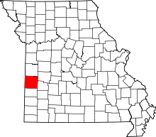 | |
| Villages | ||
| Townships | ||
| Unincorporated communities | ||
| Ghost towns | ||
| Footnotes | ‡This populated place also has portions in an adjacent county or counties | |