Shaheed Benazirabad District
| Shaheed Benazir Abad ضلعو شهيد بينظير آباد | |
|---|---|
| Districts | |
| Country | Pakistan |
| Province | Sindh |
| Headquarters | Nawabshah |
| Government | |
| • D.C | Abrar Ahmed Jaffar |
| • District Chairman | Sardar Jam Tamachi Unar |
| Area | |
| • Total | 4,502 km2 (1,738 sq mi) |
| Population (2017)[1] | |
| • Total | 1,612,847 |
| • Density | 360/km2 (930/sq mi) |
| Time zone | UTC+5 (PST) |
| Website |
District Govt. website http://sba.gos.pk/index.php Nawabshah City website |
Shaheed Benazirabad District (Sindhi ضلعو بينظير آباد ), previously known as Nawabshah District (Sindhi نوابشاہ), is one of the districts in the province of Sindh, Pakistan. The district was renamed in September 2008 when most of MPAs of Nawabshah demanded the district be renamed to honour the late party leader. The renaming of the district was criticised by the family of Syed Nawabshah and others who, while saddened at the death of Bhutto, felt that Nawabshah was a historic district and ought to have kept its name.[2]
Climate
The highest temperatures each year in Pakistan, typically rising to above 48 °C (118 °F), are usually recorded in Shaheed Benazeerabad District and Sibbi from May to August. The climate is generally dry and hot, but sometimes the temperature falls to 0 °C (32 °F); on rare occasions (once every 25 years or so) it has fallen to below −7 °C (19 °F) in December or January.
Archeology
The mausoleum of Thul Mir Rukun, a historical and archaeological tomb, is the property of the Archeology Department of the Government of Sindh and is situated 15 kilometres (9.3 mi) away from Daulatpur Taluka (Town). A road from Kazi Ahmed Town leads to Thul Rukan, via Pabjo village, reaching this exemplary thousand year old archaeological construction. The tomb is 60 feet (18 m) high. Mr. Henry Cusin, the British Archaeologist writes in his book Sindh's Archeology (Sindhi Translation Sindh Ja Qadeem Aasaar by Ata Muhammad Bhambro) that the bricks used in the construction of this tomb were made and prepared during the Buddhist Rulers' period. The line painting of the birth of Gotama Buddha was shown on the bricks clearly, which are preserved and kept by the Sindh Archaeological Department. He writes that ornaments, small effigies, and statues were also found when the ground was excavated around the tomb.
Second archaeological site of Chanhu jo daro is situated in village Jamal Keerio, Taluka Sakrand. This archaeological site belonging to the post-urban Jhukar phase of Indus valley civilization. The site is located 130 km (81 mi) south of Mohenjo-daro near the village of Jamal Keryo 2 km from Rohri canal and 10 km south of Nawabshah. The settlement was inhabited between 4000 and 1700 BCE, and is considered to have been a center for manufacturing carnelian beads. This site is a group of three low mounds that excavations have shown were parts of a single settlement, approximately 5 hectares in size.
This is one of most important and bigger sites of Indus civilization. It is situated in a desert area, but it is believed that the Sarasvati River used to flow near this site. Sarasvati River is believed to have dried up during 2nd millennium BC, causing the life at Chanhu jo daro and several hundreds of dwellings situated on the banks of Sarasvati to become very difficult. The people there probably had to abandon their houses for that reason which led to decline of these dwellings (cities and villages) which in turn contributed to the decline of Indus civilization itself. For building houses, baked bricks were used extensively at Chanhu jo daro - similar to Mohenjo-daro. Several constructions were identified as workshops or industrial quarters and some of the buildings of Chanhu jo daro might have been warehouses. An impressive workshop, recognized as a bead making factory, was found at Chanhu jo daro which included a furnace. Shell bangles, beads of many materials, stealite seals and metal works were also manufactured here.
History
After the 1853 invasion by General Charles Napier, Sindh was divided into provinces and assigned to Zamindars (or landlords) to collect taxes for the British. Sindh was later made part of British India's Bombay Presidency and became a separate province in 1935. Nawabshah (Urdu: نوابشاہ) Taluka Nawabshah was established in 1907, which later in 1912 was upgraded to the "Nawabshah District", named after Syed Nawab Shah son of Syed Nawaz Ali Shah, who migrated from the Sann district Dadu to Nawabshah with his family in 1881. There are two Irrigation Water Supply Divisions called "Nusrat Division" and "Dad Division" in the district. But later the rulers of that period developed this area into an urban area. The families from some other districts and provinces also came to the area and started to reside there. The rulers named these small developed areas as "Talukas" in Sindh. Therefore, they named this Taluka by the name of the immigrant Syed Nawab Shah. It was initially called Nawabshah Town, then named Nawabshah Taluka before finally being changed to Nawabshah District.
Shaheed Benazeerabad District is situated on the left bank of the River Indus. The name of the district was changed from Nawabshah District to Shaheed Benazeerabad District in April 2008 when a resolution was passed by the Provincial Assembly of Sindh unanimously, to pay tribute to the Mohtarma Benazeer Bhutto, who was assassinated in a suicidal terrorist attack, shortly after delivering an address to the general public in the 2008 general election campaign. Benazeer Bhutto was married by Asif Ali Zardari in this district, which is why the Member of Provincial Assembly (MPA) from Nawabshah proposed the resolution, which was passed by a unanimous vote following the demand of the general public and the workers of the Pakistan Peoples Party from the district.
Mr. Hamid Ali was the first Deputy Commissioner of Nawabshah District to take office on November 1, 1912. The First Suprintendent of Police of the district was P. M. Stewart, and the first Indian Superintendent of Police of Nawabshah District was Molvi Zia-ud-deen who assumed office on July 26, 1918.
At the establishment of the district in 1912, the seven talukas were included in this district:
- Kandiaro
- Naushero Feroze
- Moro
- Sakrand
- Nawabshah
- Sinjhoro
- Shahdadpur
In 1953 the talukas of Shahdadpur and Sinjhoro became part of the newly established Sanghar District, while in 1989 another part of the district (the talukas of Nausehro Feroz, Kandiaro and half of the taluka of Moro) were cleaved out to form the new Naushahro Feroze District.[3]
Landlords of the Jatoi, Syed, and Jam tribes were active in the politics of Nawabshah from the very beginning, but from 1970 and onwards, the Pakistan Peoples Party became the biggest political party of the district. Since then, the main ruling communities in the district are from Jatoi, Jokhio and Jokhio's many villages, and from Syed, Keeria, Magsi, Unar, Dahri, Rind and Zardari. This district is located in the centre of the Sindh Province of Pakistan, and is therefore commonly known as the Heart of Sindh.
In May 2014, a 5.0 magnitude earthquake struck the district, killing one person and injuring 70.[4]
Administrative divisions
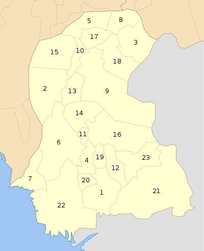
Shaheed Benazir Abad formerly formed part of Nawabshah District. The Deputy Commissioner is responsible for overall administration of the district. The district is sub-divided into four Talukas:
- sakrand
- Nawabshah
- Qazi Ahmed
- duar
Demographics
The population counted in the 1998 census was 1,072,000,[5] which according to estimates from 2011 has increased to 1,585,000.[6] 96.3% of the population are Muslim, and 2.77% – Hindu.[7] The major first language is Sindhi, accounging for 79% of the population. Urdu was the first language of 8.7%, Punjabi – 7.9% and Balochi – 1.8%.[8]
Education
District Shaheed Benazirabad is ranked at the 125th position in the education score index of the Pakistan District Education Rankings 2017 published by Alif Ailaan. The education score is composed of the learning score, retention score and gender parity score. In the middle school infrastructure index, which focuses on availability of basic facilities and the building condition, Shaheed Benazirabad ranks 70th. However, it ranks 77th in the primary school infrastructure. Both have a comparatively above average scores of availability of electricity and drinking water, access to toilets, but the building conditions lie below average in both primary and middle schools.
Using data from the Standardized Achievement Test (SAT) report published by the Sindh government in 2017, it was found in the “2013-2018 Five Years of Education Reforms in Sindh. Wins, Losses and challenges for 2018-2023.” report that Shaheed Benazirabad ranked 17th for student achievement in language in grade 8. However, with a score of only 39.98, it is still below average. In grade 8, Shaheed Benazirabad ranked at 12th position for student achievement in maths and 21st position for science.
Low learning outcome issues remain a hindrance for district Shaheed Benazirabad. Issues reported by the residents via the Taleem Do! App complain of the lack of primary schools in the area. The debate on whether basic education should be provided in the regional, national or official languages has been a point of debate in Pakistan for several years.
NGOs
- falah insaniyat foundation (FIF) nawabshah and sakrand
- IMDAD FONDATION SAKRAND
- Sindhica Reforms Society (SRS)
- United Global Organization of Development (UGOOD)
- Marie Stopes Society (MSS)
- Karam Ali Jamali Welfare Trust(KAJWT)
- The Education Service Welfare Association(TESWA)
- United Youth Network (UYN)
- Society for sustainable agriculture and Friendly Environment (SAFE)
- Nawabshah Disability Forum (NDF)
- Pakistan Down Syndrome Association (PDSA)
- Insaf Jarga Welfare Association (IJWA Sindh)
- Al-Khair Social Welfare Association (Al-KhairSWA)
- DevCon
- Al-Nijat Welfare Society
- ACT International
- Goth Sudhar Sanghat Haji Keerio
- Muhammad Ameen Keryo Environmental Services (MAKES)
- Institute for Social Change- ISC
- women Awareness And Development Association (WADA) NGO
- Indus Support Foundation - ISF
- Shah Sachal Sami Foundation (SSSF)
- National Disability & Development Forum (NDF) Pakistan
- Village Welfare Society (VWS) Shaheed Benazirabad
- Yar Muhammad Samejo Educational Society & Development Organization (YMSESDO)
Other cities, villages and towns of Benazirabad
- SAKRAND
- Bandhi duar
- Daur
- Bucheri nawabshah
- Jam Sahib nawabshah
- Qazi Ahmed
- Daulatpur
- Saboo Rahu sakrand
- Shahpur Jahania daulatpur
- HABERI duar
- Majeed Keerio sakrand
- Haji Keerio sakrand
- Sandh Keerio sakrand
- Landhi (Nawabshah)
- Rupa Mari sakrand
- khaddar sakrand
- Jamal Keerio sakrand
- 60 Miles nawabshah
- Fazul Muhammad Keerio sakrand
- Magsiabad (Dad wah) sakrand
- Manharo
- Mehrabpur sakrand
- Makhand
- Kathri
- Khabar Lakhmir sakrand
- Village Memon
- fath pur sakrand
- mudd banglo sakrand
- mari jalbani sakrand
- p k chandio sakrand
- natho keerio sakrand
- haji abdul qadir noonari sakrand
- 4 mile stop sakrand
- Masakh stop sakrand
- anjman qazi ahmed
- nawab wali muhammad khan qazi ahmed
- sarkari kooh qazi ahmed
- lakhat sakrand
- nasri sakrand
Sports
Shaheed Benazeerabad District has a cricket stadium named Bilawal Stadium where first class matches are played. sayed shabir ahmed shah cricket stadium govt boys school hyderabad road sakrand
Events
The H. M. Khoja Annual Flower Show was introduced by H. M. Khoja in 1954 at Khoja Garden. The celebrations take place for three or four days.[9]
Major educational institutions and schools
Educational institutions in district Benazirabad include:
- Quaid-e-Awam University of Engineering, Science and Technology
- Shaheed Benazir Bhutto University
- Shaheed Benazir Bhutto University of Veterinary and Animal Sciences, Sakrand
- Peoples University of Medical and Health Sciences
- Acadmey of exellance school near sayed villa sakrand
- Indus Institute of Information Technology Nawabshah
- Gbels Dourai Mahar
- TechSys Solutions Institute of Technology Nawabshah
- Keep Straight Academy of English language sakrand road, Nawabshah
- Virtual University of Pakistan (Nawabshah Campus @ TechSys Solutions Institute)
- Fauji Foundation Model School, Society Nawabshah
- The City School, Senior Branch, Society Nawabshah
- AIR Foundation School System Nawabshah
- Govt. Habib College of Technology, Nawabshah
- Govt. Degree (Boys) College, Nawabshah
- Govt. Degree (Girls) College, Nawabshah
- Govt. Sachal Sarmast College, Nawabshah
- Govt. Shaheen Vocational Institute Nawabshah
- Govt. Islamia Girls Higher Secondary School Nawabshah
- Szabist College, Nawabshah
- Mariam convent High School Nawabshah
- Gulshan Public High School Nawabshah
- Rangers Public School & College, Nawabshah
- TES Public Higher Secondary School & College Daur
- IMPERIAL Science College Sakrand Road Nawabshah
- Deputy Directorate of women Development Department Benazir Abad (legal aid office)
- Deaf Reach School and Training Centre, Nawabshah
- Noor Eastern Collegiate, Nawabshah
- New Oxford Public School (Maharr Colony Sakrand) Complete Free Education
- British English Language Center, Nawabshah
- Faraz Model High School Nawabshah
- Syed Jial Shah High School Landhi (Pvt.) Sakrand road Nawabshah
- Govt. High School Ghulam Mustafa Shah Landhi
- Govt.High School Hassan Jamali
- NAWABSHAH Homoeopathic Medical College & Hospital, Nawabshah
- CDF School of Excellence Asghar Colony Sakrand
- ATI ( agriculture traning instittute ) sakrand
- Amanullah noonari karati traning school and club sakrand 03063203218
- Ad dawwah school sakrand campus
- Provincial Institute of Teachers Education
- Bilawal Institute of Historical and Research
- Govt. (MPL) Higher Secondary School Shahdadpur Road Nawabshah
- Oxford Public High School Hussainabad Sakrand
- Abid Lashari Inclusive Public School, Village Jan Muhammad Lashari
- Assad Public Higher Secondary School, Shahpur Jahania
- Sakrand Sugar Mills Limited Near Ismail Kolachi Deh Tharo Unar Taluka Sakrand
- Govt. Higher Secondary School Khabar Lakhmir
References
- ↑ "DISTRICT WISE CENSUS RESULTS CENSUS 2017" (PDF). www.pbscensus.gov.pk. Archived from the original (PDF) on 2017-08-29.
- ↑ "Nawabshah renamed after Benazir Bhutto". Retrieved 2016-12-26.
- ↑ PCO 2000, p. 10.
- ↑ Magnitude 5 Earthquake Kills 1 In Pakistan, npr.org.
- ↑ PCO 2000, p. 21.
- ↑ "Sindh population surges by 81.5 pc, households by 83.9 pc". Thenews.com.pk. 2 April 2012. Retrieved 2013-04-21.
- ↑ PCO 2000, p. 24.
- ↑ PCO 2000, p. 26.
- ↑ The H.M Khoja Annual Flower Show
Sources
- 1998 District census report of Nawabshah. Census publication. 63. Islamabad: Population Census Organization, Statistics Division, Government of Pakistan. 2000.
- Different Newspapers and Sindh Assembly Meetings Reports published, aired or broadcast in the local media in April 2008.
- Website of the Election Commission of Pakistan (Election Results National Assembly)
- The book Aeena Zila Nawabshah compiled and written by Muhammad Ayub Shad
- History stone fixed on the walls of the tombs and shrines