Ghotki District
Student Boys Group Ghotki
| Ghotki District ضِلعو گھوٽڪي | |
|---|---|
| District | |
 Ghotki is located in the north east of Sindh. | |
| Coordinates: 27°49′N 69°39′E / 27.817°N 69.650°ECoordinates: 27°49′N 69°39′E / 27.817°N 69.650°E | |
| Country | Pakistan |
| Province | Sindh |
| Capital | Ghotki City |
| Area | |
| • Total | 6,083 km2 (2,349 sq mi) |
| Population (2017)[1] | |
| • Total | 1,646,318 |
| • Density | 270/km2 (700/sq mi) |
| Time zone | UTC+5 (PST) |
| Website |
www |
Ghotki District (Sindhi: ضِلعو گھوٽڪي) (Urdu: ضلع گھوٹکی) is a district in Pakistan, located in the Sindh province. Its capital city is Ghotki City. Prior to its establishment as a district in 1983, it formed part of Sukkur District.[2] According to the 1998 census, the district had a population of 970,550. Of these residents, 158,500 (16.33%) lived in urban areas, and 812,050 (83.67%) lived in rural areas.[3] Aftab Ahmed Laghari
Administration
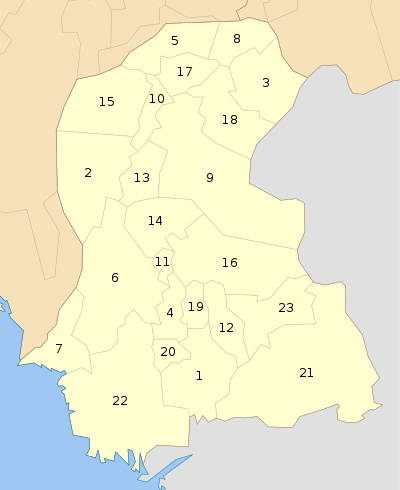
The Ghotki district is administratively subdivided into the following Tehsils:
Location
The Ghotki District is a border district between the northern Sindh province of Pakistan and Punjab, Pakistan.
Industry and Economics
Ghotki is an industrial area in the Sindh province. Local companies based in Ghotki include OGDCL, Engro Fertilizers, Fauji fo Fertilizers (formerly Pak Saudi Fertilizer), TNB Liberty Power Plant, EngroPowergen PowerPlant, and Dosan Power Plant. Ghotki also has three gas fields: the Mari Gas Field, Qadirpur Gas Field, and Rehmat Gas Field.
Cotton is one of the district's major crops, with forty cotton-ginning factories in Ghotki. Another valuable crop is sugar cane. Four sugar mills are located in the Ghotki District: JDW Sugar Mills-3, SGM Sugar Mills, Daherki Sugar Mills, and Reti Sugar Mills.
The region is also famous for its mangoes, vegetables, and abundance of date trees. The important products of Ghotki includes cotton, wheat, sugar, rice, milk, polttery etc. Fishing and tourism is also play an important role in economy.
Demography
According to the 1998 census results, the major first languages spoken in the district were Sindhi (92%), Urdu (3.1%) and Punjabi (2.9%).[4]
Religion
Per the 1998 census of Pakistan,[5] the most common religions in the Ghotki District are:
- Islam 93.06%
- Hinduism 6.68%
- Christianity 0.14%
- Others: 0.04%
Also according to the census, the district's Hindus, Christians, and Urdu-speaking Muslims are mainly concentrated in the urban areas.
Populated Places
Cities, towns, villages, and industrial areas where people live and work include:
- Village Behishti Lashkar Khan Kolachi (wadi Behishti) (4 km)
- kabir khan Kolachi(khohara)
- Village Kamil Behishti Kolachi
- Village Taj Muhammad Khan Ruk
- Ruk Farm
- Village Haji Khan Dharejo
- Jam Mohammad Ali Lakhan
- Village Misri Khan Dharejo (2 km).
- Zohaib Ahmed Kalwar s/o Zubair Ahmed Kalwar
- Aman Malhan
- Sardar khan bozdar
- Ghotki (0 km)
- Lakhan Colony (0.3 km)
- Jindu Ghoto Village (1.4 km)
- Pakhīmār(Anwrabad) (1.7 km)
- Jalāl Khān Village (1.8 km)
- Haji Muhammad Azeem Chachar (2.2 km)
- Fateh Ali (2.3 km)
- Village Muhammad Rafique Dharejo (5 km)
- Goth Kaheri (2.4 km)
- Dingāro (2.7 km)
- Abul Mīr Bahr (2.7 km)
- Kehri (2.9 km)
- Rehmonwali (3.1 km)
- Sāīn Dināh (3.1 km)
- Panju Bāgh (3.2 km)
- Seche Mohān (3.3 km)
- Village punhoon waseer(5.0 km)
- village arbab kaladi (7.8 km)
- village allah dino kaladi (6.5 km)
- Laluwali (3.3 km)
- Village Suleman Society
- Village Noor Muhammad Society
- Odhar Wali (3.3 km)
- Lakhe Mithal Mir Muhammad village (3.3 km)
- Gulan Laghāri (3.5 km)
- Jamāl Dīn (3.7 km)
- Bagga Village (3.8 km)
- Pindki (4 km)
- Sanghar (4.1 km)
- Massu Ghota (4.1 km)
- Pinio Labana (4.1 km)
- Rajo Kolāchi (4.3 km)
- Tandra Hasal Khān village (4.4 km)
- Atal Village (4.5 km)
- Ali Sher Jaskāni (4.9 km)
- Saifal Khān Kolāchi (5 km)
- Bakro (5.1 km)
- Izzat Khān Dherejo (5.2 km)
- Sharīf Sanghar (5.2 km)
- Goth Sābu (5.3 km)
- Murād Goth (5.3 km)
- Jamal (5.5 km)
- Bhatiyun (5.5 km)
- Khokhar (5.5 km)
- Jumma (5.5 km)
- Garhi Sher Muhammad (5.7 km)
- Jiwan Kolāchi (5.8 km)
- Badal Mangsi (5.8 km)
- Husain Khān Sanghar (5.8 km)
- Mubarak Khān Kolāchi (6.1 km)
- Sādiq Ghota (6.2 km)
- Sāīm Dād (6.3 km)
- Allāh Warāyo Gujar (6.4 km)
- Muhammad Chāchar (6.5 km)
- Jānu (6.5 km)
- Karām Bakhsh (6.6 km)
- Ayub Lakhan (7.0 km)
- Bindi (7.1 km)
- Azkaban (9.1 km)
- Husain Beli (7.1 km)
- Mīrānpur (7.1 km)
- Abdullah Lakhan (7.1 km)
- Paula Abdul Ghani Lakhan (7.7 km)
- Jam Muhammad Ali Lakhan (11.8 km)
- Village Imdad Hussain Abro (12 km)
- Hassija mahar (12 km)
- Mohammad Ali Bozdar (24 km)
- Pir Muhammad Khan Khatian (27 km)
- Village Sahib Khan Jalbani
- Village Pir Bux Jalbani
- Village Pipli Jalbani
- Village Darya Khan Jalbani
- Village Raja Form
- Village Dil Murad Mahar(Late)
- Village Jan Muhammad Arain
- Village Haji Khan Dharejo (6 km).
- village sijawal khan Dhandhu
- Village Rijab khan Dhandhu
References
- ↑ "DISTRICT WISE CENSUS RESULTS CENSUS 2017" (PDF). www.pbscensus.gov.pk.
- ↑ PCO 1998, p. 10.
- ↑ "Archived copy". Archived from the original on 2014-11-29. Retrieved 2014-11-23.
- ↑ PCO 1998, p. 26.
- ↑ http://www.pbs.gov.pk/sites/default/files/other/pocket_book2006/2.pdf
Bibliography
- 1998 District census report of Ghotki. Census publication. 88. Islamabad: Population Census Organization, Statistics Division, Government of Pakistan. 2000.