Natsudomari Peninsula
| Natsudomari Peninsula | |
|---|---|
| 夏泊半島 | |
 Landsat image of Natsudomari Peninsula | |
  | |
| Location | Aomori Prefecture, Japan |
| Coordinates | 40°54′37″N 140°57′55″E / 40.9103°N 140.9652°ECoordinates: 40°54′37″N 140°57′55″E / 40.9103°N 140.9652°E |
| Part of | Hiranai, Aomori |
| Highest point |
Mount Mizugasawa 325 m (1,066.27 ft) |
| Area | Appx. 100 square kilometres (39 sq mi) |
Natsudomari Peninsula (Japanese:
Location
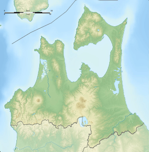
The Natsudomari Peninsula is bordered by Mutsu Bay to the east and north and Aomori Bay to the west. The peninsula is connected to the mainland of Honshū to the south. The Ōu Mountain Range begins on the peninsula and continues to the Nasu Mountains at the northern boundary of the Kantō region. The peninsula lies near the geographic center of Aomori Prefecture, the northernmost prefecture of the main Japanese island, Honshū.[1]
Notable places
Notable places in the Natsudomari Peninsula include :
- Asamushi-Natsudomari Prefectural Natural Park
- Yogoshiyama Forest Park
- Asamushi Onsen
- Kominato Swan Nesting Shallow Shore
Transportation
Railway
Highway

- Aomori Prefecture Route 9 - a scenic road known also as the "Hotate Line" that travels around the edge of the peninsula.[4]
Transit
- Hiranai Town Bus
- Aomori City Bus
References
- 1 2 Nishiwaki, H. (2006). "Landforms of Tohoku". GLGArcs. Retrieved 2008-09-11.
- ↑ 青森県平内町. "平内町の概要 - 青森県平内町". Town.hiranai.aomori.jp. Retrieved 25 July 2018.
- ↑ "浅虫夏泊県立自然公園|青森県庁ウェブサイト Aomori Prefectural Government". Pref.aomori.lg.jp. Retrieved 25 July 2018.
- ↑ "Natsudomari Hotate Line". Precious Roads. 2002. Retrieved 2018-01-07.