| [3] |
Name on the Register[4] |
Image |
Date listed[5] |
Location |
Description |
|---|
| 1 |
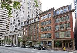
Alkemeyer Commercial Buildings |
|
December 9, 1980
(#80003034) |
19-23 W. Court St.
39°06′21″N 84°30′52″W / 39.105833°N 84.514444°W / 39.105833; -84.514444 (Alkemeyer Commercial Buildings) |
|
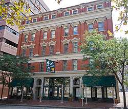
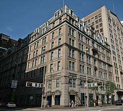
| 2 |
Brittany Apartment Building |
|
March 3, 1980
(#80003037) |
100-104 W. 9th St.
39°06′19″N 84°30′57″W / 39.105278°N 84.515833°W / 39.105278; -84.515833 (Brittany Apartment Building) |
|
| 3 |
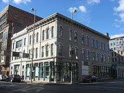
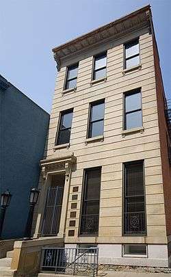
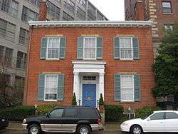
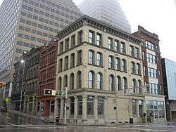
Brunswick-Balke-Collender Building |
|
January 24, 2017
(#100000568) |
130-132 E. 6th St.
39°06′11″N 84°30′38″W / 39.102942°N 84.510604°W / 39.102942; -84.510604 (Brunswick-Balke-Collender Building) |
|
| 4 |
Building at 620-622 Vine Street |
|
February 14, 2018
(#100002121) |
620-622 Vine St.
39°06′12″N 84°30′49″W / 39.103378°N 84.513515°W / 39.103378; -84.513515 (Building at 620-622 Vine Street) |
|
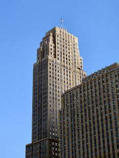
| 5 |
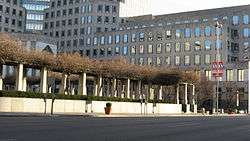
Carew Tower |
|
August 5, 1982
(#82003578) |
W. 5th St. and Fountain Sq.
39°06′04″N 84°30′42″W / 39.101°N 84.511667°W / 39.101; -84.511667 (Carew Tower) |
|
| 6 |
John Church Company Building |
|
June 17, 1994
(#94000592) |
14-16 E. 4th St.
39°06′01″N 84°30′43″W / 39.100278°N 84.511944°W / 39.100278; -84.511944 (John Church Company Building) |
|
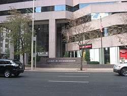
| 7 |
Cincinnati and Suburban Telephone Company Building |
|
April 20, 1995
(#95000495) |
209 W. 7th St.
39°06′10″N 84°31′02″W / 39.102778°N 84.517222°W / 39.102778; -84.517222 (Cincinnati and Suburban Telephone Company Building) |
|
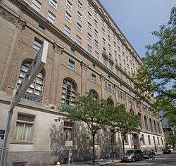
| 8 |
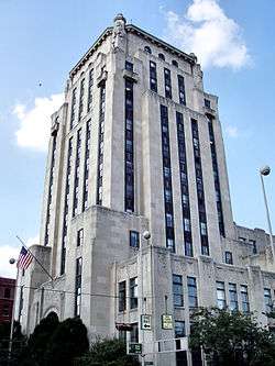
Cincinnati City Hall |
|
December 11, 1972
(#72001017) |
801 Plum St.
39°06′15″N 84°31′10″W / 39.104167°N 84.519444°W / 39.104167; -84.519444 (Cincinnati City Hall) |
|
| 9 |
Cincinnati East Manufacturing and Warehouse District |
|
March 12, 1999
(#99000318) |
Between E. Court and E. 8th, Broadway and Main Sts.
39°06′19″N 84°30′32″W / 39.105278°N 84.508889°W / 39.105278; -84.508889 (Cincinnati East Manufacturing and Warehouse District) |
|
| 10 |
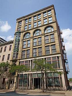
Cincinnati Enquirer Building |
|
November 13, 1985
(#85002787) |
617 Vine St.
39°06′11″N 84°30′49″W / 39.103056°N 84.513611°W / 39.103056; -84.513611 (Cincinnati Enquirer Building) |
|
| 11 |
Cincinnati Gymnasium and Athletic Club |
|
February 17, 1983
(#83001978) |
111 Shillito Pl.
39°06′09″N 84°30′55″W / 39.1025°N 84.515278°W / 39.1025; -84.515278 (Cincinnati Gymnasium and Athletic Club) |
|
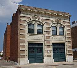
| 12 |
Court Street Firehouse |
|
July 18, 1974
(#74001510) |
311 W. Court St.
39°06′19″N 84°31′10″W / 39.105278°N 84.519444°W / 39.105278; -84.519444 (Court Street Firehouse) |
|
| 13 |
Courtland Flats |
|
December 20, 1984
(#84001046) |
117-121 E. Court St.
39°06′23″N 84°30′42″W / 39.106389°N 84.511667°W / 39.106389; -84.511667 (Courtland Flats) |
|
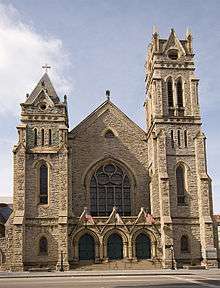
| 14 |
Covenant First Presbyterian Church |
|
January 29, 1973
(#73001455) |
8th and Elm Sts.
39°06′14″N 84°31′02″W / 39.103889°N 84.517222°W / 39.103889; -84.517222 (Covenant First Presbyterian Church) |
|
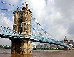
| 15 |
Covington and Cincinnati Suspension Bridge |
|
May 15, 1975
(#75000786) |
Spans the Ohio River between Cincinnati and Covington
39°05′32″N 84°30′34″W / 39.092222°N 84.509444°W / 39.092222; -84.509444 (Covington and Cincinnati Suspension Bridge) |
Extends into Kenton County, Kentucky |
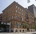
| 16 |
Cuvier Press Club |
|
October 26, 1972
(#72001019) |
22 Garfield Pl.
39°06′17″N 84°30′52″W / 39.104722°N 84.514444°W / 39.104722; -84.514444 (Cuvier Press Club) |
|
| 17 |
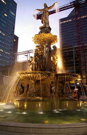
Tyler Davidson Fountain |
|
October 11, 1979
(#79001854) |
5th St.
39°06′05″N 84°30′44″W / 39.101389°N 84.512222°W / 39.101389; -84.512222 (Tyler Davidson Fountain) |
|
| 18 |
H. W. Derby Building |
|
March 3, 1980
(#80003045) |
300 W. 4th St.
39°05′57″N 84°31′03″W / 39.099167°N 84.5175°W / 39.099167; -84.5175 (H. W. Derby Building) |
|
| 19 |
Doctors' Building |
|
December 4, 1986
(#86003317) |
19 Garfield Pl.
39°06′15″N 84°30′53″W / 39.104167°N 84.514722°W / 39.104167; -84.514722 (Doctors' Building) |
|
| 20 |
Duttenhofer Building |
|
December 26, 2017
(#100001933) |
299 E. 6th St.
39°06′11″N 84°30′31″W / 39.103132°N 84.508666°W / 39.103132; -84.508666 (Duttenhofer Building) |
|
| 21 |
East Fourth Street Historic District |
|
February 22, 1988
(#88000078) |
123, 127, and 135-137 E. 4th St.
39°06′N 84°31′W / 39.1°N 84.51°W / 39.1; -84.51 (East Fourth Street Historic District) |
|
| 22 |
Fenwick Club Annex |
|
March 7, 1973
(#73001458) |
426 E. 5th St.
39°06′09″N 84°30′21″W / 39.1025°N 84.505833°W / 39.1025; -84.505833 (Fenwick Club Annex) |
|
| 23 |
First National Bank Building |
|
January 24, 2017
(#100000570) |
105 E. 4th St.
39°06′01″N 84°30′39″W / 39.100223°N 84.510804°W / 39.100223; -84.510804 (First National Bank Building) |
|
| 24 |
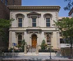
Abraham J. Friedlander House |
|
May 7, 1979
(#79001855) |
8 W. 9th St.
39°06′19″N 84°30′51″W / 39.105278°N 84.514167°W / 39.105278; -84.514167 (Abraham J. Friedlander House) |
|
| 25 |
Goodall Building |
|
February 9, 1984
(#84003710) |
324 W. 9th St.
39°06′17″N 84°31′12″W / 39.104722°N 84.52°W / 39.104722; -84.52 (Goodall Building) |
|
| 26 |
Gwynne Building |
|
August 3, 1979
(#79001856) |
6th and Main Sts
39°06′11″N 84°30′36″W / 39.103056°N 84.51°W / 39.103056; -84.51 (Gwynne Building) |
|
| 27 |
Hooper Building |
|
March 3, 1980
(#80003058) |
139-151 W. 4th St.
39°05′57″N 84°30′56″W / 39.099167°N 84.515556°W / 39.099167; -84.515556 (Hooper Building) |
|
| 28 |
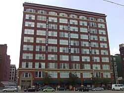
Hotel Metropole |
|
June 18, 2009
(#09000443) |
609 Walnut St.
39°06′11″N 84°30′43″W / 39.103086°N 84.512028°W / 39.103086; -84.512028 (Hotel Metropole) |
Transformed into the 21c Museum Hotel |
| 29 |
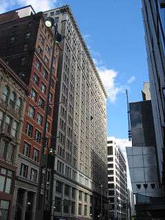
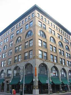
Ingalls Building |
|
March 7, 1975
(#75001418) |
6 E. 4th St.
39°06′00″N 84°30′45″W / 39.1°N 84.5125°W / 39.1; -84.5125 (Ingalls Building) |
|
| 30 |
Krippendorf-Dittman Company |
|
March 3, 1980
(#80003061) |
628 Sycamore St.
39°06′14″N 84°30′30″W / 39.103889°N 84.508333°W / 39.103889; -84.508333 (Krippendorf-Dittman Company) |
|
| 31 |
Lombardy Apartment Building |
|
March 3, 1980
(#80003062) |
318-326 W. 4th St.
39°05′57″N 84°31′05″W / 39.099167°N 84.518056°W / 39.099167; -84.518056 (Lombardy Apartment Building) |
|
| 32 |
Lytle Park Historic District |
|
March 26, 1976
(#76001435) |
Roughly bounded by 3rd, 5th, Sycamore, Commercial Sq., and Butler Sts.
39°06′04″N 84°30′19″W / 39.101111°N 84.505278°W / 39.101111; -84.505278 (Lytle Park Historic District) |
|
| 33 |
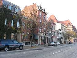
Main and Third Street Cluster |
|
July 15, 1983
(#83001984) |
300-302, 304-306 Main St., and 208-210 E. 3rd St.; also 308-318 Main St.
39°05′58″N 84°30′31″W / 39.099444°N 84.508611°W / 39.099444; -84.508611 (Main and Third Street Cluster) |
308-318 Main represents a boundary increase of November 14, 2012, the Main-Third Street Buildings |
| 34 |
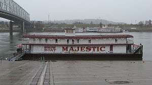
MAJESTIC |
|
January 3, 1980
(#89002456) |
Ohio River below Central Bridge
39°05′49″N 84°30′17″W / 39.096944°N 84.504722°W / 39.096944; -84.504722 (MAJESTIC) |
Originally listed on the NRHP as "SHOWBOAT MAJESTIC"; declared a National Historic Landmark under this name on December 20, 1989 |
| 35 |
Newport and Cincinnati Bridge |
|
April 17, 2001
(#01000364) |
Spans the Ohio River
39°05′41″N 84°29′40″W / 39.094722°N 84.494444°W / 39.094722; -84.494444 (Newport and Cincinnati Bridge) |
Also known as the Newport Southbank Bridge; extends into Campbell County, Kentucky |
| 36 |
Ninth Street Historic District |
|
November 25, 1980
(#80003067) |
9th St. between Vine and Plum Sts.
39°06′17″N 84°30′59″W / 39.104722°N 84.516389°W / 39.104722; -84.516389 (Ninth Street Historic District) |
|
| 37 |
Palace Hotel |
|
March 3, 1980
(#80003071) |
6th and Vine Sts.
39°06′09″N 84°30′49″W / 39.1025°N 84.513611°W / 39.1025; -84.513611 (Palace Hotel) |
|
| 38 |
Palace Theatre |
|
March 24, 1980
(#80004067) |
12 E. 6th St.
39°06′09″N 84°30′46″W / 39.1025°N 84.512778°W / 39.1025; -84.512778 (Palace Theatre) |
|
| 39 |
Phoenix Building/Cincinnati Club |
|
January 11, 1985
(#85000068) |
30 Garfield Pl. and 812 Race St.
39°06′17″N 84°30′55″W / 39.104722°N 84.515278°W / 39.104722; -84.515278 (Phoenix Building/Cincinnati Club) |
|
| 40 |
Phoenix Club |
|
March 3, 1980
(#80003073) |
9th and Race Sts.
39°06′18″N 84°30′55″W / 39.105°N 84.515278°W / 39.105; -84.515278 (Phoenix Club) |
|
| 41 |
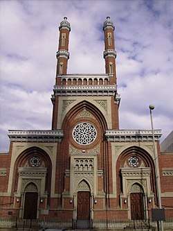
Plum Street Temple |
|
December 27, 1972
(#72001021) |
8th and Plum Sts.
39°06′13″N 84°31′05″W / 39.103611°N 84.518056°W / 39.103611; -84.518056 (Plum Street Temple) |
Now known as Isaac M. Wise Temple |
| 42 |
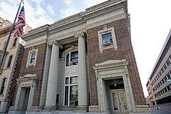
Police Station No. 2 |
|
May 18, 1981
(#81000655) |
314 Broadway
39°06′01″N 84°30′20″W / 39.100389°N 84.505667°W / 39.100389; -84.505667 (Police Station No. 2) |
|
| 43 |
Power Building |
|
March 5, 1999
(#99000276) |
224 E. 8th St.
39°06′19″N 84°30′32″W / 39.105278°N 84.508889°W / 39.105278; -84.508889 (Power Building) |
|
| 44 |
Provident Savings Bank and Trust Co. |
|
September 6, 2018
(#100002878) |
630-632 Vine St.
39°06′13″N 84°30′49″W / 39.1035°N 84.5136°W / 39.1035; -84.5136 (Provident Savings Bank and Trust Co.) |
|
| 45 |
Race Street Historic District |
|
August 4, 1995
(#95000878) |
Roughly along Race, W. 6th and W. 7th Sts. and Shillito Pl.
39°06′11″N 84°30′54″W / 39.103056°N 84.515°W / 39.103056; -84.515 (Race Street Historic District) |
|
| 46 |
Reakirt Building |
|
January 24, 2017
(#100000569) |
126-128 E. 6th St.
39°06′11″N 84°30′39″W / 39.102921°N 84.510792°W / 39.102921; -84.510792 (Reakirt Building) |
|
| 47 |
Nathaniel Ropes Building |
|
September 30, 1982
(#82003585) |
917 Main St.
39°06′22″N 84°30′40″W / 39.106111°N 84.511111°W / 39.106111; -84.511111 (Nathaniel Ropes Building) |
|
| 48 |
St. Francis Xavier Church |
|
July 18, 1980
(#80003087) |
607 Sycamore St.
39°06′12″N 84°30′33″W / 39.103333°N 84.509167°W / 39.103333; -84.509167 (St. Francis Xavier Church) |
|
| 49 |
St. Peter-In-Chains Cathedral |
|
January 18, 1973
(#73001469) |
325 W. 8th St.
39°06′13″N 84°31′11″W / 39.103611°N 84.519722°W / 39.103611; -84.519722 (St. Peter-In-Chains Cathedral) |
|
| 50 |
Saxony Apartment Building |
|
March 3, 1980
(#80003083) |
105-111 W. 9th St.
39°06′19″N 84°30′56″W / 39.105278°N 84.515556°W / 39.105278; -84.515556 (Saxony Apartment Building) |
|
| 51 |
Taft Museum |
|
January 29, 1973
(#73001470) |
316 Pike St.
39°06′09″N 84°30′12″W / 39.1025°N 84.503333°W / 39.1025; -84.503333 (Taft Museum) |
Also known as Baum-Taft House |
| 52 |
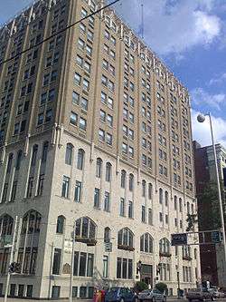
Terrace Plaza Hotel |
|
August 24, 2017
(#100001493) |
15 W. 6th St.
39°06′09″N 84°30′52″W / 39.102461°N 84.514524°W / 39.102461; -84.514524 (Terrace Plaza Hotel) |
|
| 53 |
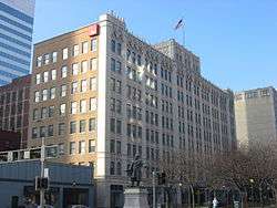
Times-Star Building |
|
November 25, 1983
(#83004309) |
800 Broadway
39°06′21″N 84°30′24″W / 39.105833°N 84.506667°W / 39.105833; -84.506667 (Times-Star Building) |
|
| 54 |
Traction Company Building |
|
July 3, 2017
(#100001270) |
432 Walnut St.
39°06′04″N 84°30′41″W / 39.101101°N 84.511299°W / 39.101101; -84.511299 (Traction Company Building) |
|
| 55 |
Underwriters Salvage Corps |
|
July 15, 1982
(#82003589) |
110-112 E. 8th St.
39°06′18″N 84°30′42″W / 39.105°N 84.511667°W / 39.105; -84.511667 (Underwriters Salvage Corps) |
|
| 56 |
Union Trust Building |
|
August 29, 2008
(#08000802) |
36 E. 4th St.
39°06′00″N 84°30′42″W / 39.100119°N 84.511536°W / 39.100119; -84.511536 (Union Trust Building) |
|
| 57 |
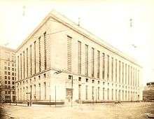
United States Post Office and Court House |
|
April 28, 2015
(#15000184) |
100 E. 5th St.
39°06′06″N 84°30′37″W / 39.1018°N 84.5104°W / 39.1018; -84.5104 (United States Post Office and Court House) |
Now known as the Potter Stewart United States Courthouse. |
| 58 |
West Fourth Street Historic District |
|
August 13, 1976
(#79001861) |
Bounded by Central Ave, W. 5th, Plum, and McFarland Sts.; also W. 5th and Perry Sts. between Central Ave. and Plum St., 4th St. between Central Ave. and Race St.; also 1-35 and 2-18 W. 4th St.; also 309 Vine St.
39°05′58″N 84°31′06″W / 39.099444°N 84.518333°W / 39.099444; -84.518333 (West Fourth Street Historic District) |
Second, third, and fourth sets of boundaries represent boundary increases |
| 59 |
Young Women's Christian Association of Cincinnati |
|
September 16, 1982
(#82003591) |
9th and Walnut Sts.
39°06′19″N 84°30′43″W / 39.105278°N 84.511944°W / 39.105278; -84.511944 (Young Women's Christian Association of Cincinnati) |
|


.jpg)