| [5] |
Name on the Register |
Image |
Date listed[6] |
Location |
City or town |
Description |
|---|
| 1 |
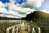
35-DO-130-Tahkenitch Landing Site |
|
June 10, 2003
(#01000132) |
Address restricted[7]
|
Gardiner |
|
| 2 |
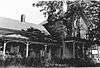
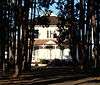
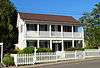
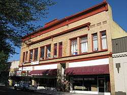
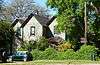
Charles Applegate House |
|
March 17, 1975
(#75001583) |
512 Old Applegate Road
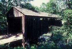
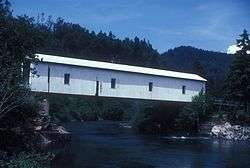
43°36′40″N 123°16′22″W / 43.611081°N 123.272691°W / 43.611081; -123.272691 (Charles Applegate House) |
Yoncalla |
|
| 3 |
Baimbridge–Kanipe Farmstead Historic District |
|
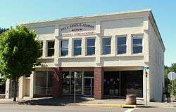
January 29, 2008
(#07001506) |
16513 Elkhead Rd.
43°29′00″N 123°13′16″W / 43.483391°N 123.221131°W / 43.483391; -123.221131 (Baimbridge–Kanipe Farmstead Historic District) |
Oakland |
|
| 4 |
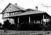
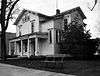
Henry Brown House |
|
October 30, 1979
(#79002057) |
19521 Highway 38
43°38′49″N 123°38′58″W / 43.646943°N 123.649398°W / 43.646943; -123.649398 (Henry Brown House) |
Elkton |
|
| 5 |
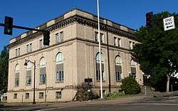
Will Q. Brown House and Wash House |
|
September 10, 1987
(#87001539) |
274 Main St.
42°56′52″N 123°21′50″W / 42.947719°N 123.363830°W / 42.947719; -123.363830 (Will Q. Brown House and Wash House) |
Riddle |
|
| 6 |
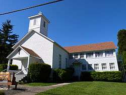
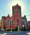
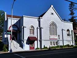
Canyonville Methodist Church |
|
April 5, 1984
(#84002983) |
2nd and Pine Sts.
42°55′38″N 123°16′49″W / 42.927111°N 123.280235°W / 42.927111; -123.280235 (Canyonville Methodist Church) |
Canyonville |
|
| 7 |
China Ditch |
|
May 22, 1991
(#91000616) |
Upper reaches of N. Myrtle Cr.
43°08′45″N 123°07′55″W / 43.145733°N 123.131989°W / 43.145733; -123.131989 (China Ditch) |
Myrtle Creek |
|
| 8 |
Nathaniel Curry House |
|
November 25, 1983
(#83004166) |
1458 Quail Lane
43°15′50″N 123°25′56″W / 43.26396°N 123.432193°W / 43.26396; -123.432193 (Nathaniel Curry House) |
Roseburg |
|
| 9 |
Charles D. Drain Jr. House |
|
December 12, 1978
(#78002286) |
500 S. Main St.
43°39′31″N 123°18′43″W / 43.658506°N 123.311983°W / 43.658506; -123.311983 (Charles D. Drain Jr. House) |
Drain |
|
| 10 |
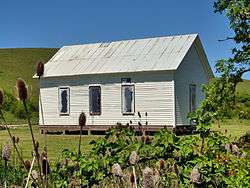
English Settlement School |
|
September 4, 2007
(#07000924) |
17455 Elkhead Rd.
43°28′20″N 123°13′27″W / 43.472122°N 123.224055°W / 43.472122; -123.224055 (English Settlement School) |
Oakland |
|
| 11 |
First Presbyterian Church of Roseburg |
|
July 28, 1988
(#88001162) |
823 SE Lane Ave.
43°12′25″N 123°20′45″W / 43.20691944°N 123.3457472°W / 43.20691944; -123.3457472 (First Presbyterian Church of Roseburg) |
Roseburg |
|
| 12 |
Creed Floed House |
|
December 31, 1974
(#74001684) |
544 SE Douglas St.
43°12′43″N 123°20′44″W / 43.21201389°N 123.3456194°W / 43.21201389; -123.3456194 (Creed Floed House) |
Roseburg |
|
| 13 |
Gardiner Historic District |
|
January 31, 1994
(#93000003) |
Roughly bounded by 3rd, Camp, 2nd, Pitt, Spring, Front and Garden Sts.
43°43′49″N 124°06′36″W / 43.73027778°N 124.11°W / 43.73027778; -124.11 (Gardiner Historic District) |
Gardiner |
|
| 14 |
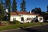
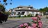
Glide Ranger Station |
|
April 8, 1986
(#86000820) |
121 Glide Loop Drive
43°17′52″N 123°06′02″W / 43.297862°N 123.100585°W / 43.297862; -123.100585 (Glide Ranger Station) |
Glide |
|
| 15 |
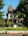
Judge James Watson Hamilton House |
|
February 21, 1997
(#97000141) |
759 SE Kane St.
43°12′23″N 123°20′36″W / 43.206396°N 123.343307°W / 43.206396; -123.343307 (Judge James Watson Hamilton House) |
Roseburg |
|
| 16 |
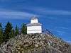
Hershberger Mountain Lookout |
|
December 29, 2000
(#00000507) |
Approximately 7 miles (11 km) north of Union Cr.
43°02′01″N 122°27′18″W / 43.033535°N 122.454900°W / 43.033535; -122.454900 (Hershberger Mountain Lookout) |
Prospect vicinity |
|
| 17 |
Howell–Kohlhagen House |
|
July 28, 1988
(#88001145) |
848 SE Jackson St.
43°12′24″N 123°20′46″W / 43.206536°N 123.346099°W / 43.206536; -123.346099 (Howell–Kohlhagen House) |
Roseburg |
|
| 18 |
Kohlhagen Building |
|
June 13, 1997
(#97000589) |
630 SE Jackson St.
43°12′31″N 123°20′41″W / 43.208545°N 123.344586°W / 43.208545; -123.344586 (Kohlhagen Building) |
Roseburg |
|
| 19 |
Laurelwood Historic District |
|
October 16, 1990
(#90001521) |
Roughly bounded by the S. Umpqua R., Laurelwood Ct., and Bowden Ave.
43°12′55″N 123°21′03″W / 43.215385°N 123.350806°W / 43.215385; -123.350806 (Laurelwood Historic District) |
Roseburg |
|
| 20 |
Methodist Episcopal Church South |
|
June 6, 1985
(#85001179) |
809 SE Main St.
43°12′24″N 123°20′41″W / 43.20656389°N 123.3448194°W / 43.20656389; -123.3448194 (Methodist Episcopal Church South) |
Roseburg |
|
| 21 |
Mill–Pine Neighborhood Historic District |
|
June 20, 1985
(#85001348) |
Roughly bounded by Short St., Mosher Ave., Stephens St. and Rice Ave.
43°12′13″N 123°21′07″W / 43.20362778°N 123.3520361°W / 43.20362778; -123.3520361 (Mill–Pine Neighborhood Historic District) |
Roseburg |
Beginning in 1878, this neighborhood of modest homes developed to house employees of the adjacent railroad and the service and retail workers who served them. Physical evolution of the district largely ceased after the Southern Pacific moved its operational base from Roseburg to Eugene in 1927, leaving an unusually cohesive example of a working-class residential neighborhood of the late 19th and early 20th centuries.[8] |
| 22 |
Miller's Mountain House |
|
October 25, 1984
(#84000129) |
1195 Roberts Mountain Rd.
43°07′14″N 123°22′55″W / 43.120583°N 123.381856°W / 43.120583; -123.381856 (Miller's Mountain House) |
Roseburg |
|
| 23 |
Milo Academy Bridge |
|
November 29, 1979
(#79002055) |
Southeast of Days Creek
42°56′07″N 123°02′20″W / 42.935235°N 123.038976°W / 42.935235; -123.038976 (Milo Academy Bridge) |
Days Creek |
|
| 24 |
Dr. Robert R. and Mary Helen Mooers House |
|
June 25, 2018
(#100002632) |
1247 SE Kane St.
43°12′06″N 123°20′42″W / 43.201529°N 123.345067°W / 43.201529; -123.345067 (Dr. Robert R. and Mary Helen Mooers House) |
Roseburg |
|
| 25 |
C. E. Moyer Nurseries Property |
|
July 22, 1988
(#88001114) |
8374 Old Hwy. 99 S.
43°06′43″N 123°25′00″W / 43.112026°N 123.416599°W / 43.112026; -123.416599 (C. E. Moyer Nurseries Property) |
Winston |
|
| 26 |
Oakland Historic District |
|
March 30, 1979
(#79002058) |
Roughly bounded by Chestnut, 1st, Cedar, and 8th Sts.
43°25′21″N 123°17′51″W / 43.422533°N 123.297425°W / 43.422533; -123.297425 (Oakland Historic District) |
Oakland |
|
| 27 |
Oregon State Soldier's Home Hospital |
|
March 7, 2012
(#12000079) |
1624 W. Harvard Avenue
43°12′50″N 123°22′04″W / 43.21384°N 123.367706°W / 43.21384; -123.367706 (Oregon State Soldier's Home Hospital) |
Roseburg |
|
| 28 |
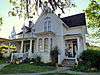
Moses Parrott House |
|
November 6, 1980
(#80003313) |
1772 SE Jackson St.
43°11′55″N 123°21′07″W / 43.19873°N 123.351892°W / 43.19873; -123.351892 (Moses Parrott House) |
Roseburg |
|
| 29 |
Rice Brothers and Adams Building |
|
August 11, 1983
(#83002149) |
136 N. Main St.
43°01′30″N 123°17′23″W / 43.02503°N 123.289777°W / 43.02503; -123.289777 (Rice Brothers and Adams Building) |
Myrtle Creek |
|
| 30 |
Napoleon Rice House |
|
December 9, 1981
(#81000482) |
709 SE Kane St.
43°12′26″N 123°20′35″W / 43.207137°N 123.343145°W / 43.207137; -123.343145 (Napoleon Rice House) |
Roseburg |
|
| 31 |
Roseburg Downtown Historic District |
|
June 18, 2003
(#02000661) |
Roughly bounded by SP tracks, Deer Creek, Fowler, Chadwick, Kane & Mosher Sts.
43°12′34″N 123°20′38″W / 43.209444°N 123.343889°W / 43.209444; -123.343889 (Roseburg Downtown Historic District) |
Roseburg |
|
| 32 |
Roseburg Oregon National Guard Armory |
|
May 27, 1993
(#93000447) |
1034 SE Oak St.
43°12′31″N 123°20′34″W / 43.20858333°N 123.3427944°W / 43.20858333; -123.3427944 (Roseburg Oregon National Guard Armory) |
Roseburg |
|
| 33 |
Roseburg Veterans Administration Hospital Historic District |
|
January 29, 2013
(#12001247) |
913 NW Garden Valley Boulevard
43°13′27″N 123°22′02″W / 43.224129°N 123.367091°W / 43.224129; -123.367091 (Roseburg Veterans Administration Hospital Historic District) |
Roseburg |
|
| 34 |
Bernard Pitzer Smith House |
|
August 25, 1988
(#88001313) |
15892 Old Hwy. 99 S.
43°03′43″N 123°21′19″W / 43.061808°N 123.355269°W / 43.061808; -123.355269 (Bernard Pitzer Smith House) |
Myrtle Creek |
|
| 35 |
Henry Clay Smith House |
|
June 27, 1997
(#97000585) |
275 Winston Section Rd.
43°07′53″N 123°23′53″W / 43.131391°N 123.398141°W / 43.131391; -123.398141 (Henry Clay Smith House) |
Winston |
|
| 36 |
Stephens Community Historic District |
|
October 25, 1984
(#84000135) |
Fort McKay and Scott Henry Rds.
43°22′57″N 123°23′34″W / 43.382584°N 123.392830°W / 43.382584; -123.392830 (Stephens Community Historic District) |
Sutherlin |
|
| 37 |
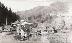
Susan Creek Indian Mounds Site |
|
November 20, 1974
(#74001683) |
Address restricted[7]
|
Glide |
|
| 38 |
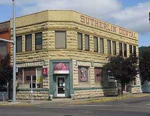
Sutherlin Bank Building |
|
August 1, 1984
(#84002987) |
101 W. Central Ave.
43°23′25″N 123°18′49″W / 43.390238°N 123.313653°W / 43.390238; -123.313653 (Sutherlin Bank Building) |
Sutherlin |
|
| 39 |
Tiller Ranger Station |
|
March 6, 1991
(#91000162) |
OR 227, Umpqua NF
42°55′39″N 122°56′52″W / 42.9275°N 122.947778°W / 42.9275; -122.947778 (Tiller Ranger Station) |
Tiller |
|
| 40 |
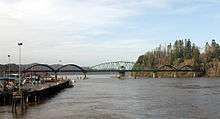
Umpqua River Bridge No. 01822 |
|
August 5, 2005
(#05000815) |
Oregon Route Coast 9/U.S. Route 101 at mile post 211.21
43°42′35″N 124°06′03″W / 43.709827°N 124.100922°W / 43.709827; -124.100922 (Umpqua River Bridge No. 01822) |
Reedsport |
|
| 41 |
Umpqua River Light House |
|
October 21, 1977
(#77001100) |
Southwest of Winchester Bay off U.S. 101
43°39′44″N 124°11′55″W / 43.662291°N 124.198476°W / 43.662291; -124.198476 (Umpqua River Light House) |
Winchester Bay |
|
| 42 |
Umpqua–Eden Site |
|
January 11, 1996
(#95001524) |
Address restricted[7]
|
Reedsport |
|
| 43 |
U.S. Army Fort Umpqua |
|
May 26, 2015
(#15000269) |
Address restricted[7]
|
Corvallis vicinity |
|
| 44 |
U.S. Coast Guard Station – Umpqua River, Administration and Equipment Buildings |
|
June 4, 1992
(#92000662) |
Douglas Co. Rd. 87
43°39′50″N 124°11′53″W / 43.663779°N 124.197988°W / 43.663779; -124.197988 (U.S. Coast Guard Station – Umpqua River, Administration and Equipment Buildings) |
Winchester Bay |
|
| 45 |
U.S. Post Office |
|
June 18, 1979
(#79002059) |
704 SE Cass Ave.
43°12′31″N 123°20′46″W / 43.208724°N 123.346215°W / 43.208724; -123.346215 (U.S. Post Office) |
Roseburg |
|
| 46 |
Weaver–Worthington Farmstead |
|
August 1, 1984
(#84002996) |
8873 Days Creek Cutoff Rd.
42°58′25″N 123°12′56″W / 42.973668°N 123.215624°W / 42.973668; -123.215624 (Weaver–Worthington Farmstead) |
Canyonville vicinity |
|
| 47 |
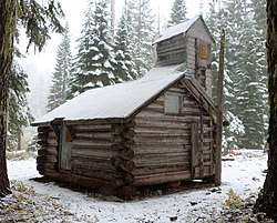
Whaleback Snow-Survey Cabin |
|
December 29, 2000
(#00000514) |
Approximately 10 miles (16 km) north of Prospect
42°54′40″N 122°34′51″W / 42.911229°N 122.580729°W / 42.911229; -122.580729 (Whaleback Snow-Survey Cabin) |
Prospect vicinity |
|
| 48 |
Judge William R. Willis House |
|
June 5, 1975
(#75001582) |
744 SE Rose St.
43°12′28″N 123°20′47″W / 43.207828°N 123.346379°W / 43.207828; -123.346379 (Judge William R. Willis House) |
Roseburg |
|
| 49 |
James Wimer Octagonal Barn |
|
December 2, 1985
(#85003039) |
1191 Coos Bay Wagon Rd.
43°10′42″N 123°30′24″W / 43.178413°N 123.506745°W / 43.178413; -123.506745 (James Wimer Octagonal Barn) |
Lookingglass |
|
| 50 |
Winchester Dam |
|
June 3, 1996
(#96000627) |
N. Umpqua River at Hwy. 99
43°17′03″N 123°21′14″W / 43.284243°N 123.353979°W / 43.284243; -123.353979 (Winchester Dam) |
Winchester |
|
| 51 |
William C. and Agnes Winston House |
|
September 10, 1987
(#87001540) |
350 Winston Section Rd.
43°07′53″N 123°23′49″W / 43.131359°N 123.396831°W / 43.131359; -123.396831 (William C. and Agnes Winston House) |
Winston |
|
.jpg)
_(douDA0045).jpg)
_-_cropped.jpg)
.jpg)

_(douDA0061).jpg)
_(douDA0027).jpg)
_(douDA0211).jpg)
_(douDA0216).jpg)
_(douDA0077a).jpg)
_(douDA0067a).jpg)