| [3] |
Name on the Register[4] |
Image |
Date listed[5] |
Location |
City or town |
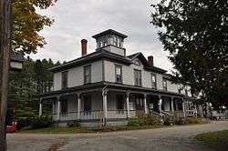
Description |
|---|
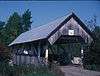
| 1 |
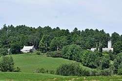
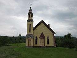
Barnet Center Historic District |
|
July 12, 1984
(#84003440) |
Barnet Center Rd. at Ferguson Rd.
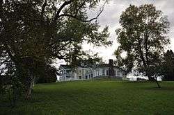
44°18′44″N 72°05′09″W / 44.312222°N 72.085833°W / 44.312222; -72.085833 (Barnet Center Historic District) |
Barnet |
|
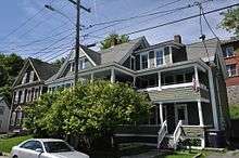
| 2 |
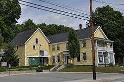
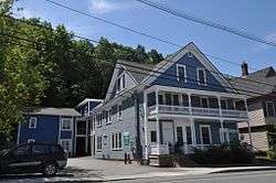
Benoit Apartment House-74 Pearl Street |
|
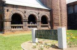
May 6, 1994
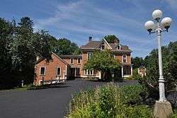
(#94000378) |
439 Pearl St.
44°25′11″N 72°01′02″W / 44.419722°N 72.017222°W / 44.419722; -72.017222 (Benoit Apartment House-74 Pearl Street) |
St. Johnsbury |
|
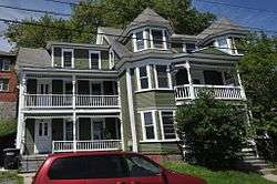
| 3 |
Benoit Apartment House-76 Pearl Street |
|
May 6, 1994
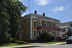
(#94000379) |
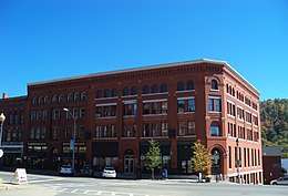
447 Pearl St.
44°25′09″N 72°01′02″W / 44.419167°N 72.017222°W / 44.419167; -72.017222 (Benoit Apartment House-76 Pearl Street) |
St. Johnsbury |
|
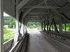
| 4 |
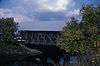
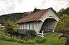
Bradley Covered Bridge |
|
June 13, 1977
(#77000096) |
North of Lyndon on Center St. over Miller Run
44°32′31″N 72°00′38″W / 44.541944°N 72.010556°W / 44.541944; -72.010556 (Bradley Covered Bridge) |
Lyndon |
|
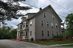
| 5 |
Building at 143 Highland Avenue |
|
April 6, 2000
(#00000358) |
143 Highland Ave.
44°30′22″N 72°22′07″W / 44.506111°N 72.368611°W / 44.506111; -72.368611 (Building at 143 Highland Avenue) |
Hardwick |
|
| 6 |
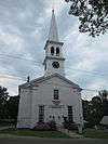
Burklyn Hall |
|
May 7, 1973
(#73000191) |
Bemis Hill Rd.
44°35′04″N 71°57′49″W / 44.584444°N 71.963611°W / 44.584444; -71.963611 (Burklyn Hall) |
East Burke |
|
| 7 |
Burrington Covered Bridge |
|
June 13, 1974
(#74000203) |
Northeast of Lyndon off VT 114 over the East Branch of the Passumpsic River
44°33′13″N 71°58′12″W / 44.553611°N 71.97°W / 44.553611; -71.97 (Burrington Covered Bridge) |
Lyndon |
|
| 8 |
Caledonia No. 9 Grange Hall |
|
December 26, 2017
(#100001937) |
88 Church St.
44°31′21″N 72°18′27″W / 44.522396°N 72.307407°W / 44.522396; -72.307407 (Caledonia No. 9 Grange Hall) |
East Hardwick |
|
| 9 |
Centre Covered Bridge |
|
June 20, 1974
(#74000204) |
Northeast of Lyndon off U.S. Route 5, over the Passumpsic River
44°32′36″N 72°00′06″W / 44.543333°N 72.001667°W / 44.543333; -72.001667 (Centre Covered Bridge) |
Lyndon |
|
| 10 |
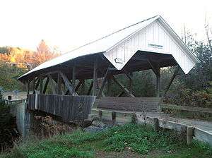
Chamberlin Mill Covered Bridge |
|
July 30, 1974
(#74000205) |
West of VT 114 over the South Wheelock Branch of Passumpsic River
44°30′59″N 72°01′00″W / 44.516389°N 72.016667°W / 44.516389; -72.016667 (Chamberlin Mill Covered Bridge) |
Lyndon |
|
| 11 |
Christian Union Society Meetinghouse |
|
May 23, 1980
(#80000385) |
Bayley-Hazen Military Rd.
44°28′43″N 72°17′30″W / 44.478611°N 72.291667°W / 44.478611; -72.291667 (Christian Union Society Meetinghouse) |
South Walden |
|
| 12 |
Cobb School |
|
September 30, 1993
(#93001007) |
Junction of Hardwick Town Highway 10 (Cobb School Rd.) and Sanborn Cemetery Rd.
44°33′23″N 72°20′32″W / 44.556389°N 72.342222°W / 44.556389; -72.342222 (Cobb School) |
Hardwick |
|
| 13 |
Cote Apartment House |
|
May 6, 1994
(#94000377) |
16 Elm St.
44°25′18″N 72°00′40″W / 44.421667°N 72.011111°W / 44.421667; -72.011111 (Cote Apartment House) |
St. Johnsbury |
|
| 14 |
Darling Estate Historic District |
|
August 23, 2011
(#10000911) |
Darling Hill Rd. in Burke and Lyndon; Pinkham Rd. in Burke[6]
44°35′24″N 71°57′37″W / 44.59°N 71.9603°W / 44.59; -71.9603 (Darling Estate Historic District) |
Burke and Lyndon |
|
| 15 |
Darling Inn |
|
November 24, 1980
(#80000386) |
Depot St.
44°32′03″N 72°00′16″W / 44.534167°N 72.004444°W / 44.534167; -72.004444 (Darling Inn) |
Lyndonville |
|
| 16 |
J. R. Darling Store |
|
May 12, 2004
(#04000442) |
1334 Scott Highway
44°12′44″N 72°11′41″W / 44.212222°N 72.194722°W / 44.212222; -72.194722 (J. R. Darling Store) |
Groton |
|
| 17 |
District 6 School House |
|
February 1, 2006
(#05001588) |
73 Cemetery Circle
44°32′20″N 72°00′46″W / 44.538980°N 72.012648°W / 44.538980; -72.012648 (District 6 School House) |
Lyndon |
|
| 18 |
Downtown Hardwick Village Historic District |
|
September 30, 1982
(#82001698) |
Main, Church, Maple, and Mill Sts.; also Brush St.
44°30′19″N 72°21′50″W / 44.505278°N 72.363889°W / 44.505278; -72.363889 (Downtown Hardwick Village Historic District) |
Hardwick |
Brush St. represents a boundary increase |
| 19 |
Elkins Tavern |
|
December 18, 1978
(#78000228) |
Bayley-Hazen Rd.
44°19′22″N 72°09′58″W / 44.322680°N 72.165998°W / 44.322680; -72.165998 (Elkins Tavern) |
Peacham |
|
| 20 |
Fairbanks Museum |
|
January 2, 2008
(#07001344) |
1302 Main St.
44°25′12″N 72°01′13″W / 44.42°N 72.020278°W / 44.42; -72.020278 (Fairbanks Museum) |
St. Johnsbury |
|
| 21 |
Franklin Fairbanks House |
|
September 27, 1980
(#80000329) |
357 Western Ave.
44°25′02″N 72°01′39″W / 44.417222°N 72.0275°W / 44.417222; -72.0275 (Franklin Fairbanks House) |
St. Johnsbury |
|
| 22 |
William and Agnes Gilkerson Farm |
|
October 29, 1992
(#92001504) |
Town Highway 5 (Kitchel Hill Rd.) west of its junction with U.S. Route 5
44°21′44″N 72°03′41″W / 44.362222°N 72.061389°W / 44.362222; -72.061389 (William and Agnes Gilkerson Farm) |
Barnet |
Also known as Kitchel Hill Farm. |
| 23 |
Alice Lord Goodine House |
|
May 12, 2004
(#04000441) |
1304 Scott Highway
44°12′37″N 72°11′40″W / 44.210278°N 72.194444°W / 44.210278; -72.194444 (Alice Lord Goodine House) |
Groton |
Houses the local library. |
| 24 |
Greenbanks Hollow Covered Bridge |
|
June 13, 1974
(#74000206) |
South of Danville, Greenbanks Hollow Rd. over Joes Brook
44°22′38″N 72°07′20″W / 44.377222°N 72.122222°W / 44.377222; -72.122222 (Greenbanks Hollow Covered Bridge) |
Danville |
|
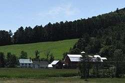
| 25 |
Grouselands |
|
December 22, 1983
(#83004224) |
Town Highway 26
44°29′38″N 72°07′14″W / 44.493889°N 72.120556°W / 44.493889; -72.120556 (Grouselands) |
Danville |
|
| 26 |
Hardwick Street Historic District |
|
June 22, 1979
(#79000321) |
Northeast of Hardwick
44°33′00″N 72°17′58″W / 44.55°N 72.299444°W / 44.55; -72.299444 (Hardwick Street Historic District) |
Hardwick |
|
| 27 |
Lee Farm |
|
May 26, 1983
(#83003205) |
VT 18
44°25′20″N 71°57′03″W / 44.422222°N 71.950833°W / 44.422222; -71.950833 (Lee Farm) |
Waterford |
|
| 28 |
Lind Houses |
|
September 27, 1988
(#88001589) |
Pleasant St.
44°11′07″N 72°08′19″W / 44.185278°N 72.138611°W / 44.185278; -72.138611 (Lind Houses) |
South Ryegate |
|
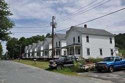
| 29 |
Maple Street-Clarks Avenue Historic District |
|
May 5, 1994
(#94000381) |
17-49 Maple St., 4-34 Clarks Ave., 95½-101 Main St., 4 and 6 Frost Ave., and 3 and 5 Idlewood Terr.
44°25′18″N 72°01′04″W / 44.421667°N 72.017778°W / 44.421667; -72.017778 (Maple Street-Clarks Avenue Historic District) |
St. Johnsbury |
|
| 30 |
Caleb H. Marshall House |
|
August 16, 1994
(#94000868) |
426 Summer St.
44°25′17″N 72°01′18″W / 44.421389°N 72.021667°W / 44.421389; -72.021667 (Caleb H. Marshall House) |
St. Johnsbury |
|
| 31 |
Mathewson Block |
|
May 20, 1999
(#99000623) |
Junction of Main St. and Maple St.
44°32′07″N 72°00′21″W / 44.535278°N 72.005833°W / 44.535278; -72.005833 (Mathewson Block) |
Lyndon |
|
| 32 |
McIndoes Academy |
|
May 6, 1975
(#75000137) |
Main St.
44°15′51″N 72°03′52″W / 44.264167°N 72.064444°W / 44.264167; -72.064444 (McIndoes Academy) |
McIndoe Falls |
|
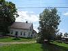
| 33 |
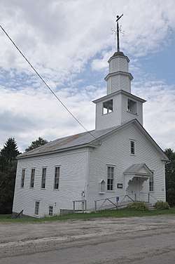
Methodist-Episcopal Church |
|
January 5, 1978
(#78000229) |
Off VT 16
44°32′33″N 72°12′48″W / 44.5425°N 72.213333°W / 44.5425; -72.213333 (Methodist-Episcopal Church) |
Stannard |
|
| 34 |
Morency Paint Shop and Apartment Building |
|
May 5, 1994
(#94000380) |
73-77 Portland St.
44°25′13″N 72°00′30″W / 44.420278°N 72.008333°W / 44.420278; -72.008333 (Morency Paint Shop and Apartment Building) |
St. Johnsbury |
|
| 35 |
New Discovery State Park |
|
January 17, 2002
(#01001475) |
4239 VT 232
44°18′36″N 72°15′08″W / 44.31°N 72.252222°W / 44.31; -72.252222 (New Discovery State Park) |
Peacham |
|
| 36 |
Old Schoolhouse Bridge |
|
March 31, 1971
(#71000055) |
S. Wheelock Rd. over Cold Hill Brook
44°30′57″N 72°00′38″W / 44.515833°N 72.010556°W / 44.515833; -72.010556 (Old Schoolhouse Bridge) |
Lyndon |
|
| 37 |
Peacham Corner Historic District |
|
December 18, 2003
(#03001308) |
Bayley Hazen Rd., Main St., Church St., Academy Hill, Old Cemetery Rd., Macks Mountain Rd.
44°19′39″N 72°10′21″W / 44.3275°N 72.1725°W / 44.3275; -72.1725 (Peacham Corner Historic District) |
Peacham |
|
| 38 |
Railroad Street Historic District |
|
June 25, 1974
(#74000354) |
Roughly bounded north and south by Railroad St. and the Canadian Pacific railroad tracks
44°25′01″N 72°01′00″W / 44.416944°N 72.016667°W / 44.416944; -72.016667 (Railroad Street Historic District) |
St. Johnsbury |
|
| 39 |
Ricker Pond State Park |
|
March 29, 2002
(#02000277) |
526 State Forest Rd.
44°14′41″N 72°14′54″W / 44.244722°N 72.248333°W / 44.244722; -72.248333 (Ricker Pond State Park) |
Groton |
|
| 40 |
Riverside |
|
June 17, 1993
(#93000532) |
Lily Pond Rd. south of Lyndonville
44°30′47″N 71°59′40″W / 44.513056°N 71.994444°W / 44.513056; -71.994444 (Riverside) |
Lyndonville |
|
| 41 |
Shearer and Corser Double House |
|
August 16, 1994
(#94000861) |
592 Summer St.
44°25′26″N 72°01′12″W / 44.423899°N 72.019985°W / 44.423899; -72.019985 (Shearer and Corser Double House) |
St. Johnsbury |
|
| 42 |
Josiah and Lydia Shedd Farmstead |
|
March 17, 2005
(#05000188) |
1721 Bayley-Hazen Rd.
44°20′37″N 72°10′36″W / 44.343748°N 72.176543°W / 44.343748; -72.176543 (Josiah and Lydia Shedd Farmstead) |
Peacham |
|
| 43 |
St. Johnsbury Athenaeum |
|
June 18, 1996
(#96000970) |
30 Main St.
44°25′04″N 72°01′19″W / 44.417778°N 72.021944°W / 44.417778; -72.021944 (St. Johnsbury Athenaeum) |
St. Johnsbury |
Significant due to its construction, its American paintings and books from its original role as a public library and free art gallery, and its funding by Horace Fairbanks, manufacturer of the world’s first platform scale. |
| 44 |
St. Johnsbury Federal Fish Culture Station |
|
March 18, 2005
(#05000189) |
374 Emerson Falls Rd.
44°25′59″N 72°02′15″W / 44.433100°N 72.037584°W / 44.433100; -72.037584 (St. Johnsbury Federal Fish Culture Station) |
St. Johnsbury |
Now houses offices. |
| 45 |
St. Johnsbury Historic District |
|
April 17, 1980
(#80000424) |
U.S. Routes 2 and 5
44°25′06″N 72°01′02″W / 44.418333°N 72.017222°W / 44.418333; -72.017222 (St. Johnsbury Historic District) |
St. Johnsbury |
|
| 46 |
St. Johnsbury Main Street Historic District |
|
May 28, 1975
(#75000238) |
Area along Main St. including intersecting streets
44°25′06″N 72°01′14″W / 44.418333°N 72.020556°W / 44.418333; -72.020556 (St. Johnsbury Main Street Historic District) |
St. Johnsbury |
|
| 47 |
Stannard Schoolhouse |
|
December 12, 1977
(#77000097) |
Off VT 16
44°32′34″N 72°12′52″W / 44.542778°N 72.214444°W / 44.542778; -72.214444 (Stannard Schoolhouse) |
Stannard |
Now the town hall. |
| 48 |
Stillwater State Park |
|
March 29, 2002
(#02000278) |
126 Boulder Beach Rd.
44°16′46″N 72°16′23″W / 44.279444°N 72.273056°W / 44.279444; -72.273056 (Stillwater State Park) |
Groton |
|
| 49 |
Thresher Mill |
|
April 4, 1996
(#96000386) |
W. Barnet Rd., approximately 1.5 mi (2.4 km) west of Barnet
44°18′37″N 72°05′51″W / 44.310278°N 72.0975°W / 44.310278; -72.0975 (Thresher Mill) |
Barnet |
|
| 50 |
Phineas Thurston House |
|
October 30, 1989
(#89001788) |
Barnet Town Highway 12
44°21′56″N 72°01′29″W / 44.365556°N 72.024722°W / 44.365556; -72.024722 (Phineas Thurston House) |
Barnet |
|
| 51 |
Toll House |
|
August 9, 2006
(#06000704) |
2028 Mountain Rd.
44°35′38″N 71°54′12″W / 44.593889°N 71.903333°W / 44.593889; -71.903333 (Toll House) |
Burke |
|
| 52 |
Union Meeting House |
|
January 4, 2008
(#07001345) |
2614 Burke Hollow Rd.
44°37′20″N 71°56′55″W / 44.622222°N 71.948611°W / 44.622222; -71.948611 (Union Meeting House) |
Burke |
|
| 53 |
West View Farm |
|
January 6, 1995
(#94001522) |
Along Waterford Highway 34
44°24′08″N 71°59′33″W / 44.402222°N 71.9925°W / 44.402222; -71.9925 (West View Farm) |
Waterford |
|
| 54 |
Wheelock Common Historic District |
|
August 30, 2007
(#07000894) |
VT 122 and Town Highway 17
44°35′16″N 72°04′59″W / 44.5877°N 72.0830°W / 44.5877; -72.0830 (Wheelock Common Historic District) |
Wheelock |
|
| 55 |
Whitehill House |
|
May 30, 1975
(#75000138) |
North of Ryegate on Groton-Peacham Rd.
44°15′55″N 72°10′27″W / 44.265278°N 72.174167°W / 44.265278; -72.174167 (Whitehill House) |
Ryegate |
|
| 56 |
Whittier House |
|
August 23, 1984
(#84003456) |
Greenbanks Hollow Rd.
44°22′43″N 72°07′22″W / 44.378611°N 72.122778°W / 44.378611; -72.122778 (Whittier House) |
Danville |
|
.jpg)