East Hardwick, Vermont
| East Hardwick, Vermont | |
|---|---|
| Village | |
 East Hardwick | |
| Coordinates: 44°31′18″N 72°18′31″W / 44.52167°N 72.30861°WCoordinates: 44°31′18″N 72°18′31″W / 44.52167°N 72.30861°W | |
| Country | United States |
| State | Vermont |
| County | Caledonia |
| Elevation | 1,083 ft (330 m) |
| Time zone | UTC-5 (Eastern (EST)) |
| • Summer (DST) | UTC-4 (EDT) |
| ZIP code | 05836 |
| Area code(s) | 802 Exchange: 472 |
| GNIS feature ID | 1457279[1] |
East Hardwick is an unincorporated village in the town of Hardwick, Caledonia County, Vermont, United States. It is part of what is known as the Northeast Kingdom of Vermont. The community is located on the Lamoille River and along Vermont Route 16, 16 miles (26 km) west-northwest of St. Johnsbury. East Hardwick has a post office with ZIP code 05836, which opened on October 10, 1810.[2][3] According to a 1937 WPA Federal Writers Project Guidebook, East Hardwick is a "side hill village spilling from the level of a plateau down a sharp incline in the valley of the Lamoille". It is surrounded by rich farm lands, Maple groves and forests.
HISTORY:
The building of the Bayley-Hazen Military Road facilitated growth of this area of Vermont. General Bayley began this road in 1776 for the purposes of conveying troops and provisions into Canada. The project was abandoned but begun again in 1779.
In 1989 the Vermont Division for Historic Preservation completed a Historic Sites and Structures Survey of the village, designating an East Hardwick Historic District. Much of the following information is derived from the Statement of Significance and other portions of that document.
In 1797 Samuel Stevens came to the area. He was the first settler of East Hardwick, then called Stevensville or Stevens Mills. By 1800 Stevens had erected a sawmill and a grist mill. He was known as an intelligent and enterprising man who practiced temperance and exerted a moral influence on the village. By 1885 Stevensville was a thriving community, boasting two general stores, two churches, a carriage factory, a saw mill, a grist mill and several dwellings.
ARCHITECTURE:
The first period of East Hardwick's growth dates from approx. 1800 - 1850. During this time two Federal style houses and many Greek Revival residences and commercial structures were built along Main Street.
The second period of growth dates from 1870 to 1900. During this period building continued in the Greek Revival style, one structure with Gothic Revival influence and many with embellishments in the Italianate style. Several Colonial Revival buildings were erected at the turn of the century. By the 1880's most of the present structures in the village had been built. East Hardwick is fortunate to have retained a wealth of 18th century structures. Generally, these structures are well preserved. Some are at-risk but still retain many of their original features.
PRESENT DAY:
Today the brick house built by Samuel Stevens is a perennial garden center with an English tea garden where the owners serve lunch and afternoon tea on the lawn adjacent to the house and overlooking the river. An unimproved rail trail follows the river below the brick house and provides a path for those who want to walk or snow shoe along the river.
The village is mostly a bedroom community and boasts a nursery school, an art gallery, a chiropractic office in the old school house, a mini-mart and an auto repair facility, as well as a few businesses along the highway. There is a small but active Congregational Church and a Grange Hall. Caledonia Grange #9 on Church Street is the oldest continuously operating Grange in New England. It is listed in the State Historic Registry and the National Historic Registry. The building also hosts summer concerts, meetings and educational workshops. Additionally, the community supports a charming springtime children's parade and a fall harvest dinner at the Church.
At the corner of Main and School Streets there is a Women's Christian Temperance Union water tub. It is planted with flowers each spring by the women of the community, who retreat to a nearby porch for gin and tonic after this activity.
There is an active group of "villagers" who are working to preserve structures and improve community life in the village.
In 2018 the village was selected as a Designated Village Center by the Vermont Agency of Commerce and Community Development. This community revitalization program helps maintain or evolve small to medium-sized historic centers with existing civic and commercial buildings. The designation supports the historic center and targets training and financial incentives to bring additional public and private investment to spark village revitalization.
GOVERNMENT:
East Hardwick Village is part of the incorporated Town of Hardwick. The town is managed by a town manager and five member select board. The town holds an annual town meeting in March. The town has one elementary school (K-6). Grades 7-12 attend the Hazen Union School (Greensboro, Hardwick, Woodbury) which is located in Hardwick. Additional programs available within the district include Green Mountain Training Center, the Central Vermont Career Center, Dual Enrollment, Early College and Pathways/Independent Study. The enrollment levels over the last ten years span from 314 students to 376 students.
Sanborn Cemetery is on Montgomery Hill in East Hardwick. It is owned by the town of Hardwick but managed by a local board of trustees. East Hardwick does not have a sewage treatment plant; residences and businesses have private septic systems. The village of East Hardwick has its own water system, fed by springs and wells and gravity fed into the village. The Hardwick police department and volunteer ambulance service and the Hardwick and Greensboro Fire Districts service the village.
References
- ↑ "East Hardwick". Geographic Names Information System. United States Geological Survey.
- ↑ United States Postal Service. "USPS - Look Up a ZIP Code". Retrieved May 22, 2017.
- ↑ "Postmaster Finder - Post Offices by ZIP Code". United States Postal Service. Retrieved May 22, 2017.
Municipalities and communities of Caledonia County, Vermont, United States | ||
|---|---|---|
| Towns | 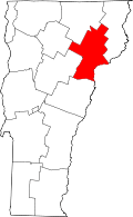 | |
| Incorporated villages | ||
| Non-village CDPs | ||
| Unincorporated communities | ||