Narsapur, Medak district
| Narsapur నరసాపుర్ نارسپر | |
|---|---|
| Census Town | |
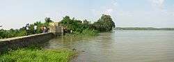 Narsapur Lake | |
 Narsapur Location in Telangana, India  Narsapur Narsapur (India) | |
| Coordinates: 17°44′19″N 78°16′58″E / 17.73861°N 78.28278°ECoordinates: 17°44′19″N 78°16′58″E / 17.73861°N 78.28278°E | |
| Country |
|
| State | Telangana |
| District | Medak |
| Area[1] | |
| • Total | 7.20 km2 (2.78 sq mi) |
| Elevation | 560 m (1,840 ft) |
| Population (2011)[1] | |
| • Total | 6,647 |
| • Density | 920/km2 (2,400/sq mi) |
| Languages | |
| • Official | Telugu |
| Time zone | UTC+5:30 (IST) |
| PIN | 502313 |
| Telephone code | 08458 |
| Vehicle registration | TS 15 |
| Lok Sabha constituency | Medak |
| Website |
medak |
Narsapur is a census town in Medak district of the Indian state of Telangana. It is located in Narsapur mandal.[1][2]
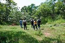
Narsapur Trekking Picture
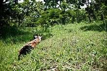
Forest
Demographics
Telugu is the Local Language here. Total population of Narsapur is 14735 .Males are 7691 and Females are 7,044 living in 2733 Houses. Total area of Narsapur is 2264 hectares.
Colleges
1
Padmasri Dr. B. V. Raju Institute of Technology
2
Ellenki Degree College
3
References
- 1 2 3 "District Census Handbook – Karimnagar" (PDF). Census of India. pp. 12, 44. Retrieved 11 June 2016.
- ↑ "District Level Mandal wise list of villages in Medak district" (PDF). Chief Commissioner of Land Administration. National Informatics Centre. Archived from the original (PDF) on 2 April 2015. Retrieved 5 March 2016.
| Wikimedia Commons has media related to Narsapur. |
Template:Sangareddy district
This article is issued from
Wikipedia.
The text is licensed under Creative Commons - Attribution - Sharealike.
Additional terms may apply for the media files.