Naracoorte, South Australia
| Naracoorte South Australia | |||||||||||||||
|---|---|---|---|---|---|---|---|---|---|---|---|---|---|---|---|
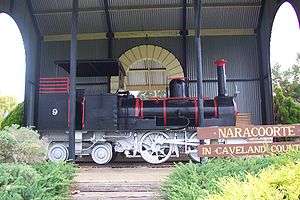 A South Australian Railways V class locomotive in a park in Naracoorte | |||||||||||||||
 Naracoorte | |||||||||||||||
| Coordinates | 36°57′18″S 140°44′34″E / 36.955°S 140.74285°ECoordinates: 36°57′18″S 140°44′34″E / 36.955°S 140.74285°E[1] | ||||||||||||||
| Population | 5,960 (2016 census)[2] | ||||||||||||||
| Established | 1845 | ||||||||||||||
| Postcode(s) | 5271[3] | ||||||||||||||
| Time zone | ACST (UTC+9:30) | ||||||||||||||
| • Summer (DST) | ACST (UTC+10:30) | ||||||||||||||
| Location |
| ||||||||||||||
| LGA(s) | Naracoorte Lucindale Council | ||||||||||||||
| Region | Limestone Coast[1] | ||||||||||||||
| County | MacDonnell[1] | ||||||||||||||
| State electorate(s) | MacKillop | ||||||||||||||
| Federal Division(s) | Barker | ||||||||||||||
| |||||||||||||||
| |||||||||||||||
| Footnotes |
Locations[3] Adjoining localities[1] | ||||||||||||||
Naracoorte is a town in the Limestone Coast region of South Australia, approximately 336 kilometres south-east of Adelaide and 100 kilometres north of Mount Gambier on the Riddoch Highway (A66).
History
Naracoorte was formed from the merger of two towns, Kincraig, founded in 1845 by Scottish explorer William Macintosh, and Narracoorte, established as a government settlement in 1847. The name has gone through a number of spellings, and is believed to be derived from the Aboriginal words for place of running water or large waterhole. It grew during the 1850s as a service town for people going to and from the Victorian gold rush. The Post Office opened on 22 March 1853 and was known as Mosquito Plains until 1861.[5] The Kingston-Naracoorte railway line was closed on 28 November 1987 then dismantled 15 September 1991 then the Mount Gambier to Wolseley line closed 12 April 1995 whilst still pending for gauge standardization.
Media
The town is home to The Naracoorte Herald, a newspaper published in the town (under that name) since 1948. Prior to that, the newspaper had used the older spelling of the town, and was known as The Narracoorte Herald, which had begun publication on 14 December 1875. It is now part of Fairfax Media, with the Fairfax regional office located in the town on Smith Street.
In 1912, a nearby publication, the Tatiara and Lawloit News (13 June 1908 – 15 June 1912), which also printed in Naracoorte, was absorbed into the Herald.
Today
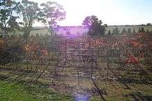
The town has historically relied largely on sheep, cattle and wheat farming. In recent decades, tourism has become a major industry with the promotion of the World Heritage-listed Naracoorte Caves National Park and the internationally recognised wetland, Bool and Hacks Lagoons. It also receives a substantial number of visitors due to its proximity to the Coonawarra, Wrattonbully, and Padthaway wine regions.
Naracoorte is in the Naracoorte Lucindale Council, the state electoral district of MacKillop and the federal Division of Barker. The postcode is 5271.
There are three schools: Naracoorte High on Stewart Terrace,[6] Naracoorte Primary on Park Terrace[7] and Naracoorte South Primary.[8] Independent schools include Naracoorte Christian School (also called Sunrise Christian School) formerly on Rolland Street, now located on Caves Road.[9]
The town has an Australian Rules football team competing in the Kowree-Naracoorte-Tatiara Football League.[10] and also supplies players for a number of surrounding teams such as Kybybolite, Padthaway and Border Districts.
Naracoorte also has a soccer club competing in the Limestone Coast Football Association.[11]
Places of interest
- The Visitor Information Centre & Sheep's Back Museum - MacDonnell Street
- Lions Pioneer Park - MacDonnell Street
- Tiny Train Park & Mini Golf - Park Terrace
- Naracoorte Art Gallery - Ormerod Street
- Mini Jumbuk Centre - 61 Smith Street
- Swimming Lake - Moore Street
- Jubilee Nature Park - Moore Street
- Russet Ridge Winery - Cnr Caves Road and Riddoch Highway
- Struan House - Riddoch Highway
- Naracoorte Caves National Park - Caves Road[12]
Heritage listings
Naracoorte has a number of heritage-listed sites, including:
- 6 Church Street: St Andrew's Presbyterian Church [13]
- DeGaris Place: Commercial Bank of South Australia Building (current council office) [14]
- 2 Laurie Crescent: St Paul's Anglican Church [15]
- MacDonnell Street: Simpson's Flour Mill (current Sheep's Back Museum) [16]
- 23-25 McDonnell Street: Limbert's Store and Residence [17]
- 30 McLeay Street: Dartmoor Homestead [18]
- 13 Ormerod Street: Old Naracoorte District Council Chambers [19]
- 81 Smith Street: National Bank Building [20]
Services
- Naracoorte Hospital (Jenkins Terrace; emergency department on Cedar Avenue)
- Police (66 Smith Street)
- Banks - ANZ Bank, Bank SA, Commonwealth Bank, National Bank, People's Choice Credit Union
- RAA - Kincraig Motors (164 Smith Street) or Vans Automotive Service (88 Stewart Terrace)
- Service stations - MoGas (117 Gordon Street), Mobil (46 Gordon Street & 9 Stewart Terrace), Caltex (12 McRae Street) Shell (62 Stewart Terrace) and On The Run (1 Deviation Road)
- Supermarkets - Woolworths/Kincraig Plaza (Robertson Street) & Foodland (63 Ormerod Street)
- Transport - Bus station (170 Smith Street)
Climate
| Climate data for Naracoorte Aerodrome, Naracoorte | |||||||||||||
|---|---|---|---|---|---|---|---|---|---|---|---|---|---|
| Month | Jan | Feb | Mar | Apr | May | Jun | Jul | Aug | Sep | Oct | Nov | Dec | Year |
| Record high °C (°F) | 45.7 (114.3) |
45.3 (113.5) |
42.0 (107.6) |
36.0 (96.8) |
29.0 (84.2) |
23.0 (73.4) |
19.0 (66.2) |
26.5 (79.7) |
29.0 (84.2) |
37.0 (98.6) |
39.1 (102.4) |
45.0 (113) |
45.7 (114.3) |
| Average high °C (°F) | 29.6 (85.3) |
29.3 (84.7) |
26.1 (79) |
22.1 (71.8) |
17.8 (64) |
15.0 (59) |
14.1 (57.4) |
15.4 (59.7) |
17.5 (63.5) |
20.4 (68.7) |
24.8 (76.6) |
27.1 (80.8) |
21.6 (70.9) |
| Average low °C (°F) | 11.5 (52.7) |
11.8 (53.2) |
10.0 (50) |
8.0 (46.4) |
7.0 (44.6) |
5.4 (41.7) |
5.1 (41.2) |
5.4 (41.7) |
6.5 (43.7) |
6.6 (43.9) |
8.6 (47.5) |
10.0 (50) |
8.0 (46.4) |
| Record low °C (°F) | 1.0 (33.8) |
1.9 (35.4) |
−0.7 (30.7) |
−2.8 (27) |
−4.0 (24.8) |
−4.1 (24.6) |
−3.4 (25.9) |
−4.2 (24.4) |
−3.0 (26.6) |
−2.8 (27) |
−1.9 (28.6) |
0.7 (33.3) |
−4.2 (24.4) |
| Average rainfall mm (inches) | 22.4 (0.882) |
20.3 (0.799) |
25.8 (1.016) |
24.7 (0.972) |
36.8 (1.449) |
57.1 (2.248) |
55.6 (2.189) |
72.7 (2.862) |
55.0 (2.165) |
37.7 (1.484) |
35.3 (1.39) |
40.4 (1.591) |
483.8 (19.047) |
| Source: Bureau of Meteorology[4] | |||||||||||||
Notable residents
- Aaron Fiora
- Alex Forster
- Alexander McLachlan
- Alan Rawlinson
- Allan Rodda
- Alice Monfries
- Elizee De Garis
- Emily Beaton
- George Ash
- George Byng Scott
- Greg Rowe
- Indira Naidoo
- Lachie Neale
- Jack Trengove
- James Gardiner
- Jessica Trengove
- John Baxter Mather
- Mountifort Conner
- Sam Burston
- Thomas Wilde Boothby
- Park Laurie
- Paul Rofe
- Percy Hutton
- Russell Dumas
- William Shiels
References
- 1 2 3 4 "Search results for Naracoorte, LOCB' with the following datasets selected – 'Suburbs and Localities', 'Government towns', 'Counties', 'Local Government Area', 'SA Government Regions' and 'Gazetteer'". Location SA Map Viewer. South Australian Government. Retrieved 30 June 2018.
- ↑ Australian Bureau of Statistics (27 June 2017). "Naracoorte (State Suburb)". 2016 Census QuickStats. Retrieved 28 January 2018.

- 1 2 "Postcode for Naracoorte, South Australai". Postcodes Australia. postcodes-australia.com. Retrieved 1 July 2018.
- 1 2 3 4 "Naracoorte Aerodrome". Climate statistics for Australian locations. Bureau of Meteorology. April 2014. Retrieved 3 April 2014.
- ↑ Premier Postal History, Post Office List, retrieved 2008-04-11
- ↑ Naracoorte High
- ↑ Naracoorte Primary
- ↑ Naracoorte South Primary
- ↑ Sunrise Christian School, Naracoorte
- ↑ Full Points Footy, Kowree-Naracoorte-Tatiara, retrieved 2008-07-25
- ↑
- ↑ "Naracoorte Caves". ParksWeb: Wonambi Fossil Centre. Government of South Australia. 2006-09-05. Archived from the original on 2007-09-01. Retrieved 2008-02-22.
- ↑ "St Andrew's Presbyterian Church". South Australian Heritage Register. Department of Environment, Water and Natural Resources. Retrieved 2 July 2016.
- ↑ "Naracoorte Council Office (former Commercial Bank of SA Naracoorte Branch) and front fence". South Australian Heritage Register. Department of Environment, Water and Natural Resources. Retrieved 2 July 2016.
- ↑ "St Paul's Anglican Church". South Australian Heritage Register. Department of Environment, Water and Natural Resources. Retrieved 2 July 2016.
- ↑ "The Sheep's Back Museum (former Simpson's Flour Mill)". South Australian Heritage Register. Department of Environment, Water and Natural Resources. Retrieved 2 July 2016.
- ↑ "Former Limbert's Store and Residence". South Australian Heritage Register. Department of Environment, Water and Natural Resources. Retrieved 2 July 2016.
- ↑ "Naracoorte (previously Dartmoor) Homestead Complex, including the homestead, two-storey building, cottage and old cottage". South Australian Heritage Register. Department of Environment, Water and Natural Resources. Retrieved 2 July 2016.
- ↑ "Shop (former Naracoorte District Council Chambers)". South Australian Heritage Register. Department of Environment, Water and Natural Resources. Retrieved 2 July 2016.
- ↑ "National Bank Naracoorte Branch". South Australian Heritage Register. Department of Environment, Water and Natural Resources. Retrieved 2 July 2016.
External links
- FairfaxDigital Travel - Naracoorte
- Naracoorte Lucindale Council Accessed 5 March 2011.