Kongorong, South Australia
| Kongorong South Australia | |||||||||||||||
|---|---|---|---|---|---|---|---|---|---|---|---|---|---|---|---|
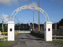 Kongorong memorial gates | |||||||||||||||
 Kongorong | |||||||||||||||
| Coordinates | 37°54′00″S 140°33′18″E / 37.8999°S 140.5549°ECoordinates: 37°54′00″S 140°33′18″E / 37.8999°S 140.5549°E[1] | ||||||||||||||
| Population | 193 (2016 census)[2] | ||||||||||||||
| Established |
30 March 1922 (town) 31 October 1996 (locality)[1][3][4] | ||||||||||||||
| Postcode(s) | 5291 | ||||||||||||||
| LGA(s) | District Council of Grant[5] | ||||||||||||||
| Region | Limestone Coast[6] | ||||||||||||||
| County | Grey[5] | ||||||||||||||
| State electorate(s) | Mount Gambier [7] | ||||||||||||||
| Federal Division(s) | Barker[8] | ||||||||||||||
| |||||||||||||||
| |||||||||||||||
| Footnotes | Adjoining localities[5] | ||||||||||||||
Kongorong is a locality in the Australian state of South Australia located southwest of Mount Gambier.[5] It has an Australian Rules Football Team and netball team. Kongorong Primary School had 61 students in 2010.[10]
The 2016 Australian census which was conducted in August 2016 reports that Kongorong had a population of 193 people.[2]
Industry
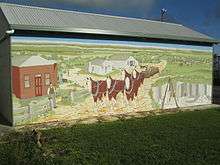
Kongorong mural
Kongorong is a service town for the surrounding community involved in dairy and sheep farming, timber plantations, and grape growing in the Mount Gambier wine region.
Governance
Kongorong is located within the federal division of Barker, the state electoral district of Mount Gambier and the local government area of the District Council of Grant.[8][7][5]
References
- 1 2 "Search results for 'Kongorong, LOCB' with the following datasets being selected - 'Suburbs and Localities', 'Counties', 'Government towns', 'Local Government Areas', 'SA Government Regions' and 'Gazetteer'". Location SA Map Viewer. Government of South Australia. Retrieved 18 April 2018.
- 1 2 Australian Bureau of Statistics (27 June 2017). "Kongorong". 2016 Census QuickStats. Retrieved 18 April 2018.

- ↑ Bice, John G. (30 March 1922). "TOWN OF KONGORONG" (PDF). The South Australian Government Gazette. South Australian Government. p. 943. Retrieved 18 April 2018.
- ↑ "GEOGRAPHICAL NAMES ACT 1991, Notice to Assign Boundaries and Names to Places" (PDF), The South Australian Government Gazette: 1517, 31 October 1996, retrieved 17 April 2018
- 1 2 3 4 5 "Search result for "Kongorong (Locality Bounded)" (Record no SA0015112) with the following layers selected - "Suburbs and Localities", "Place names (gazetteer)" and "Development Plan Layers"". Property Location Browser. Government of South Australia. Retrieved 21 August 2016.
- ↑ "Limestone Coast SA Government region" (PDF). The Government of South Australia. Retrieved 10 October 2014.
- 1 2 "District of Mount Gambier Background Profile". Electoral Commission SA. Retrieved 28 March 2016.
- 1 2 "Federal electoral division of Barker" (PDF). Australian Electoral Commission. Retrieved 28 March 2016.
- 1 2 3 "Monthly climate statistics: Summary statistics Mount Gambier Aero (nearest weather station)". Commonwealth of Australia , Bureau of Meteorology. Retrieved 21 August 2016.
- ↑ "Kongorong Primary & CPC". Department for Education and Child Development. 19 October 2010. Retrieved 29 July 2015.
This article is issued from
Wikipedia.
The text is licensed under Creative Commons - Attribution - Sharealike.
Additional terms may apply for the media files.