Mount Gambier railway line
| Mount Gambier railway line | ||||||||||||||||||||||||||||||||||||||||||||||||||||||||||||||||||||||||||||||||||||||||||||||||||||||||||||||||||||||||||||||||||||||||||||||||||||||||||||||||||||||||||||||||||||||||||||||||||||||||||||||||||||||||||||||||||||||||||||||||||||||||||||||||||||||||||||||||||||||||||||||||||||||||||||||||||||||||||||||||||||||||||||||||||||||||||||||||||||||||||||||||||||||||||||||||||||||||||||||||||||||||||||||||||||||||||||||||||||||||||||||||
|---|---|---|---|---|---|---|---|---|---|---|---|---|---|---|---|---|---|---|---|---|---|---|---|---|---|---|---|---|---|---|---|---|---|---|---|---|---|---|---|---|---|---|---|---|---|---|---|---|---|---|---|---|---|---|---|---|---|---|---|---|---|---|---|---|---|---|---|---|---|---|---|---|---|---|---|---|---|---|---|---|---|---|---|---|---|---|---|---|---|---|---|---|---|---|---|---|---|---|---|---|---|---|---|---|---|---|---|---|---|---|---|---|---|---|---|---|---|---|---|---|---|---|---|---|---|---|---|---|---|---|---|---|---|---|---|---|---|---|---|---|---|---|---|---|---|---|---|---|---|---|---|---|---|---|---|---|---|---|---|---|---|---|---|---|---|---|---|---|---|---|---|---|---|---|---|---|---|---|---|---|---|---|---|---|---|---|---|---|---|---|---|---|---|---|---|---|---|---|---|---|---|---|---|---|---|---|---|---|---|---|---|---|---|---|---|---|---|---|---|---|---|---|---|---|---|---|---|---|---|---|---|---|---|---|---|---|---|---|---|---|---|---|---|---|---|---|---|---|---|---|---|---|---|---|---|---|---|---|---|---|---|---|---|---|---|---|---|---|---|---|---|---|---|---|---|---|---|---|---|---|---|---|---|---|---|---|---|---|---|---|---|---|---|---|---|---|---|---|---|---|---|---|---|---|---|---|---|---|---|---|---|---|---|---|---|---|---|---|---|---|---|---|---|---|---|---|---|---|---|---|---|---|---|---|---|---|---|---|---|---|---|---|---|---|---|---|---|---|---|---|---|---|---|---|---|---|---|---|---|---|---|---|---|---|---|---|---|---|---|---|---|---|---|---|---|---|---|---|---|---|---|---|---|---|---|---|---|---|---|---|---|---|---|---|---|---|---|---|---|---|---|---|---|---|---|---|---|---|---|---|---|---|---|---|---|---|---|---|---|---|---|---|---|---|---|---|---|---|---|---|---|---|---|---|---|---|---|---|---|---|---|---|---|---|---|---|---|---|
| Overview | ||||||||||||||||||||||||||||||||||||||||||||||||||||||||||||||||||||||||||||||||||||||||||||||||||||||||||||||||||||||||||||||||||||||||||||||||||||||||||||||||||||||||||||||||||||||||||||||||||||||||||||||||||||||||||||||||||||||||||||||||||||||||||||||||||||||||||||||||||||||||||||||||||||||||||||||||||||||||||||||||||||||||||||||||||||||||||||||||||||||||||||||||||||||||||||||||||||||||||||||||||||||||||||||||||||||||||||||||||||||||||||||||
| System | South Australian Railways | |||||||||||||||||||||||||||||||||||||||||||||||||||||||||||||||||||||||||||||||||||||||||||||||||||||||||||||||||||||||||||||||||||||||||||||||||||||||||||||||||||||||||||||||||||||||||||||||||||||||||||||||||||||||||||||||||||||||||||||||||||||||||||||||||||||||||||||||||||||||||||||||||||||||||||||||||||||||||||||||||||||||||||||||||||||||||||||||||||||||||||||||||||||||||||||||||||||||||||||||||||||||||||||||||||||||||||||||||||||||||||||||
| Status | Closed, Dormant | |||||||||||||||||||||||||||||||||||||||||||||||||||||||||||||||||||||||||||||||||||||||||||||||||||||||||||||||||||||||||||||||||||||||||||||||||||||||||||||||||||||||||||||||||||||||||||||||||||||||||||||||||||||||||||||||||||||||||||||||||||||||||||||||||||||||||||||||||||||||||||||||||||||||||||||||||||||||||||||||||||||||||||||||||||||||||||||||||||||||||||||||||||||||||||||||||||||||||||||||||||||||||||||||||||||||||||||||||||||||||||||||
| Termini |
Wolseley Mount Gambier | |||||||||||||||||||||||||||||||||||||||||||||||||||||||||||||||||||||||||||||||||||||||||||||||||||||||||||||||||||||||||||||||||||||||||||||||||||||||||||||||||||||||||||||||||||||||||||||||||||||||||||||||||||||||||||||||||||||||||||||||||||||||||||||||||||||||||||||||||||||||||||||||||||||||||||||||||||||||||||||||||||||||||||||||||||||||||||||||||||||||||||||||||||||||||||||||||||||||||||||||||||||||||||||||||||||||||||||||||||||||||||||||
| Continues from | Adelaide–Wolseley line | |||||||||||||||||||||||||||||||||||||||||||||||||||||||||||||||||||||||||||||||||||||||||||||||||||||||||||||||||||||||||||||||||||||||||||||||||||||||||||||||||||||||||||||||||||||||||||||||||||||||||||||||||||||||||||||||||||||||||||||||||||||||||||||||||||||||||||||||||||||||||||||||||||||||||||||||||||||||||||||||||||||||||||||||||||||||||||||||||||||||||||||||||||||||||||||||||||||||||||||||||||||||||||||||||||||||||||||||||||||||||||||||
| Continues as |
Millicent line Mount Gambier-Heywood line | |||||||||||||||||||||||||||||||||||||||||||||||||||||||||||||||||||||||||||||||||||||||||||||||||||||||||||||||||||||||||||||||||||||||||||||||||||||||||||||||||||||||||||||||||||||||||||||||||||||||||||||||||||||||||||||||||||||||||||||||||||||||||||||||||||||||||||||||||||||||||||||||||||||||||||||||||||||||||||||||||||||||||||||||||||||||||||||||||||||||||||||||||||||||||||||||||||||||||||||||||||||||||||||||||||||||||||||||||||||||||||||||
| Operation | ||||||||||||||||||||||||||||||||||||||||||||||||||||||||||||||||||||||||||||||||||||||||||||||||||||||||||||||||||||||||||||||||||||||||||||||||||||||||||||||||||||||||||||||||||||||||||||||||||||||||||||||||||||||||||||||||||||||||||||||||||||||||||||||||||||||||||||||||||||||||||||||||||||||||||||||||||||||||||||||||||||||||||||||||||||||||||||||||||||||||||||||||||||||||||||||||||||||||||||||||||||||||||||||||||||||||||||||||||||||||||||||||
| Opened |
Wolseley–Tatiara: 18 April 1883 Tatiara–Naracoorte: 21 September 1881 Naracoorte–Mount Gambier: 14 June 1887 | |||||||||||||||||||||||||||||||||||||||||||||||||||||||||||||||||||||||||||||||||||||||||||||||||||||||||||||||||||||||||||||||||||||||||||||||||||||||||||||||||||||||||||||||||||||||||||||||||||||||||||||||||||||||||||||||||||||||||||||||||||||||||||||||||||||||||||||||||||||||||||||||||||||||||||||||||||||||||||||||||||||||||||||||||||||||||||||||||||||||||||||||||||||||||||||||||||||||||||||||||||||||||||||||||||||||||||||||||||||||||||||||
| Closed | 12 April 1995 | |||||||||||||||||||||||||||||||||||||||||||||||||||||||||||||||||||||||||||||||||||||||||||||||||||||||||||||||||||||||||||||||||||||||||||||||||||||||||||||||||||||||||||||||||||||||||||||||||||||||||||||||||||||||||||||||||||||||||||||||||||||||||||||||||||||||||||||||||||||||||||||||||||||||||||||||||||||||||||||||||||||||||||||||||||||||||||||||||||||||||||||||||||||||||||||||||||||||||||||||||||||||||||||||||||||||||||||||||||||||||||||||
| Operator(s) |
South Australian Railways Australian National | |||||||||||||||||||||||||||||||||||||||||||||||||||||||||||||||||||||||||||||||||||||||||||||||||||||||||||||||||||||||||||||||||||||||||||||||||||||||||||||||||||||||||||||||||||||||||||||||||||||||||||||||||||||||||||||||||||||||||||||||||||||||||||||||||||||||||||||||||||||||||||||||||||||||||||||||||||||||||||||||||||||||||||||||||||||||||||||||||||||||||||||||||||||||||||||||||||||||||||||||||||||||||||||||||||||||||||||||||||||||||||||||
| Technical | ||||||||||||||||||||||||||||||||||||||||||||||||||||||||||||||||||||||||||||||||||||||||||||||||||||||||||||||||||||||||||||||||||||||||||||||||||||||||||||||||||||||||||||||||||||||||||||||||||||||||||||||||||||||||||||||||||||||||||||||||||||||||||||||||||||||||||||||||||||||||||||||||||||||||||||||||||||||||||||||||||||||||||||||||||||||||||||||||||||||||||||||||||||||||||||||||||||||||||||||||||||||||||||||||||||||||||||||||||||||||||||||||
| Line length | 183.2 km (113.8 mi) | |||||||||||||||||||||||||||||||||||||||||||||||||||||||||||||||||||||||||||||||||||||||||||||||||||||||||||||||||||||||||||||||||||||||||||||||||||||||||||||||||||||||||||||||||||||||||||||||||||||||||||||||||||||||||||||||||||||||||||||||||||||||||||||||||||||||||||||||||||||||||||||||||||||||||||||||||||||||||||||||||||||||||||||||||||||||||||||||||||||||||||||||||||||||||||||||||||||||||||||||||||||||||||||||||||||||||||||||||||||||||||||||
| Track gauge | 1,600 mm (5 ft 3 in) Pending Standard Gauge 1,435 mm (4 ft 8 1⁄2 in) | |||||||||||||||||||||||||||||||||||||||||||||||||||||||||||||||||||||||||||||||||||||||||||||||||||||||||||||||||||||||||||||||||||||||||||||||||||||||||||||||||||||||||||||||||||||||||||||||||||||||||||||||||||||||||||||||||||||||||||||||||||||||||||||||||||||||||||||||||||||||||||||||||||||||||||||||||||||||||||||||||||||||||||||||||||||||||||||||||||||||||||||||||||||||||||||||||||||||||||||||||||||||||||||||||||||||||||||||||||||||||||||||
| Old gauge | 1,067 mm (3 ft 6 in) | |||||||||||||||||||||||||||||||||||||||||||||||||||||||||||||||||||||||||||||||||||||||||||||||||||||||||||||||||||||||||||||||||||||||||||||||||||||||||||||||||||||||||||||||||||||||||||||||||||||||||||||||||||||||||||||||||||||||||||||||||||||||||||||||||||||||||||||||||||||||||||||||||||||||||||||||||||||||||||||||||||||||||||||||||||||||||||||||||||||||||||||||||||||||||||||||||||||||||||||||||||||||||||||||||||||||||||||||||||||||||||||||
| ||||||||||||||||||||||||||||||||||||||||||||||||||||||||||||||||||||||||||||||||||||||||||||||||||||||||||||||||||||||||||||||||||||||||||||||||||||||||||||||||||||||||||||||||||||||||||||||||||||||||||||||||||||||||||||||||||||||||||||||||||||||||||||||||||||||||||||||||||||||||||||||||||||||||||||||||||||||||||||||||||||||||||||||||||||||||||||||||||||||||||||||||||||||||||||||||||||||||||||||||||||||||||||||||||||||||||||||||||||||||||||||||
The Mount Gambier railway line was a railway line on the South Australian Railways network. Opened in stages from 1881, it was built to narrow gauge and joined Mount Gambier railway station, which was at that time the eastern terminus of a line to Beachport. It connected at Naracoorte to another isolated narrow gauge line joining Naracoorte to Kingston SE, and to the broad gauge Adelaide-Wolseley line at Wolseley, at around the same time that was extended to Serviceton to become the South Australian part of the Melbourne–Adelaide railway.
History
Kingston to Naracoorte
An isolated line was built in 1876 from the port at Kingston SE inland via Lucindale to Naracoorte. It closed on 28 November 1987.
Rivoli Bay to Mount Gambier
Another narrow gauge railway was built from the port on Rivoli Bay at what is now Beachport inland via Millicent to Mount Gambier in 1878. The line and jetty at Beachport provided the ability for farms in the district to export wool and grain. When the line was converted to broad gauge in 1957, it was cut back and no longer served Beachport, but only Mount Gambier to Millicent until it closed in April 1995.
Part of the line was used by the Limestone Coast Railway tourist service, until it ceased on 1 July 2006.[2]
Mount Gambier to Wolseley

The railway connecting Mount Gambier to Naracoorte was initially approved by the Parliament of South Australia in 1867 to be built to 5 ft 3 in (1,600 mm) gauge.[3] However it was not built at this time, and that act was repealed by a later authorisation in 1884 to build it on the same alignment to 3 ft 6 in (1,067 mm) gauge.[4]
On 21 September 1881, the first section of the line opened from Naracoorte to Tatiara. It was extended north to Wolseley on 18 April 1883 and south from Naracoorte to Mount Gambier on 14 June 1887.[5][6]
The Mount Gambier line was gauge converted to broad gauge in the 1950s.[5]
Australian National passenger services ceased on 31 December 1990.[7]
When the Melbourne–Adelaide railway was converted to standard gauge, the Mount Gambier to Wolseley line was not converted and was closed on 12 April 1995.[5]
In 2001, expressions of interest were sought for a private operator to reopen the line with the state government offering financial assistance to gauge convert, but nothing came of it. If done so it would be the first in Australia to have all 3 gauges. [8]
Part of the line was used by the Limestone Coast Railway tourist service, until it ceased 1 July 2006.[2] On 15 August 2018 the SARRA (South Australian Regional Rail Aliance) called on the State Government to standardise the line for freight and possible passenger services.
Glencoe branch
On 22 August 1904, a 14.2-kilometre branch-line was constructed from Wandilo, 13 kilometres north of Mount Gambier, to Glencoe.[9] The branch closed June 1957.[5][10]
Victorian connection
On 28 November 1917, the Victorian Railways opened a broad gauge line from Heywood.[5][11] This line was closed on 11 April 1995.[5]
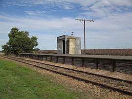
Stations
The stations and sidings included:[12]
- Wolseley
- Custon
- Bangham
- Frances
- Binnum
- Kybybolite
- Hynam
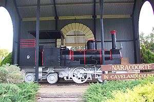
- Naracoorte
- Struan
- Glenroy
- Coonawarra
- Penola
- Krongart
- Kalangadoo
- Wandilo
- Mount Gambier
References
- ↑ Chief Engineer for Railways. "Map showing lines of railways in South Australia" (Map). Johnny's Pages. South Australian Railways. Retrieved 5 March 2016.
- 1 2 South Australia. Department for Transport, Energy and Infrastructure (2009), Green triangle region freight action plan, A Joint Initiative of the Victorian and South Australian Governments (PDF), Dept for Transport, Energy & Infrastructure : [Dept of Infrastructure], p. 51, retrieved 4 May 2017
- ↑ Mount Gambier and Narracoorte Railway Act 1867 No. 19, Government Printer, 20 June 2008, retrieved 31 July 2015
- ↑ Mount Gambier and Naracoorte Railway 47 and 48 Vic., 1884, No. 327, Government Printer, 14 May 2009, retrieved 31 July 2015
- 1 2 3 4 5 6 Quinlan, Howard; Newland, John (2000). Australian Railway Routes 1854 – 2000. Redfern: Australian Railway Historical Society. pp. 53, 58, 59. ISBN 0 909650 49 7.
- ↑ "The Mount Gambier And Narracoorte Railway". South Australian Weekly Chronicle. Adelaide, SA: National Library of Australia. 18 June 1887. p. 11. Retrieved 31 July 2015.
- ↑ "Friday rewind – bus travel 1940s style". ABC South East SA. 16 January 2015. Retrieved 4 May 2017.
- ↑ "South East Rail Freight Operations" (PDF). Annual Report. Department for Transport, Urban Planning & the Arts, Government of South Australia. 30 June 2002. p. 21. Retrieved 4 May 2017.
- ↑ "The Wandilo-Glencoe Railway". Adelaide Observer. SA: National Library of Australia. 27 August 1904. p. 4 Supplement: The Observer Country Supplement. Retrieved 31 July 2015.
- ↑ Wandilo and Glencoe Railway (discontinuance) Act, 1959. No. 27, Government Printer, 24 May 2011, retrieved 31 July 2015
- ↑ "Mount Gambier Line". Vicsig. Retrieved 4 May 2017.
- ↑ "Attachment 10 Photos of SE Railway line Wolseley to Kalangadoo" (PDF). Retrieved 29 July 2015.