Napoleons, Victoria
| Napoleons Victoria | |||||||||||||||
|---|---|---|---|---|---|---|---|---|---|---|---|---|---|---|---|
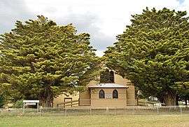 The historic Black Lead church, now home to Napoleons District Historical Society | |||||||||||||||
 Napoleons | |||||||||||||||
| Coordinates | 37°41′0″S 143°50′0″E / 37.68333°S 143.83333°ECoordinates: 37°41′0″S 143°50′0″E / 37.68333°S 143.83333°E | ||||||||||||||
| Population | 553 (2016 census)[1] | ||||||||||||||
| Postcode(s) | 3352 | ||||||||||||||
| Location | |||||||||||||||
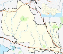
| LGA(s) | Golden Plains Shire | ||||||||||||||
| State electorate(s) | Buninyong | ||||||||||||||
| Federal Division(s) | Ballarat | ||||||||||||||
| |||||||||||||||
Napoleons is a town in Victoria, Australia in the Golden Plains Shire local government area, 131 kilometres (81 mi) west of the state capital, Melbourne. At the 2016 census, Napoleons had a population of 553.[1]
The Post Office opened on 1 September 1862, was known as Napoleon until around 1950, and closed in 1971.[2] A Community Postal Agency opened at the Napoleons store on 17 April 2012.
The town is served by Napoleons Primary School, with an enrolment of 180.[3]
References
| Wikimedia Commons has media related to Napoleons, Victoria. |
- 1 2 Australian Bureau of Statistics (27 June 2017). "Napoleons (State Suburb)". 2016 Census QuickStats. Retrieved 31 August 2017.

- ↑ Premier Postal History. "Post Office List". Retrieved 2008-04-11.
- ↑ "Schools online". Department of Education and Training (Victoria). Retrieved 2007-11-14.
This article is issued from
Wikipedia.
The text is licensed under Creative Commons - Attribution - Sharealike.
Additional terms may apply for the media files.