Rokewood, Victoria
| Rokewood Victoria | |||||||||||||||
|---|---|---|---|---|---|---|---|---|---|---|---|---|---|---|---|
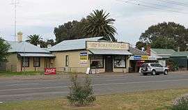 General store | |||||||||||||||
 Rokewood | |||||||||||||||
| Coordinates | 37°54′0″S 143°43′0″E / 37.90000°S 143.71667°ECoordinates: 37°54′0″S 143°43′0″E / 37.90000°S 143.71667°E | ||||||||||||||
| Population | 217 (2016 census)[1] | ||||||||||||||
| Postcode(s) | 3330 | ||||||||||||||
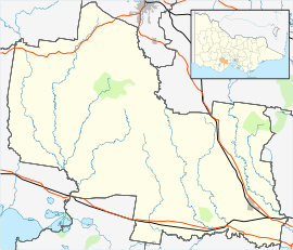
| Location | |||||||||||||||
| LGA(s) | Golden Plains Shire | ||||||||||||||
| State electorate(s) | Polwarth | ||||||||||||||
| Federal Division(s) | Corangamite | ||||||||||||||
| |||||||||||||||
Rokewood is a small rural township in Victoria, Australia in the Golden Plains Shire, 133 kilometres (83 mi) west of the state capital, Melbourne. At the 2016 census, Rokewood and the surrounding area had a population of 217.[1]
History
Rokewood Post Office opened on 1 October 1857.[2]
McMillans Bridge, which crosses the Woady Yaloak River for the Rokewood-Skipton Road between Rokewood and Werneth, is listed on the Victorian Heritage Register.[3]
Sport
In conjunction with its neighbouring township Corindhap Rokewood has an Australian Rules football and netball team, Rokewood-Corindhap. It previously competed in the Lexton Plains Football League, but the league folded at the end of the 2010 season. The team now play in the Central Highlands Football League [4]
Golfers play at the course of the Rokewood Golf Club on Rokewood - Shelford Road.[5]
References
| Wikimedia Commons has media related to Rokewood, Victoria. |
- 1 2 Australian Bureau of Statistics (27 June 2017). "Rokewood (State Suburb)". 2016 Census QuickStats. Retrieved 2017-08-31.

- ↑ Premier Postal History, Post Office List, retrieved 2008-04-11
- ↑ "McMillans Bridge (H1847)". Victorian Heritage Register. Heritage Victoria. Retrieved 7 July 2014.
- ↑ Full Points Footy, Rokewood-Corindhap, retrieved 2009-04-15
- ↑ Golf Select, Rokewood, retrieved 2009-05-11