Scarsdale, Victoria
| Scarsdale Victoria | |||||||||||||||
|---|---|---|---|---|---|---|---|---|---|---|---|---|---|---|---|
 Scarsdale | |||||||||||||||
| Coordinates | 37°40′42″S 143°40′34″E / 37.67833°S 143.67611°ECoordinates: 37°40′42″S 143°40′34″E / 37.67833°S 143.67611°E | ||||||||||||||
| Population | 744 (2016 census)[1] | ||||||||||||||
| Postcode(s) | 3351 | ||||||||||||||
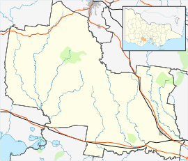
| Location | |||||||||||||||
| LGA(s) | Golden Plains Shire | ||||||||||||||
| State electorate(s) | Buninyong | ||||||||||||||
| Federal Division(s) | Corangamite | ||||||||||||||
| |||||||||||||||
Scarsdale is a small town in rural Victoria, Australia, and approximately 25km south west of Ballarat, with a few community facilities including a primary school and a kindergarten. It is situated in the north-western part of Golden Plains Shire, and is primarily an agricultural community.
At the 2016 census, Scarsdale and the surrounding area had a population of 744.[1]
- 1 2 Australian Bureau of Statistics (27 June 2017). "Scarsdale (State Suburb)". 2016 Census QuickStats. Retrieved 2017-08-31.

This article is issued from
Wikipedia.
The text is licensed under Creative Commons - Attribution - Sharealike.
Additional terms may apply for the media files.