Shelford, Victoria
| Shelford Victoria | |||||||||||||||
|---|---|---|---|---|---|---|---|---|---|---|---|---|---|---|---|
 Former general store | |||||||||||||||
 Shelford | |||||||||||||||
| Coordinates | 38°01′0″S 143°58′0″E / 38.01667°S 143.96667°ECoordinates: 38°01′0″S 143°58′0″E / 38.01667°S 143.96667°E | ||||||||||||||
| Population | 253 (2016 census)[1] | ||||||||||||||
| Postcode(s) | 3329 | ||||||||||||||
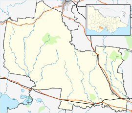
| Location |
| ||||||||||||||
| LGA(s) | Golden Plains Shire | ||||||||||||||
| State electorate(s) | Polwarth | ||||||||||||||
| Federal Division(s) | Corangamite | ||||||||||||||
| |||||||||||||||
Shelford is a rural locality in Victoria, Australia. The locality is in the Golden Plains Shire near the regional city of Geelong and 106 kilometres (66 mi) west of the state capital, Melbourne.
The Post Office opened on 1 July 1847 as The Leigh and was renamed Shelford in 1854. It became a Licensed Post Office on 20 May 1994, and has since closed; the date of closure is unknown.[2]
Heritage listed sites
Shelford contains a number of heritage listed sites, including:
- 1372 Rokewood-Shelford Road, Leigh Shire Hall and Toll House [3]
- Shelford-Bannockburn Road, Leigh River Iron Bridge [4]
References
- ↑ Australian Bureau of Statistics (27 June 2017). "Shelford (State Suburb)". 2016 Census QuickStats. Retrieved 19 March 2018.

- ↑ Premier Postal History, Post Office List, retrieved 2014-06-21
- ↑ "Former Leigh Shire Hall and Toll House (H2274)". Victorian Heritage Register. Heritage Victoria. Retrieved 7 July 2014.
- ↑ "Bridge Over Leigh River (H1452)". Victorian Heritage Register. Heritage Victoria. Retrieved 7 July 2014.
This article is issued from
Wikipedia.
The text is licensed under Creative Commons - Attribution - Sharealike.
Additional terms may apply for the media files.