Nanga-Boguila
| Nanga-Boguila | |
|---|---|
| sub-prefectures | |
| Country |
|
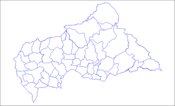
Nanga-Boguila is a sub-prefecture of Ouham in the Central African Republic.[1][2]
Geography
The commune of Nanga Boguila is located in the north-east of the Ouham prefecture. It is crossed by the axis Nana-Bakassa - Boguila - Bongaro 1, national highway RN1.
| Nana Barya | Nana-Markounda | |
| Bimbi | Nana Bakassa | |
| Ouham-Bac | Ndoro-Mboli |
Population
In 2003, the population was 23,982 people.
History
Nanga Boguila is erected in sub-prefecture of Ouham since May 2, 2002 by division of southern part of the sub-prefecture of Markounda.
Villages
The main villages are: Bondaro, Boria, Boguila 1 , Bogone 3, Boaya, Bomentana Center and Bowansen. The commune has 102 villages in rural areas identified in 2003: Arab 2, Bedin, Boaya, Bobaina, Boboro, Bodongue, Boferan, Bogama Kette, Bogama Kota, Bogassa, Bogodo, Bogomba, Bogomte Kette, Bogota Kota, Boguela, Boguila 1, Boguila 2, Boguila Kete, Boguila-Bedobo, Boguila-Gbogbol, Bohing, Bokarin, Bokote Kota 1, Bokote Kota 2, Bokote-Alato, Bokote-Kette, Bokote-Sesse, Bokparatong, Boleing Kette, Boling-Kota, Bomantana, Bomantanagbazoro , Bombaye-Kette, Bombaye-Kota, Bomber-Nouna, Bomentana-Biti, Bonanga, Bonasse 3, Bonasse Kota, Bonasse-Kette, Bondondi, Bondoro-Kette, Bondoro-Kota, Bongba Kette, Bongbara, Bongone 3, Bonoi 1, Bonoi 2, Bonte, Boria, Borok-Mo Kota, Borosse, Borro 1, Bossara, Bossole, Botongo, Botoni, Bounana-Breeding, Boundia, Bowain, Bowansem, Bowara, Boyanga, Boyanga Kette, Boyanga Kota, Bozanzon, Bozera, Bozera -Kette, Bozera-Kota, Bozima, Bozinga, Bozoe, Bozona 1, Bozona 2, Medical Center, Dangsom, Daring, Dombang, Donfera, Gbadam, Gbakera, Gbangono, Gbanou, Gbaring, Gbassom, Gom-Okpa, Gompo, Kobana 2, Kobana 2, Mbombara-Kette, Mbombara-Kota, Nanga, Ndakta, Ngazomgue, Sagon, Samon, Sokodo 3, Sokodo-Kette, Sokodo-Kota, Teyengue, Togbissa, Zekewen.
Education
The commune has 21 public schools: Sous-prefectorale of Boguila, Bolgue, Boyanga-Kota, Bobai-Kota, Nanga, Bondodi, Sokodo, Bombara-Kota, Bomentana, Bonasse-Kete, Bokote-Kete, Samon, Bokote-Kota 2, Bowing, Bomantana-Beti, Bogama-Kete, Botongo, Bouria, Gbounou, Bondaro and Bokote-Sesse.
Political representation
The Sub-prefecture of Nanga-Boguila has been a legislative constituency since 2005.
| Election date | Identity | Left |
|---|---|---|
| 2005 | Maurice Saragba | independent |
| 2011 | Maurice Saragba | independent |
| 2016 | Franck-Urban Saragba | independent |
References
- ↑ "Attack in Central African Republic kills 22, including chiefs, MSF staff". Reuters. Retrieved 5 June 2018.
- ↑ "Boguila". Google Maps. Retrieved 5 June 2018.