Bouca
| Bouca | |
|---|---|
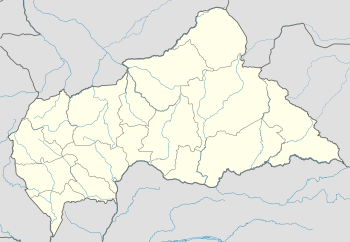 Bouca Location in Central African Republic | |
| Coordinates: 6°30′N 18°17′E / 6.500°N 18.283°E | |
| Country | Central African Republic |
| Prefecture | Ouham |
Bouca is a town located in the Central African Republic prefecture of Ouham. It is not far east of Bossangoa at the Fafa river.
On 21 March 2013, the town was overtaken by rebels of the Seleka coalition.
Climate
Köppen-Geiger climate classification system classifies its climate as tropical wet and dry (Aw).[1]
| Climate data for Bouca | |||||||||||||
|---|---|---|---|---|---|---|---|---|---|---|---|---|---|
| Month | Jan | Feb | Mar | Apr | May | Jun | Jul | Aug | Sep | Oct | Nov | Dec | Year |
| Average high °C (°F) | 37.3 (99.1) |
39.9 (103.8) |
38.2 (100.8) |
38 (100) |
36.1 (97) |
33.4 (92.1) |
32.7 (90.9) |
32.5 (90.5) |
32.6 (90.7) |
33.6 (92.5) |
34.6 (94.3) |
35.5 (95.9) |
35.4 (95.6) |
| Daily mean °C (°F) | 24 (75) |
26.9 (80.4) |
28 (82) |
28.8 (83.8) |
27.9 (82.2) |
26 (79) |
25.9 (78.6) |
25.4 (77.7) |
25.4 (77.7) |
25.9 (78.6) |
25 (77) |
24 (75) |
26.1 (78.9) |
| Average low °C (°F) | 10.7 (51.3) |
14 (57) |
17.8 (64) |
19.7 (67.5) |
19.7 (67.5) |
18.6 (65.5) |
19.2 (66.6) |
18.4 (65.1) |
18.3 (64.9) |
18.3 (64.9) |
15.4 (59.7) |
12.5 (54.5) |
16.9 (62.4) |
| Average precipitation mm (inches) | 0 (0) |
9 (0.35) |
48 (1.89) |
99 (3.9) |
132 (5.2) |
162 (6.38) |
232 (9.13) |
233 (9.17) |
224 (8.82) |
184 (7.24) |
28 (1.1) |
2 (0.08) |
1,353 (53.26) |
| Source: Climate-Data.org, altitude: 4361[1] | |||||||||||||
See also
References
- 1 2 "Climate: Bouca - Climate graph, Temperature graph, Climate table". Climate-Data.org. Retrieved 8 November 2013.
Coordinates: 6°30′N 18°17′E / 6.500°N 18.283°E
This article is issued from
Wikipedia.
The text is licensed under Creative Commons - Attribution - Sharealike.
Additional terms may apply for the media files.